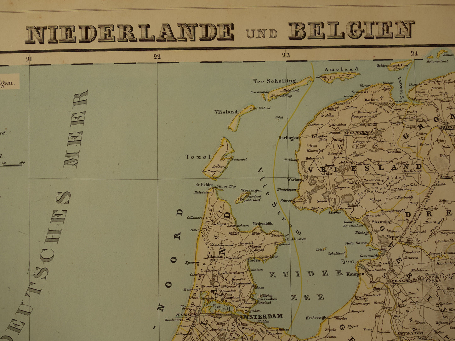
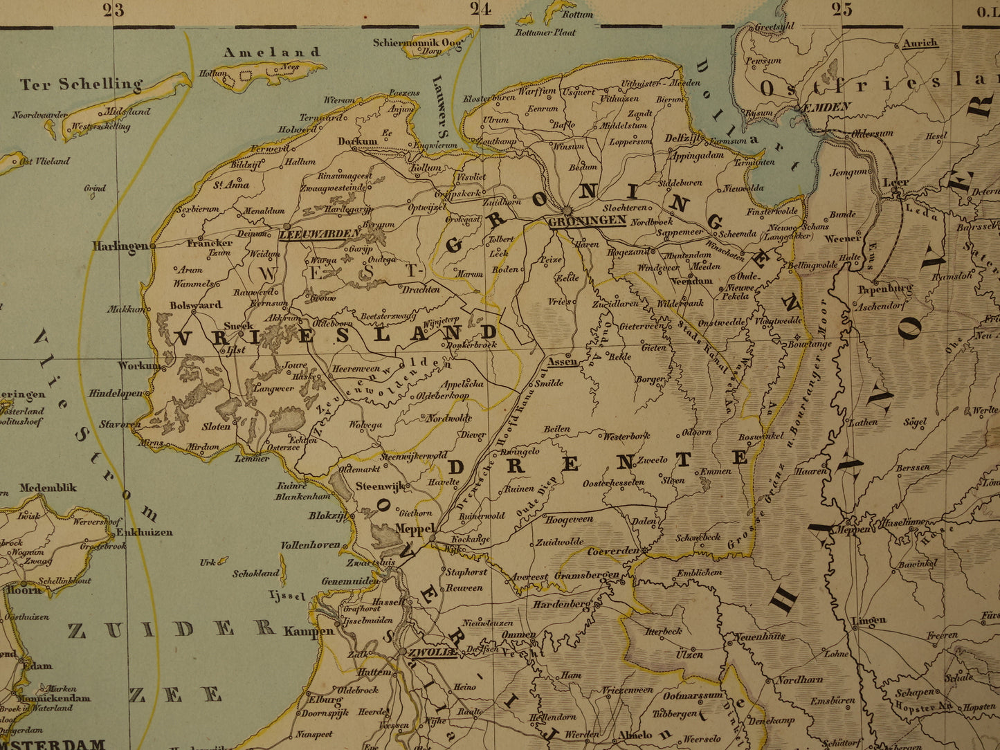
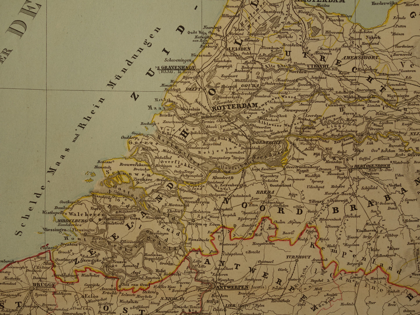
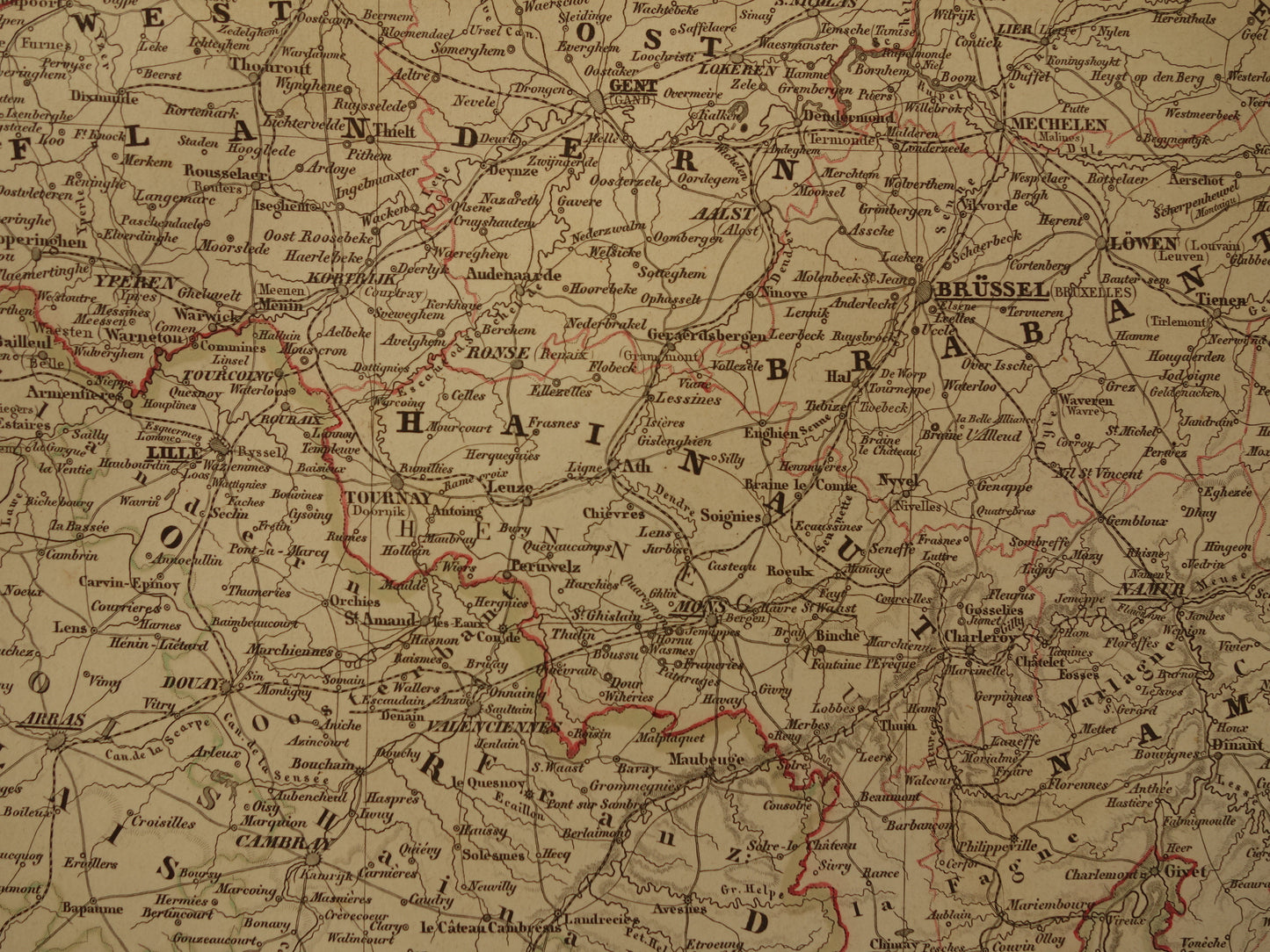
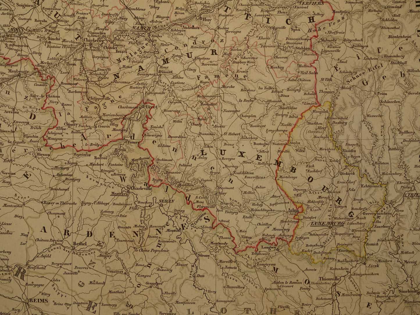
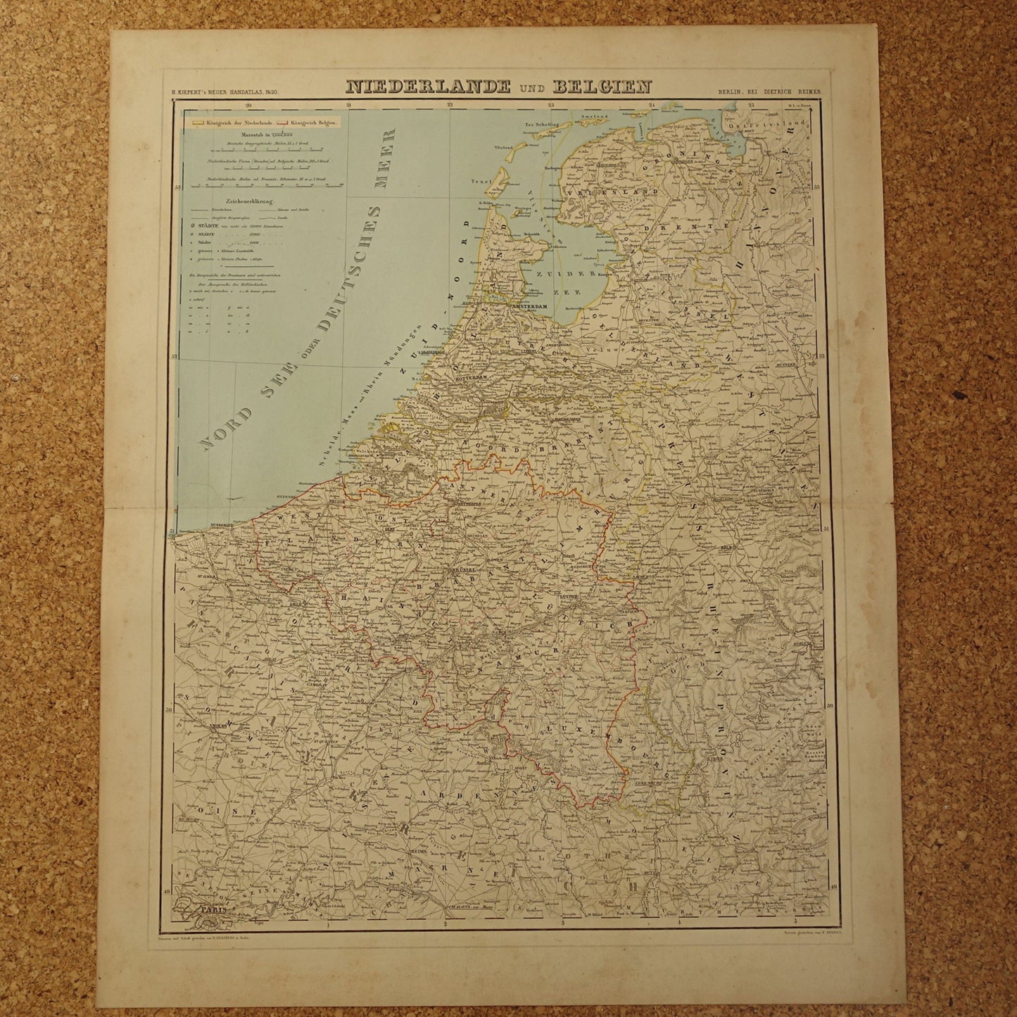
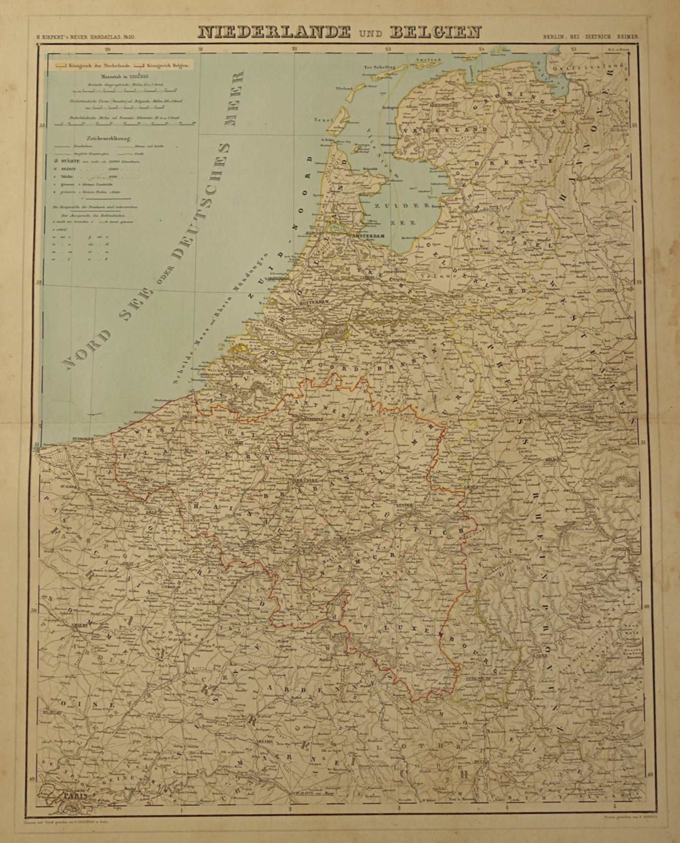
Beautiful detailed large antique German map of the Netherlands and Belgium from the year 1860. Zoom the photos for the best view. Nice wide margins and very suitable for framing. The colored borders are colored by hand.
Dimensions: the card measures 49.5 x 61.5 cm
Condition: the map is in good general condition. There are some minor signs of age and use. In addition, the map is stained in the margins, see the second to last photo. When framing with a passepartout, the stains are no longer visible. Tear of 1 cm at the right end of the horizontal center fold. Otherwise intact and in good general condition.
Origin: Kiepert's Handatlas - Heinrich Kiepert- Edition of 1860
ORDER WITHOUT RISK At Oudekaarten.com you always order without risk. Are you not completely satisfied with your purchase? You can return your purchase free of charge and get your full purchase price back.
We sell only original antique and vintage maps. We guarantee that your purchase was made on or around the date stated in the description.
Fast shipping
We will ship your order the next business day at the latest. Free shipping within the Netherlands when purchasing 2 cards. Click here for more information
"Beautiful card, exactly as described. Fast shipping and the card was packaged perfectly. Great transaction, thank you very much!"
ANNE ESCHER
Choosing a selection results in a full page refresh.