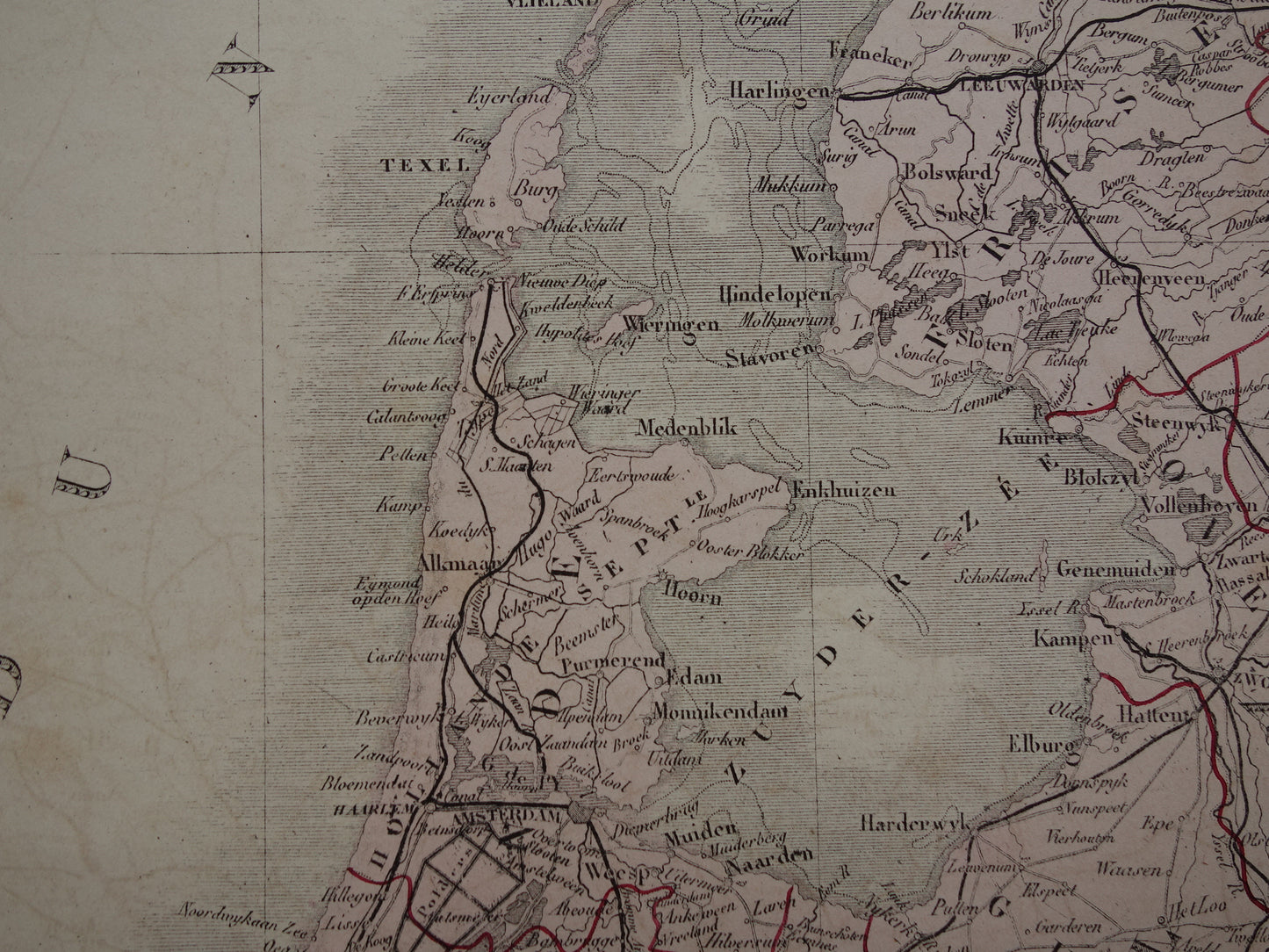
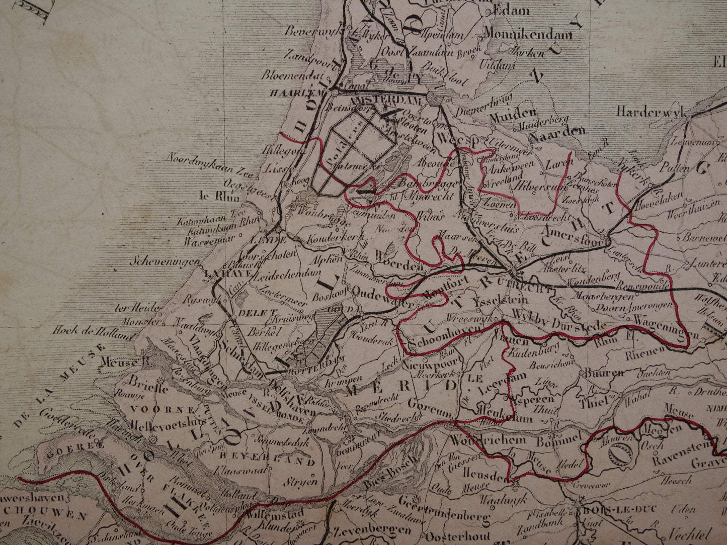
For sale is a large antique French map of the Netherlands, Belgium and Luxembourg from 1876. The map is very detailed and also shows railways and main roads from that time. The map has a nice decorative title. With wide margins, very suitable for framing.
Dimensions: 48 x 60 cm
Condition: paper is browned by age - offsetting (faint print of opposite map section) visible on white map section - dots of right corners are missing, otherwise the paper is completely intact. Issued with a centerfold.
Origin: Atlas Universel De Geographie Physique, Politique, Ancienne et Moderne - A. Brué - Edition of 1876
ORIGINAL ANTIQUE MAP Oudekaarten.com only sells original old maps, we do not sell modern reprints.
ORDER WITHOUT RISK At Oudekaarten.com you always order without risk. Are you not completely satisfied with your purchase? You can return your purchase free of charge and get your full purchase price back.
FAST SHIPPING This card will be shipped within 1 business day.
We sell only original antique and vintage maps. We guarantee that your purchase was made on or around the date stated in the description.
Fast shipping
We will ship your order the next business day at the latest. Free shipping within the Netherlands when purchasing 2 cards. Click here for more information
"Beautiful card, exactly as described. Fast shipping and the card was packaged perfectly. Great transaction, thank you very much!"
ANNE ESCHER
Choosing a selection results in a full page refresh.