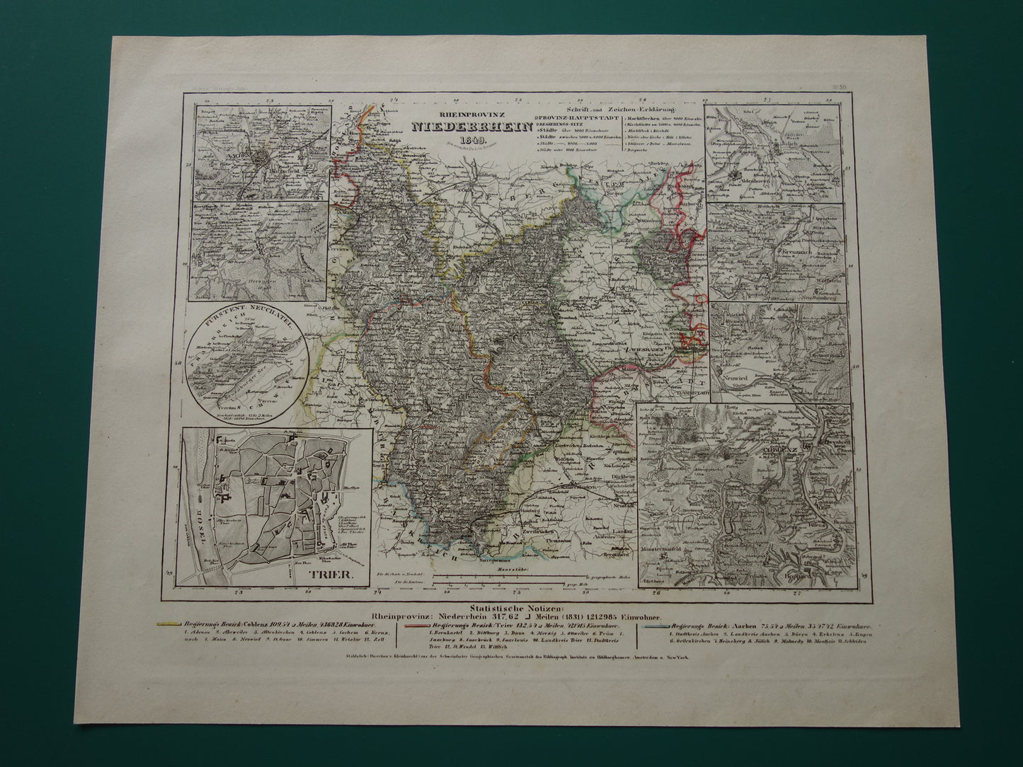
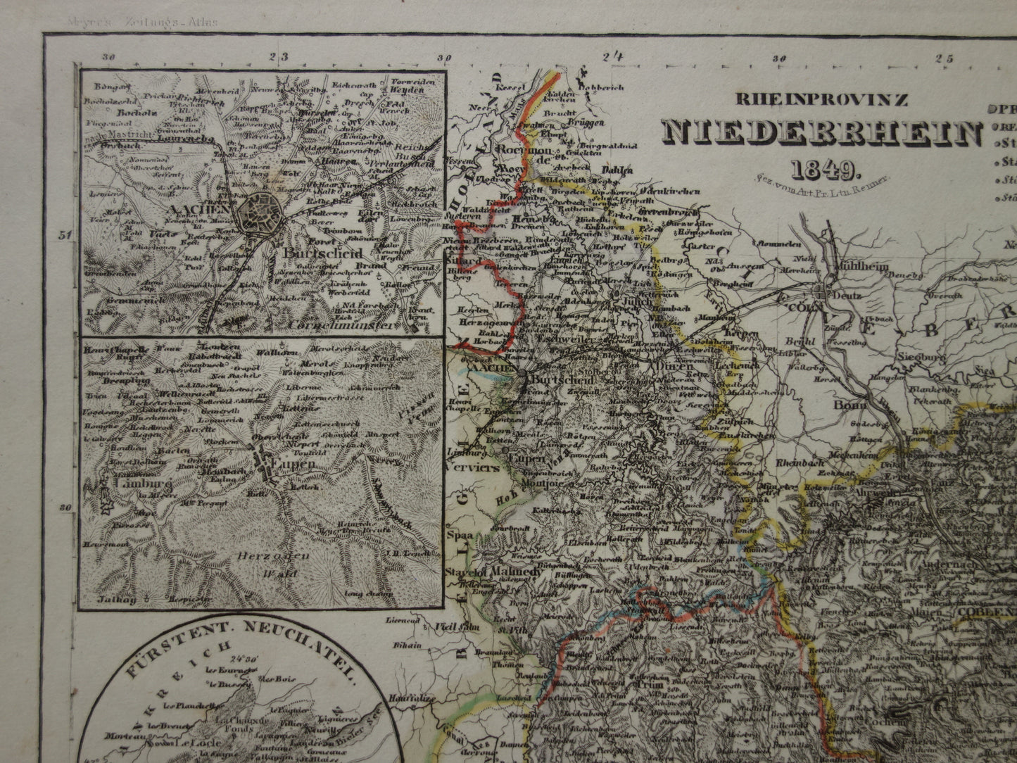
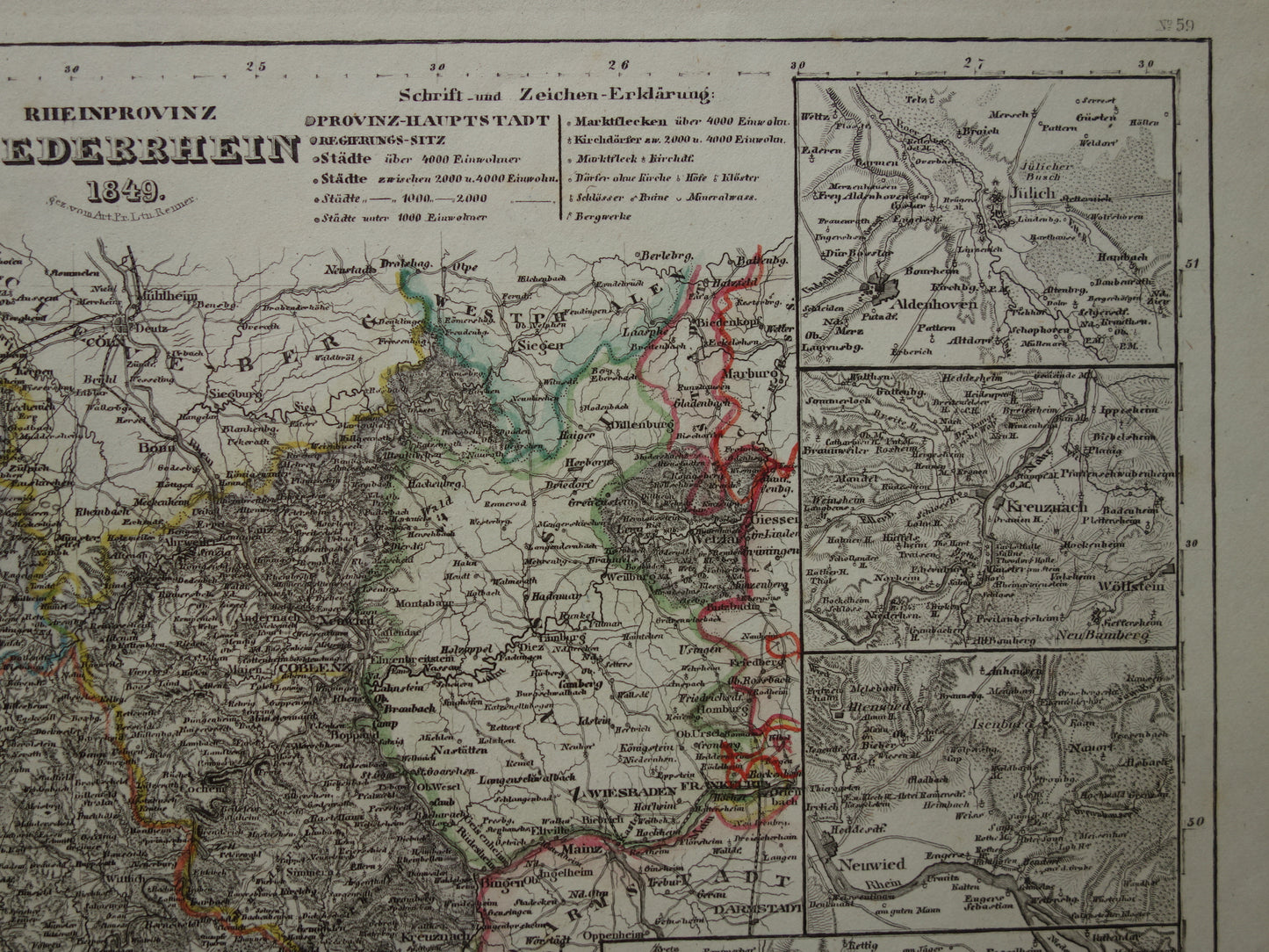
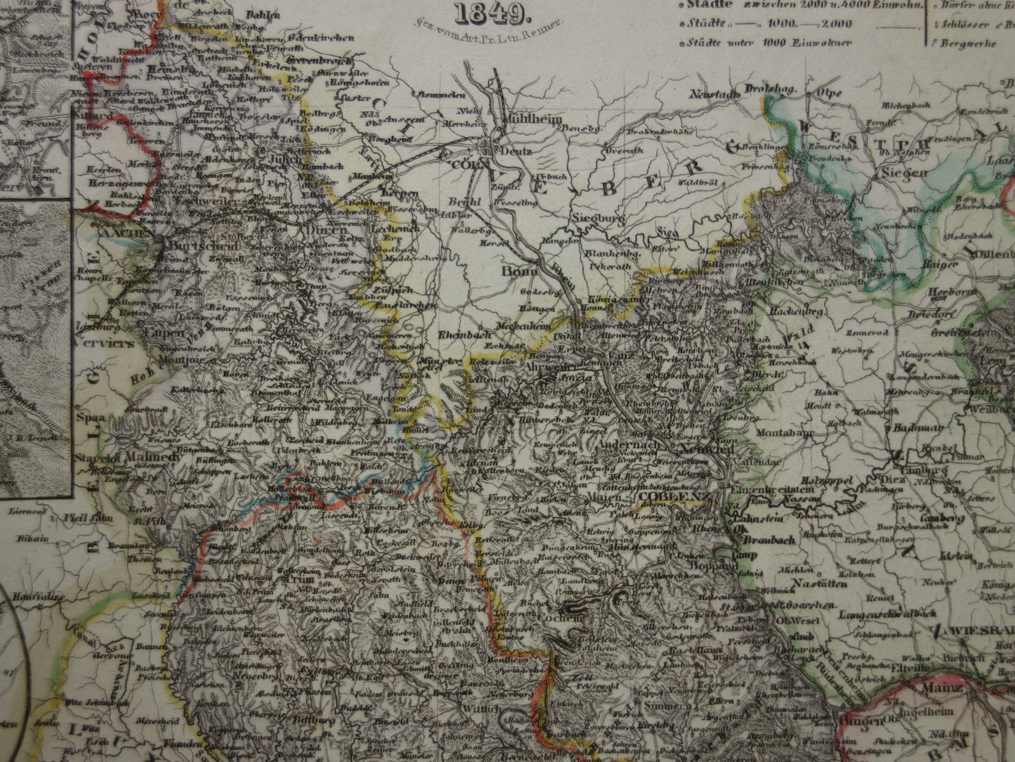
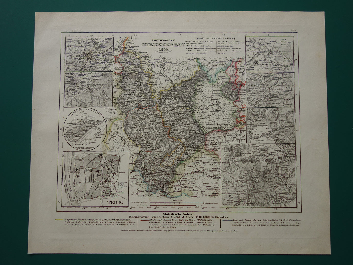
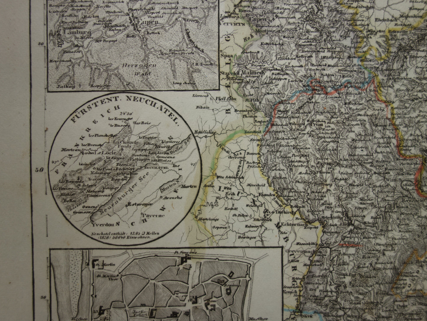
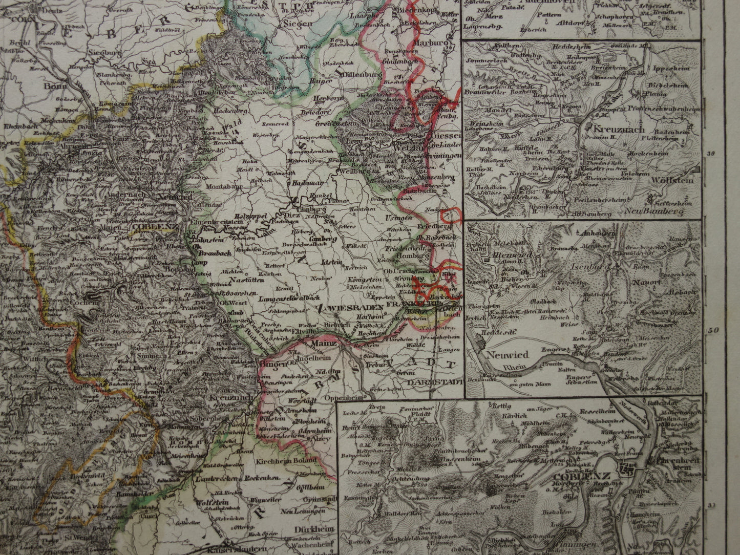
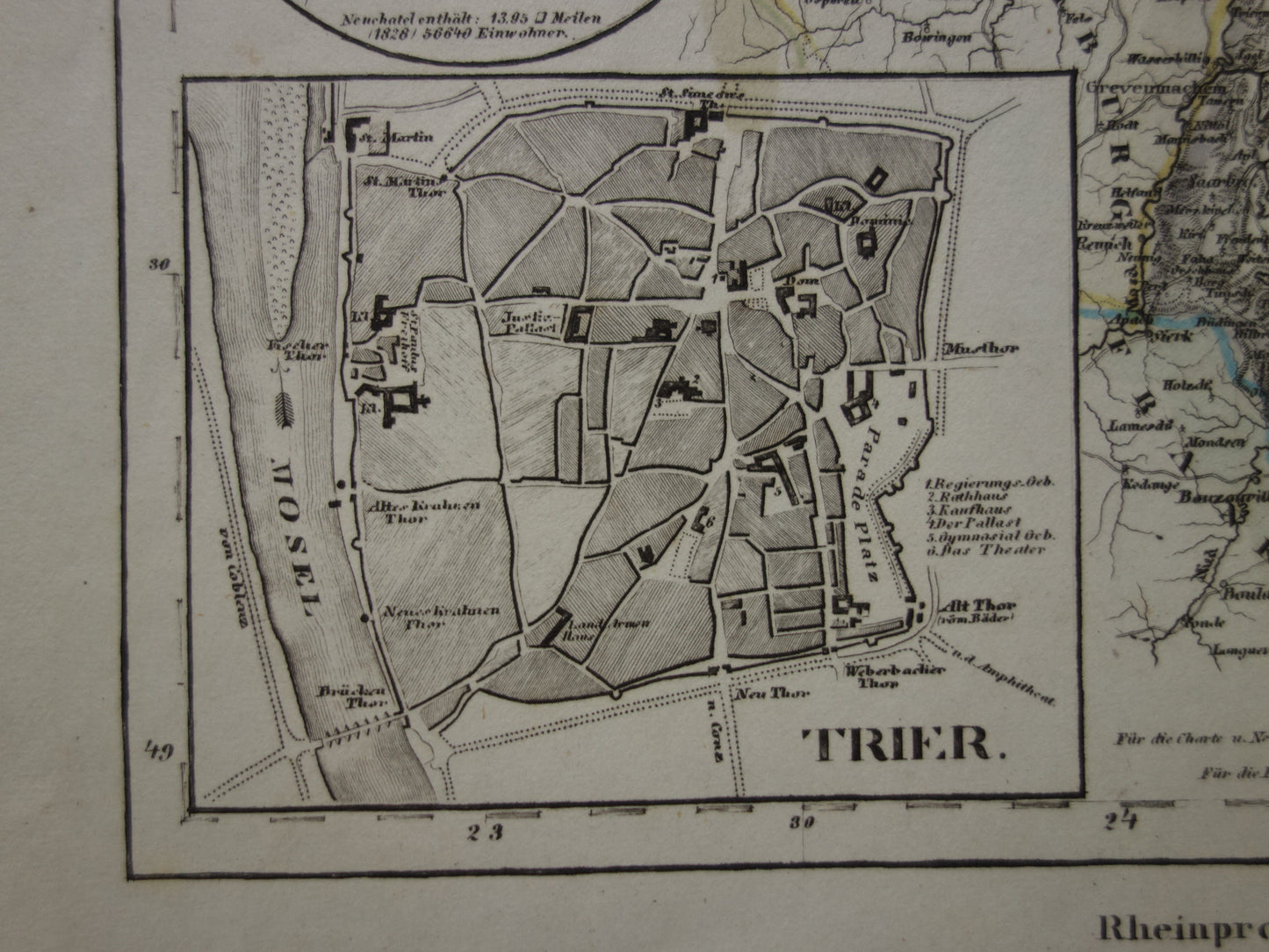
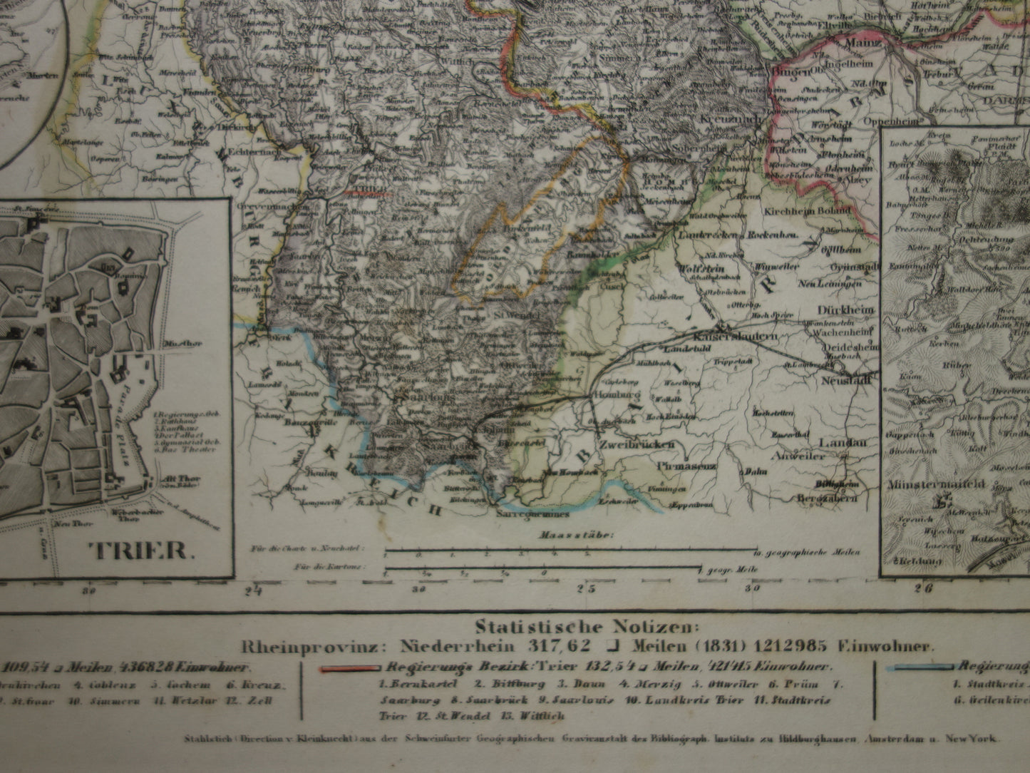
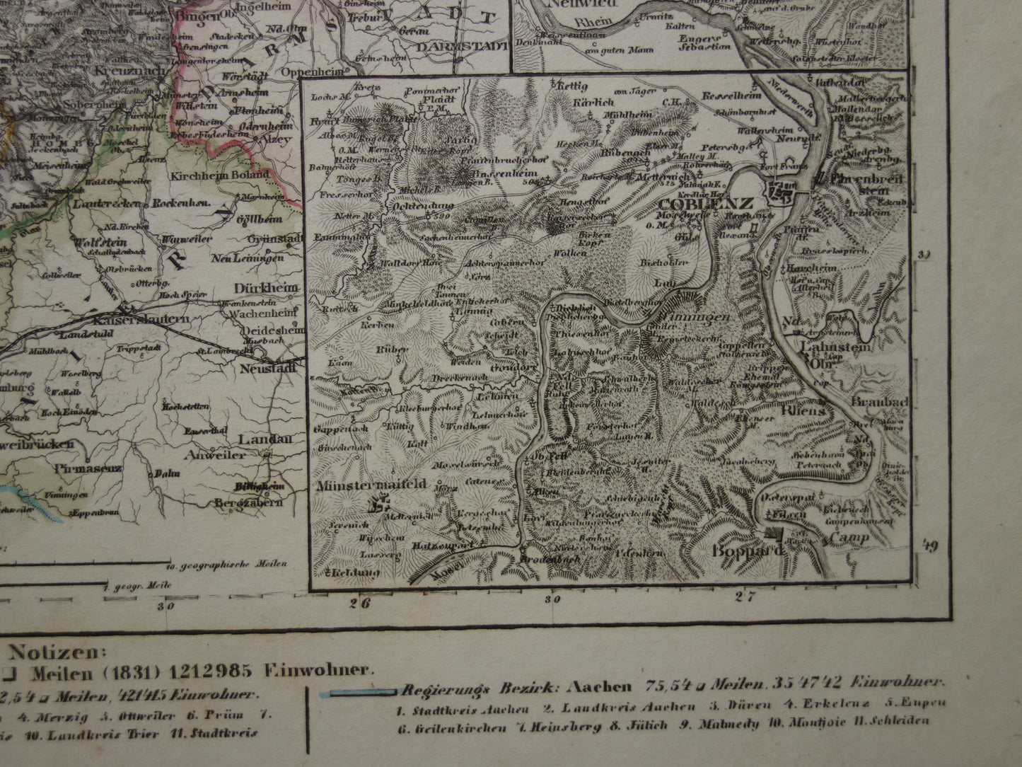
For sale is a beautiful, antique German map of the Lower Rhine from the year 1849. It contains no less than eight inset maps. Including: a map of Trier, the area around Koblenz and of Aachen and surroundings. In the lower margin you will find more information about important cities, population and size of the various provinces/states. The map is incredibly detailed and it may be necessary to use a magnifying glass to see all the details. It is a steel engraving with original hand coloring. A nice detail is that the year 1849 is in the title. All in all a very decorative map that is very suitable for framing. Zoom the photos to see the details of the map well.
Dimensions: 25 x 30.5 cm
Condition: the map is in good condition (= some small signs of age). Paper is intact.
Origin: Meyers Zeitungs Atlas - Edition 1849
ORDER WITHOUT RISK At Oudekaarten.com you always order without risk. Are you not completely satisfied with your purchase? You can return your purchase free of charge and get your full purchase price back.
We sell only original antique and vintage maps. We guarantee that your purchase was made on or around the date stated in the description.
Fast shipping
We will ship your order the next business day at the latest. Free shipping within the Netherlands when purchasing 2 cards. Click here for more information
"Beautiful card, exactly as described. Fast shipping and the card was packaged perfectly. Great transaction, thank you very much!"
ANNE ESCHER
Choosing a selection results in a full page refresh.