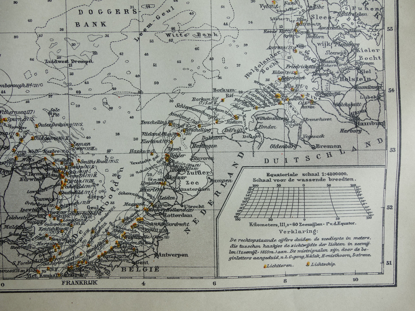
For sale is an antique sea map of the North Sea from 1920. This Dutch map shows depth. All the lighthouses along the North Sea are also on the map. Nice wide margins, very suitable for framing.
Dimensions: 25 x 31.5 cm
Condition: very good. Map has a centerfold, as issued.
Origin:Winkler Prins Encyclopedia (1920)
ORDER WITHOUT RISK At Oudekaarten.com you always order without risk. Are you not completely satisfied with your purchase? You can return your purchase free of charge and get your full purchase price back.
We sell only original antique and vintage maps. We guarantee that your purchase was made on or around the date stated in the description.
Fast shipping
We will ship your order the next business day at the latest. Free shipping within the Netherlands when purchasing 2 cards. Click here for more information
"Beautiful card, exactly as described. Fast shipping and the card was packaged perfectly. Great transaction, thank you very much!"
ANNE ESCHER
Choosing a selection results in a full page refresh.