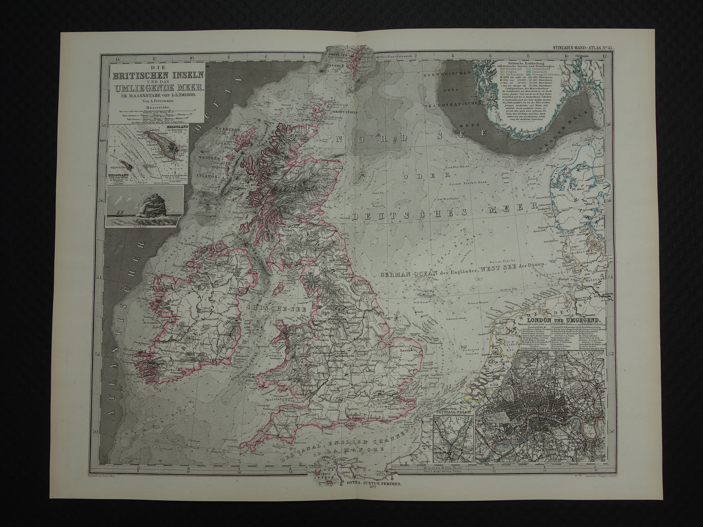
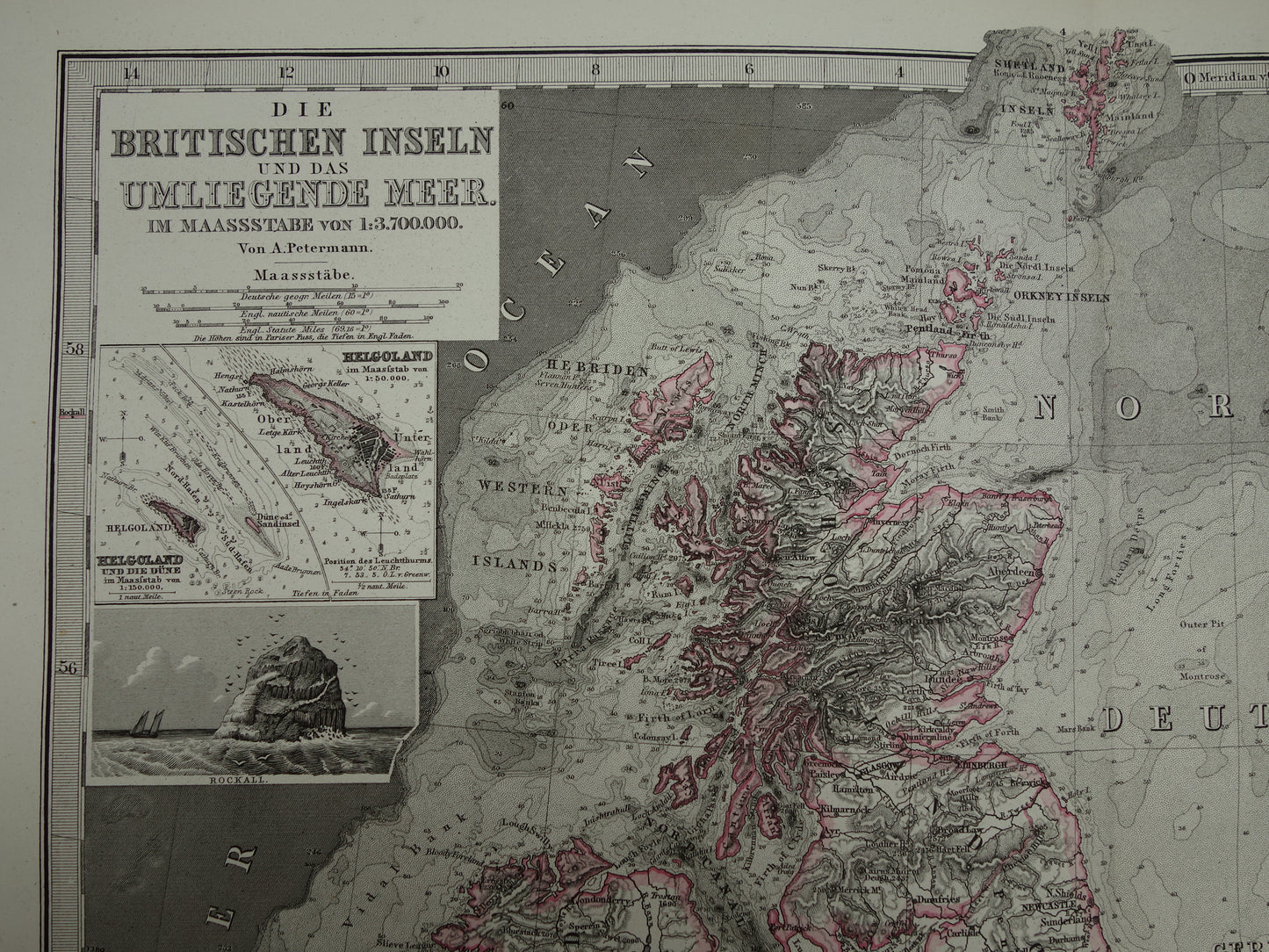
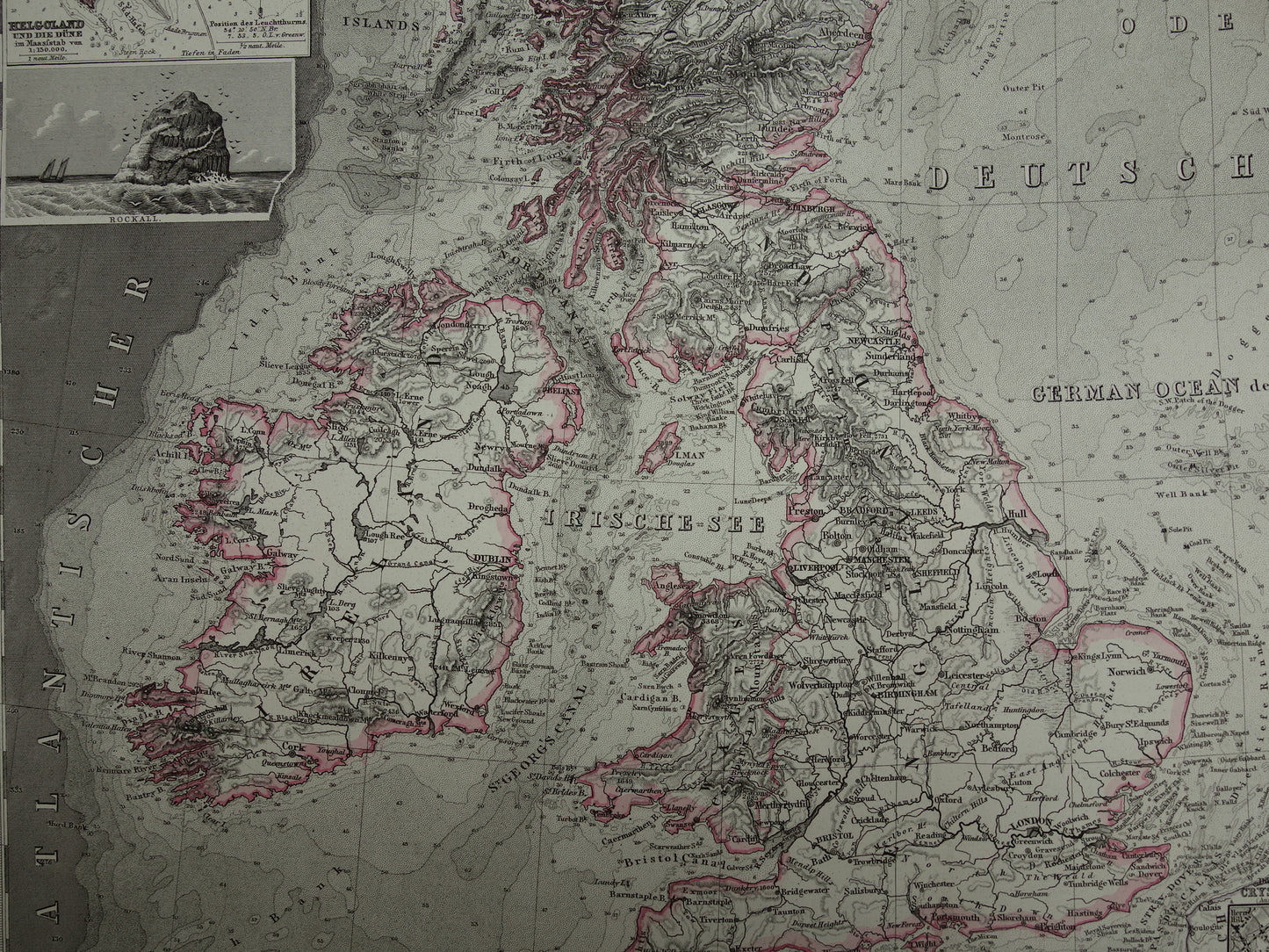
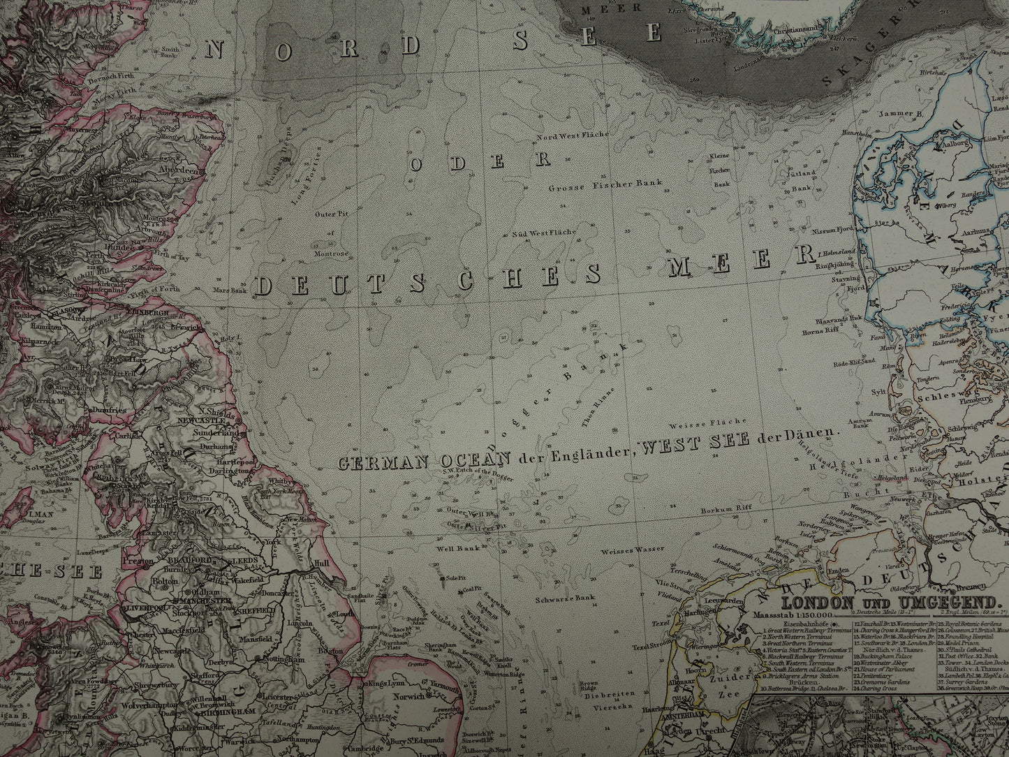
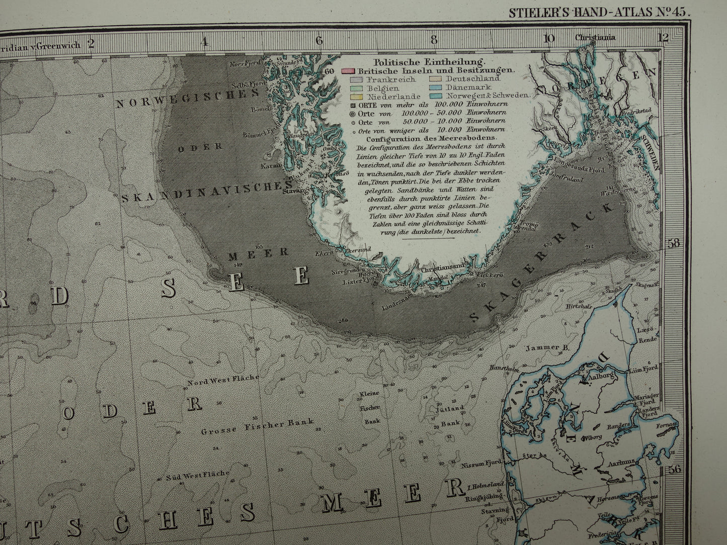
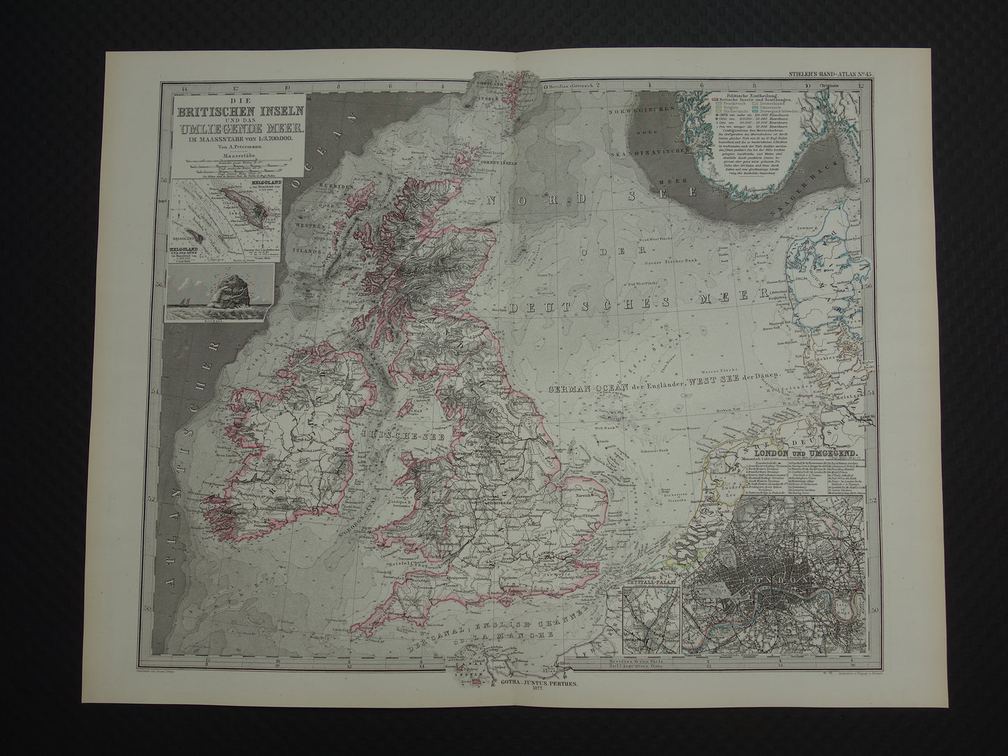
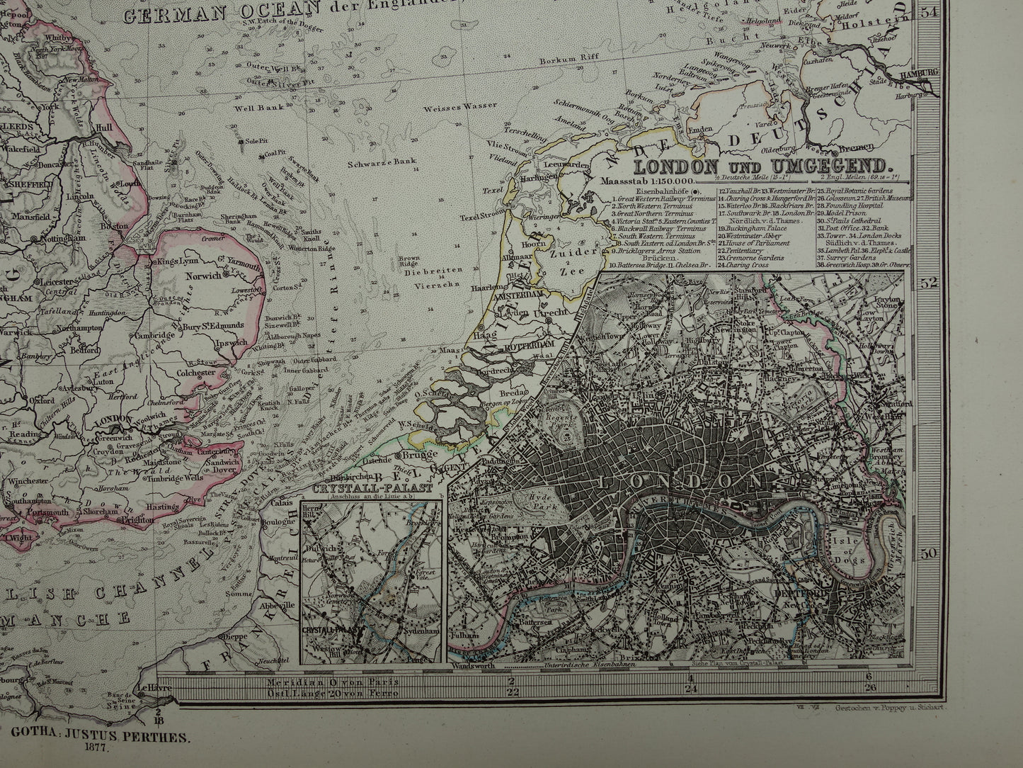
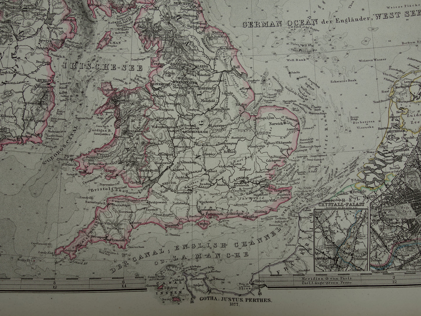
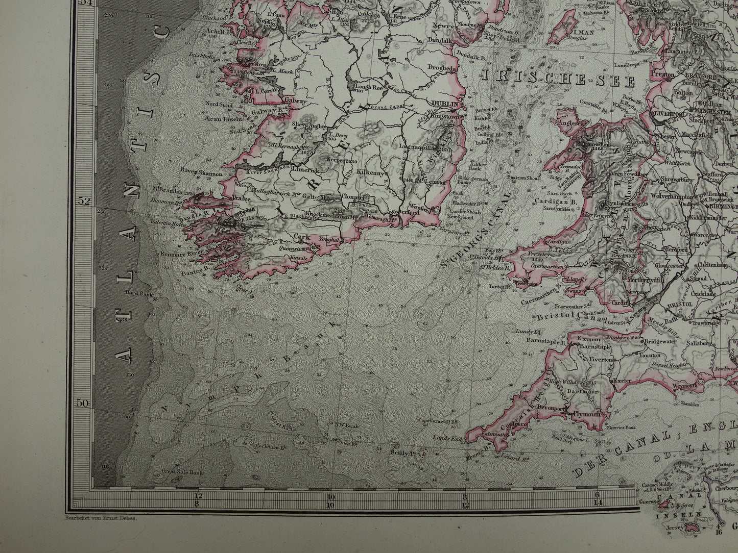
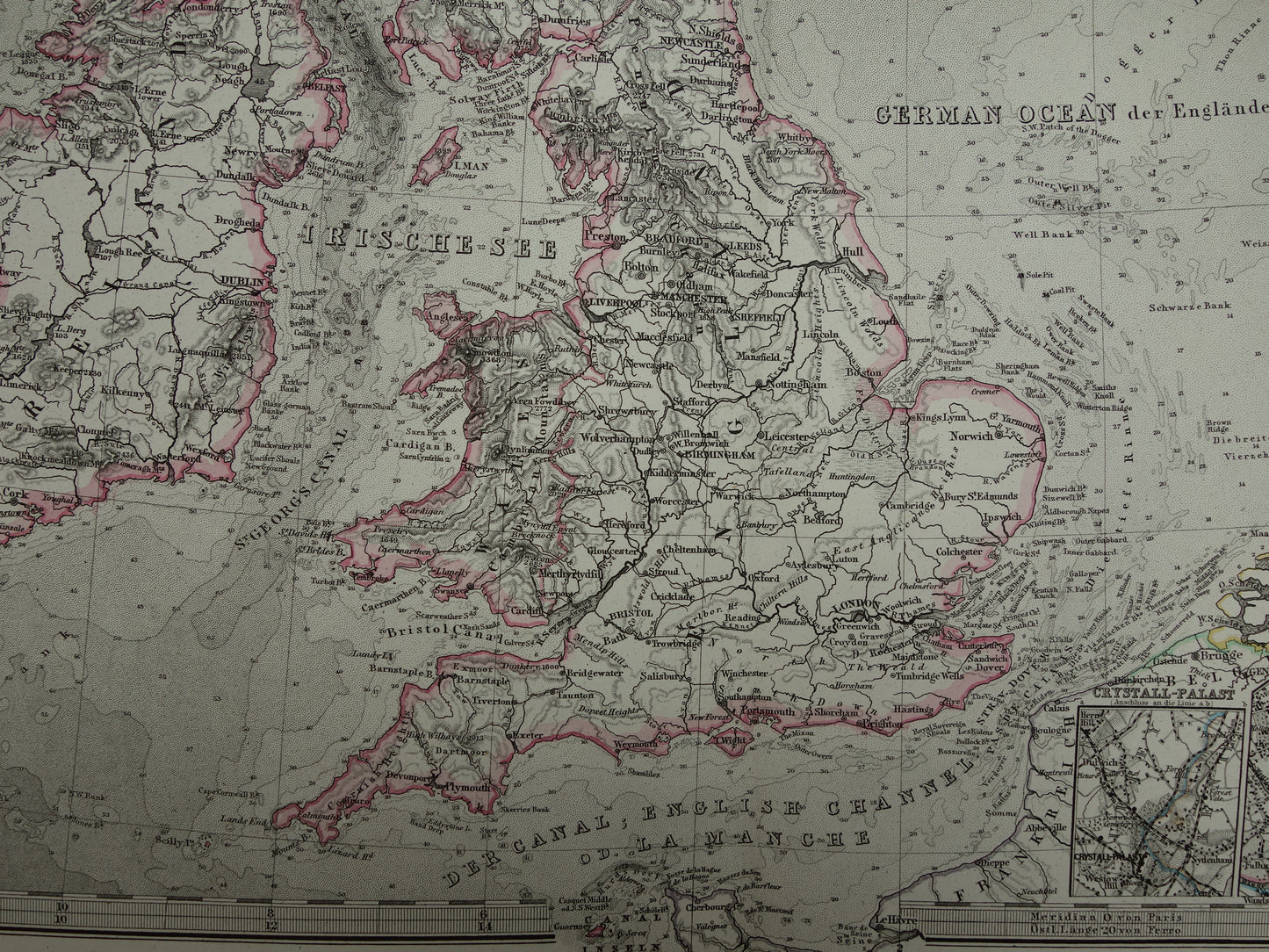
For sale is a beautiful antique map of the British Isles and the North Sea . The Netherlands is also partly on the map. The map is very detailed. Zoom the photos to see it well. Top left an inset map of Helgoland (Germany) and a view of Rockall (UK). Bottom right a detailed inset map of London and a small map of Crystal Palace. The map is an original from the year 1877. The year is also at the bottom of the map.
Dimensions: 36.5 x 47 cm
Condition: good / very good. Published with centerfold. Printed on heavy paper.
We sell only original antique and vintage maps. We guarantee that your purchase was made on or around the date stated in the description.
Fast shipping
We will ship your order the next business day at the latest. Free shipping within the Netherlands when purchasing 2 cards. Click here for more information
"Beautiful card, exactly as described. Fast shipping and the card was packaged perfectly. Great transaction, thank you very much!"
ANNE ESCHER
Choosing a selection results in a full page refresh.