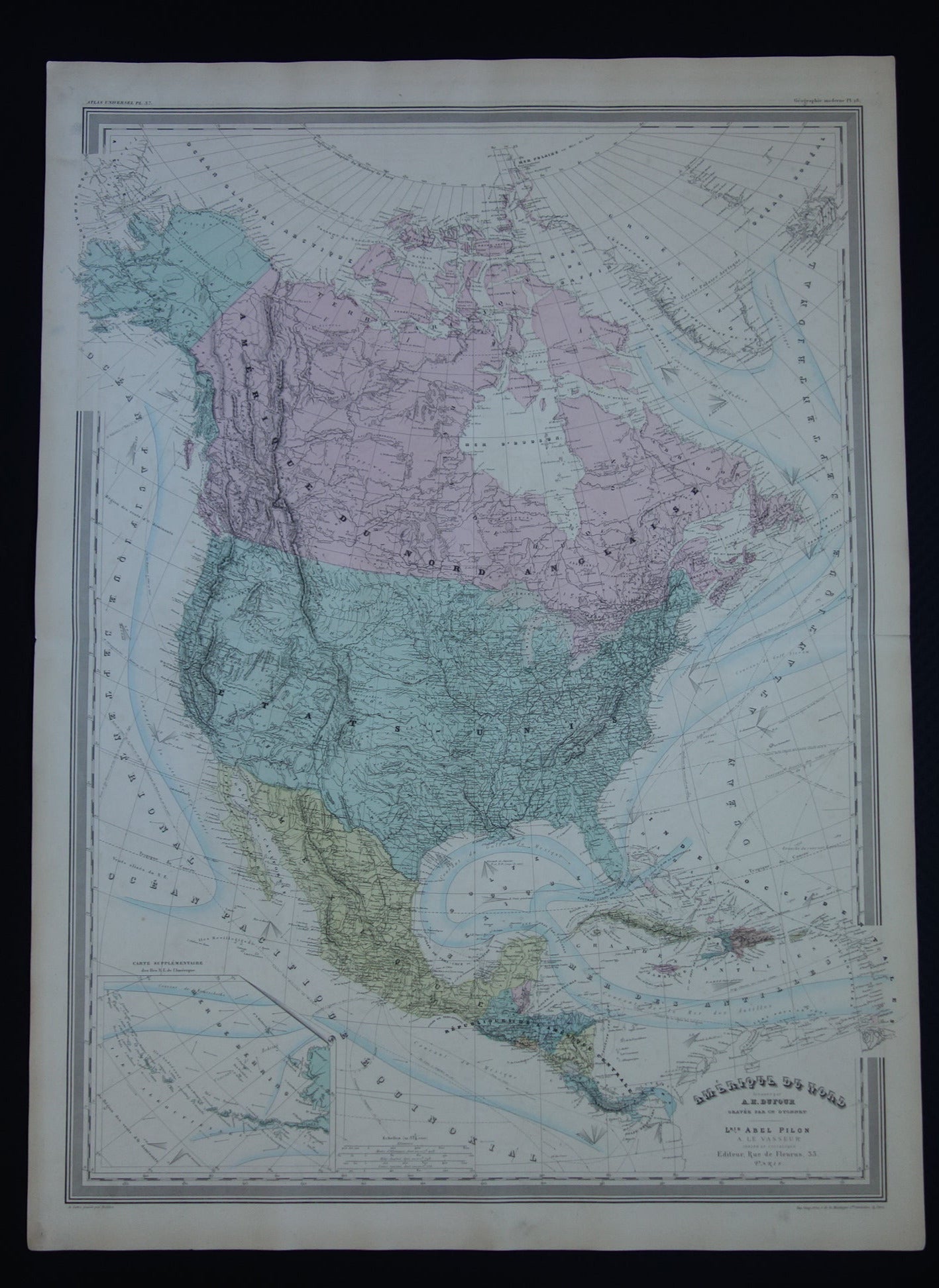
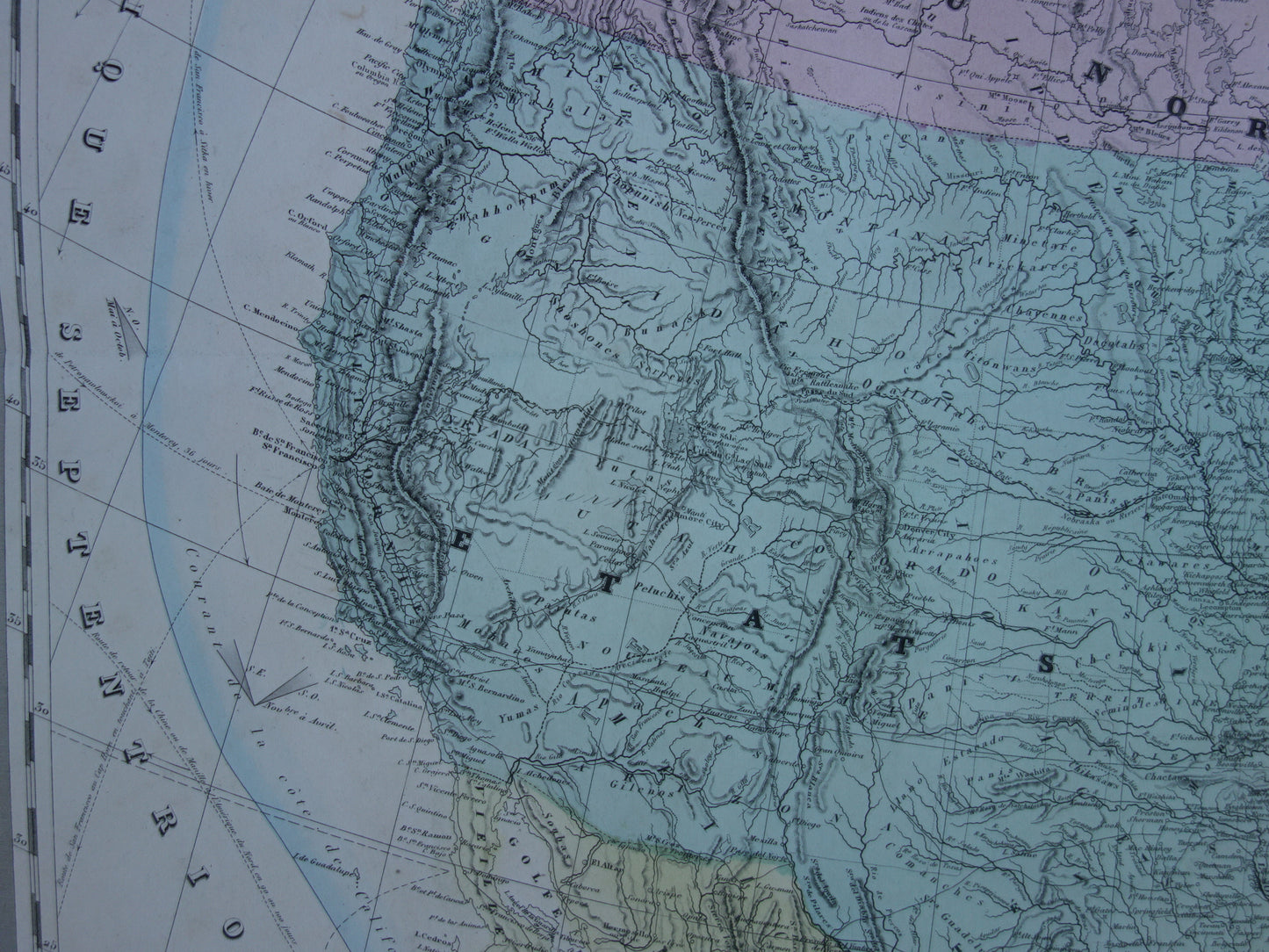
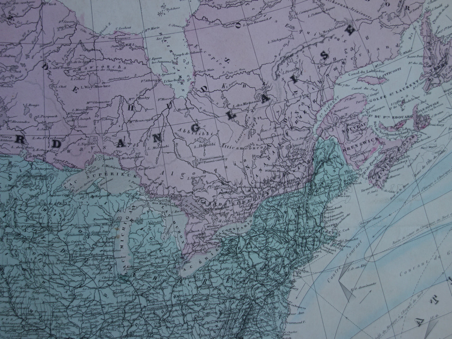
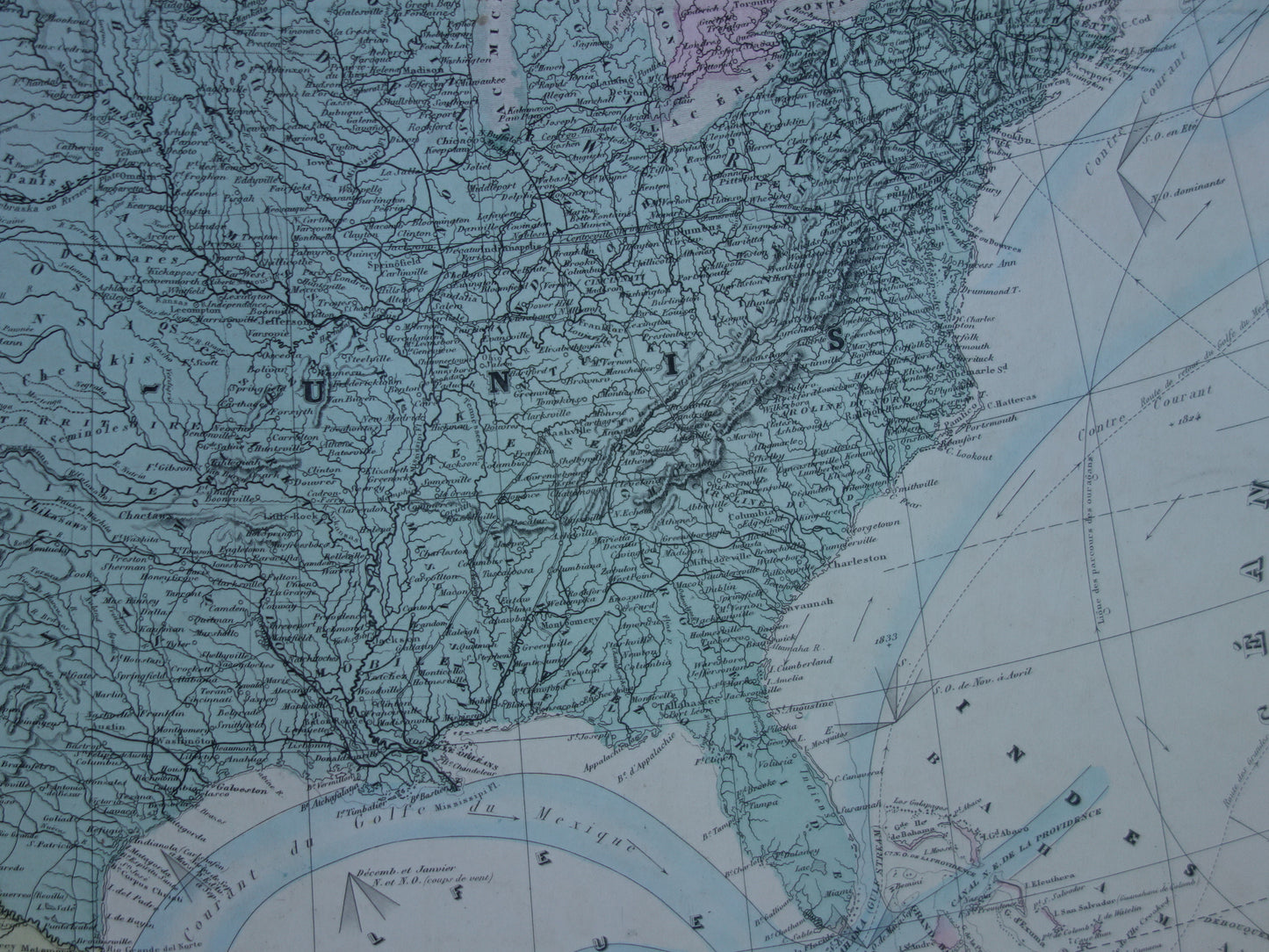
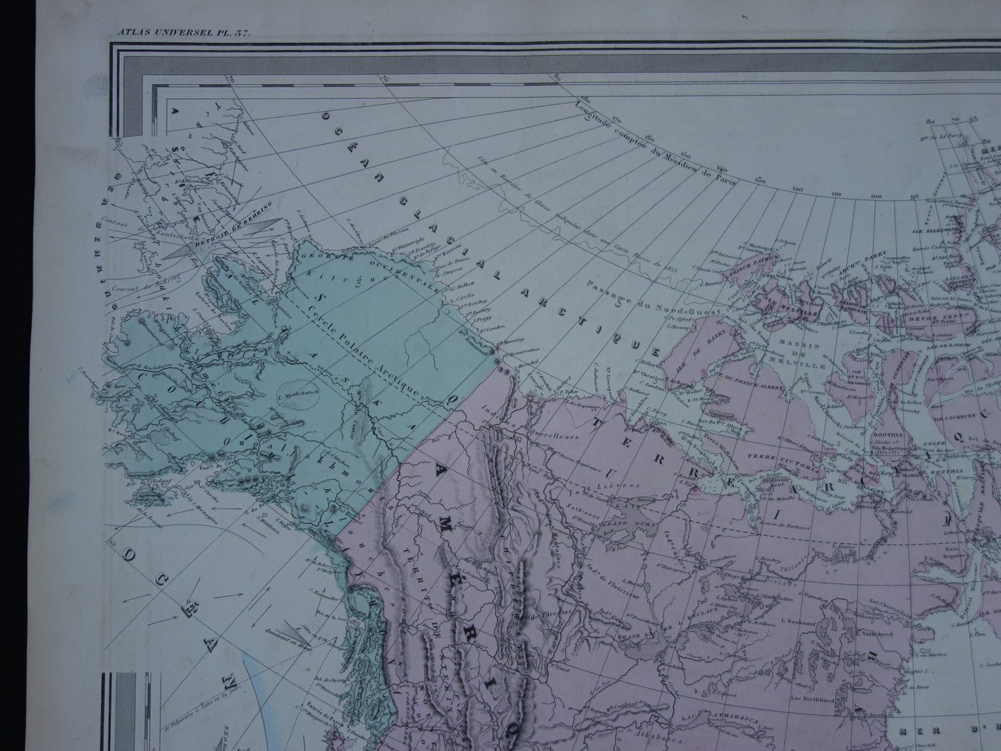
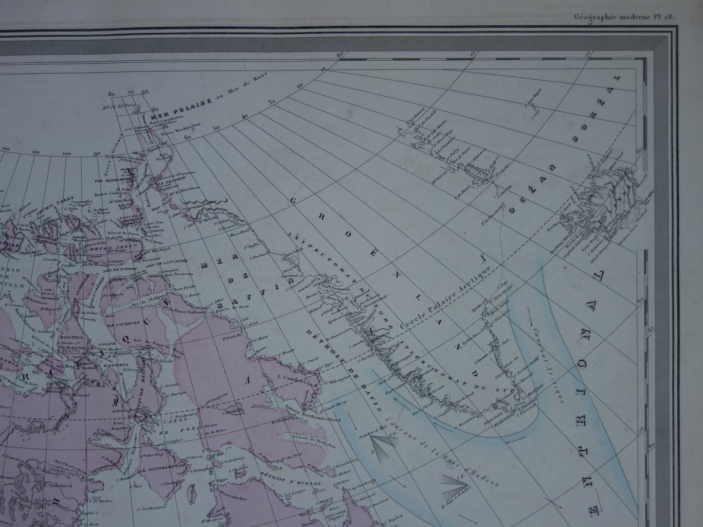
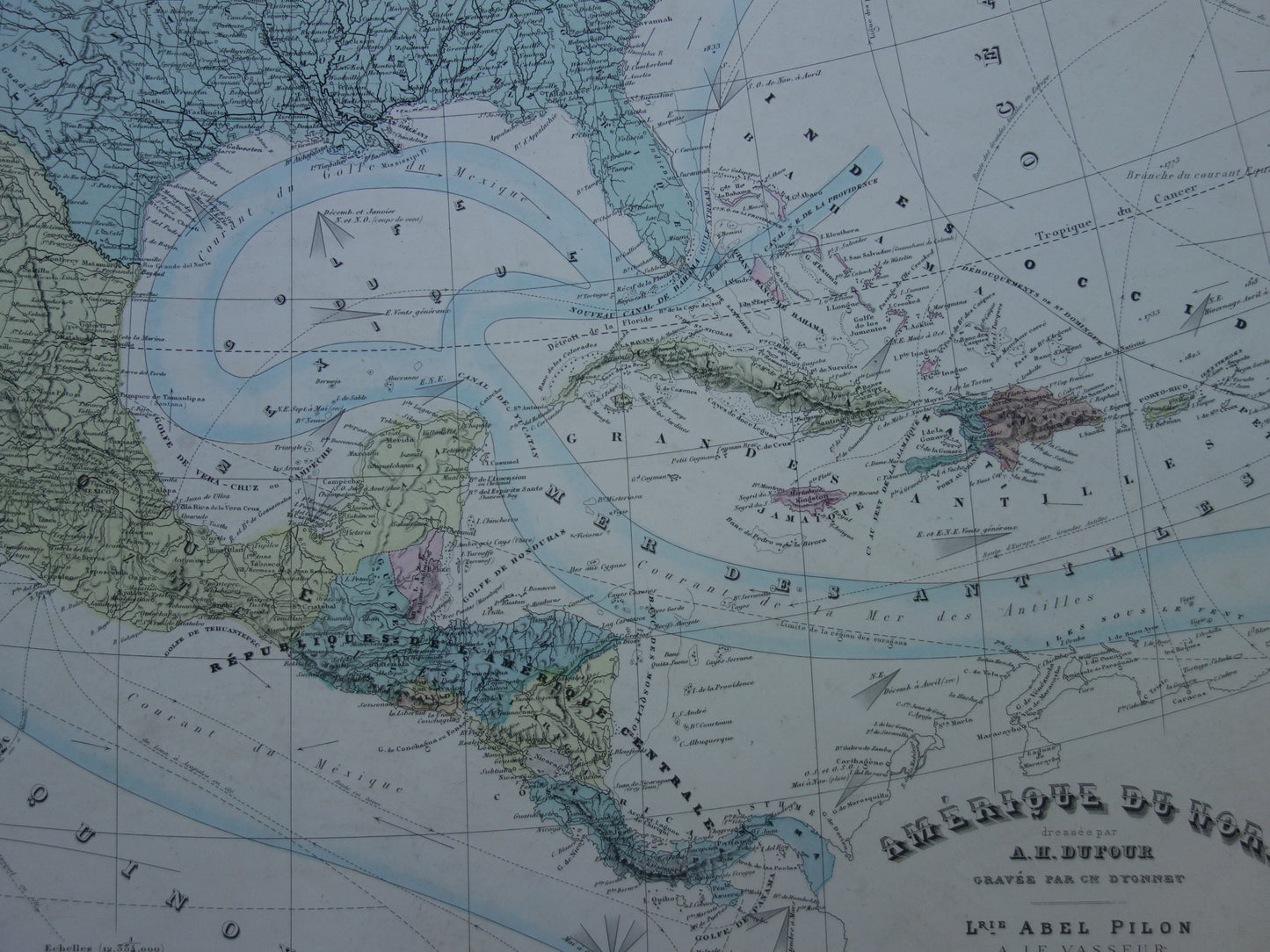
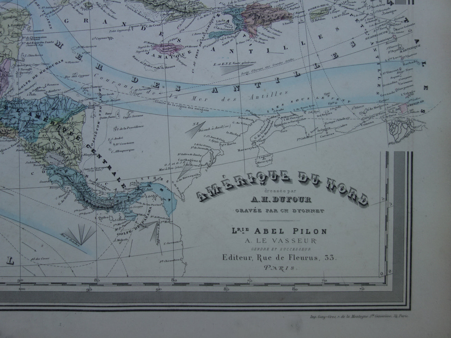
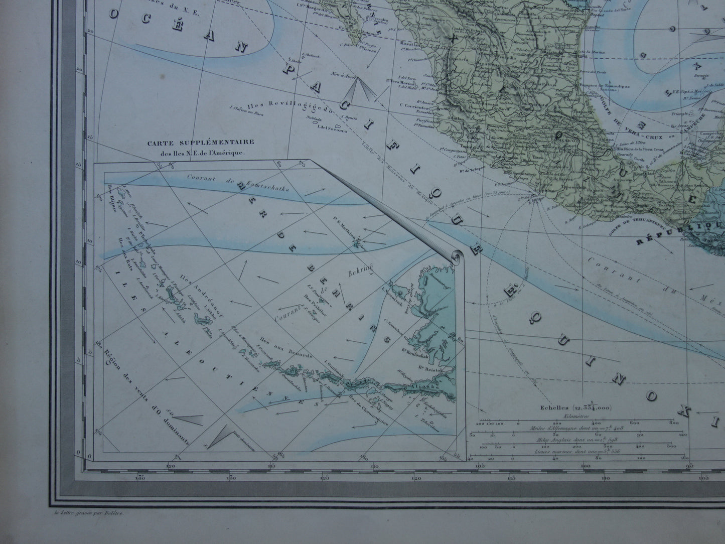
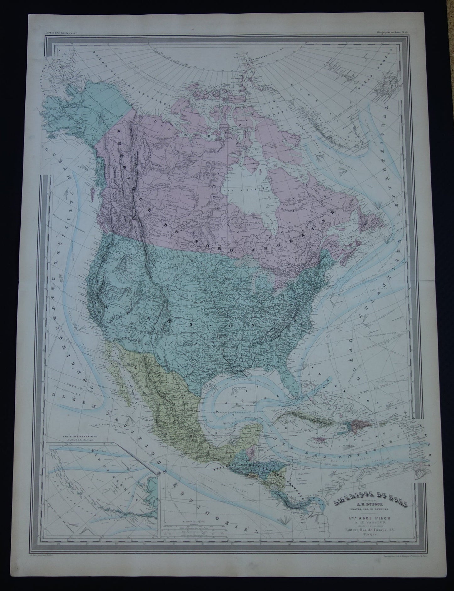
For sale is a very large antique French map of North America, featuring Mexico, the United States, and Canada. The map clearly shows that the North Pole has not yet been reached (the northernmost point Perry reached is indicated on the map). The ocean section also contains extensive information, including ocean currents and shipping routes. Zoom in on the photos to see the map's details.
Dimensions: 60 x 82 cm. Antique maps of such a large size are rare.
Condition: The map is in good condition (some minor signs of age/use, mainly in the margins - plus a 2 cm tear on the right side of the centerfold, in the margin). The map has a centerfold, as issued.
Origin: Atlas Universel - Dufour- Published circa 1880 (exact year of publication unknown)
ORDER WITHOUT RISK At Oudekaarten.com, ordering is always risk-free. Not completely satisfied with your purchase? You can return it and receive a full refund. Returns are free for Dutch customers.
We sell only original antique and vintage maps. We guarantee that your purchase was made on or around the date stated in the description.
Fast shipping
We will ship your order the next business day at the latest. Free shipping within the Netherlands when purchasing 2 cards. Click here for more information
"Beautiful card, exactly as described. Fast shipping and the card was packaged perfectly. Great transaction, thank you very much!"
ANNE ESCHER
Choosing a selection results in a full page refresh.