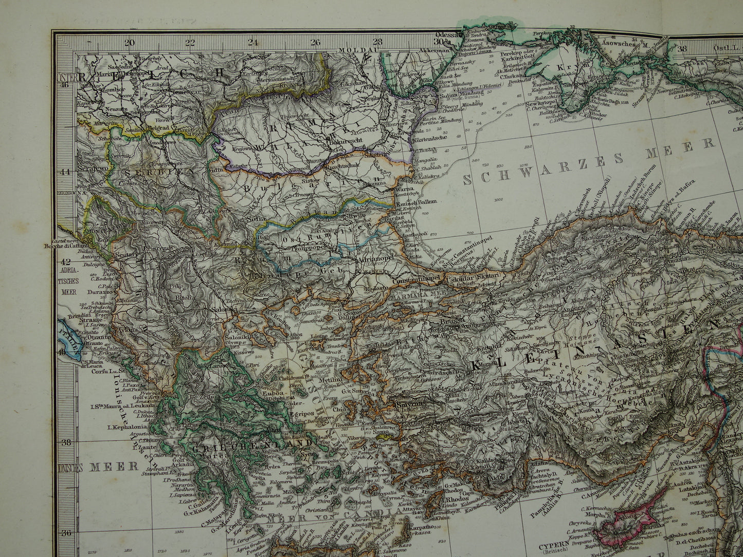
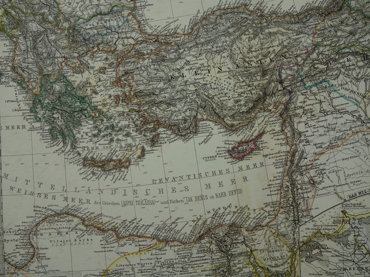
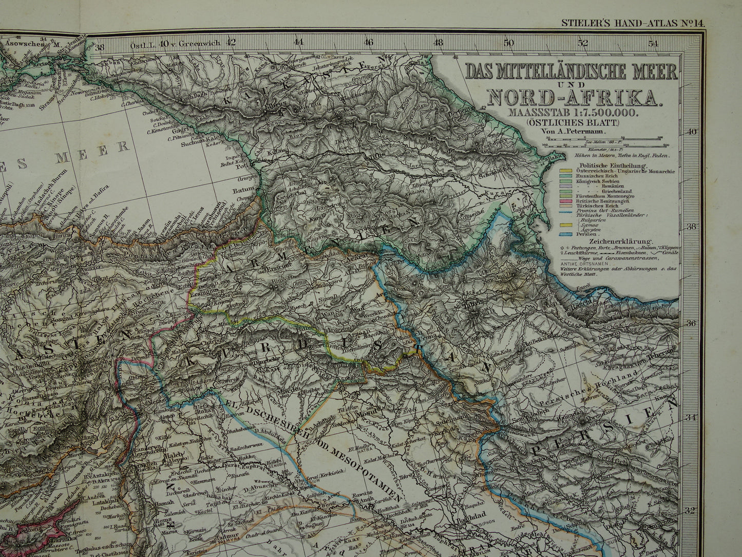
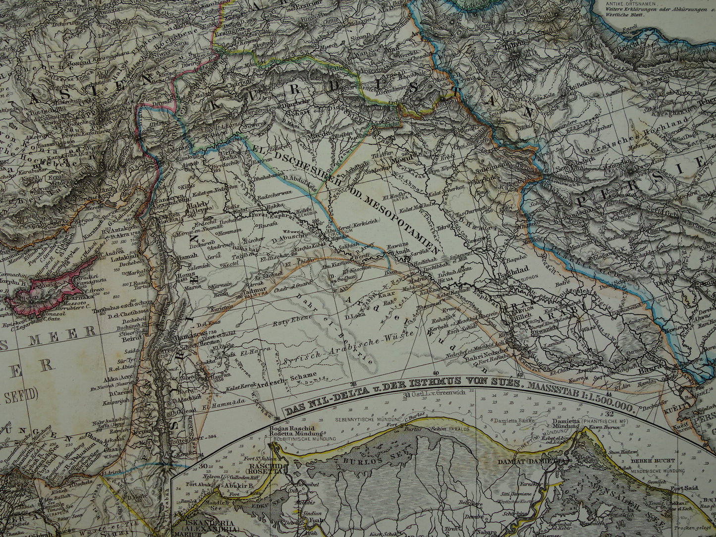
Mediterranean Sea antique map of Mediterranée from 1886 Original 135+ year old hand colored map Italy Greece Spain Turkey North Africa poster M. sea area
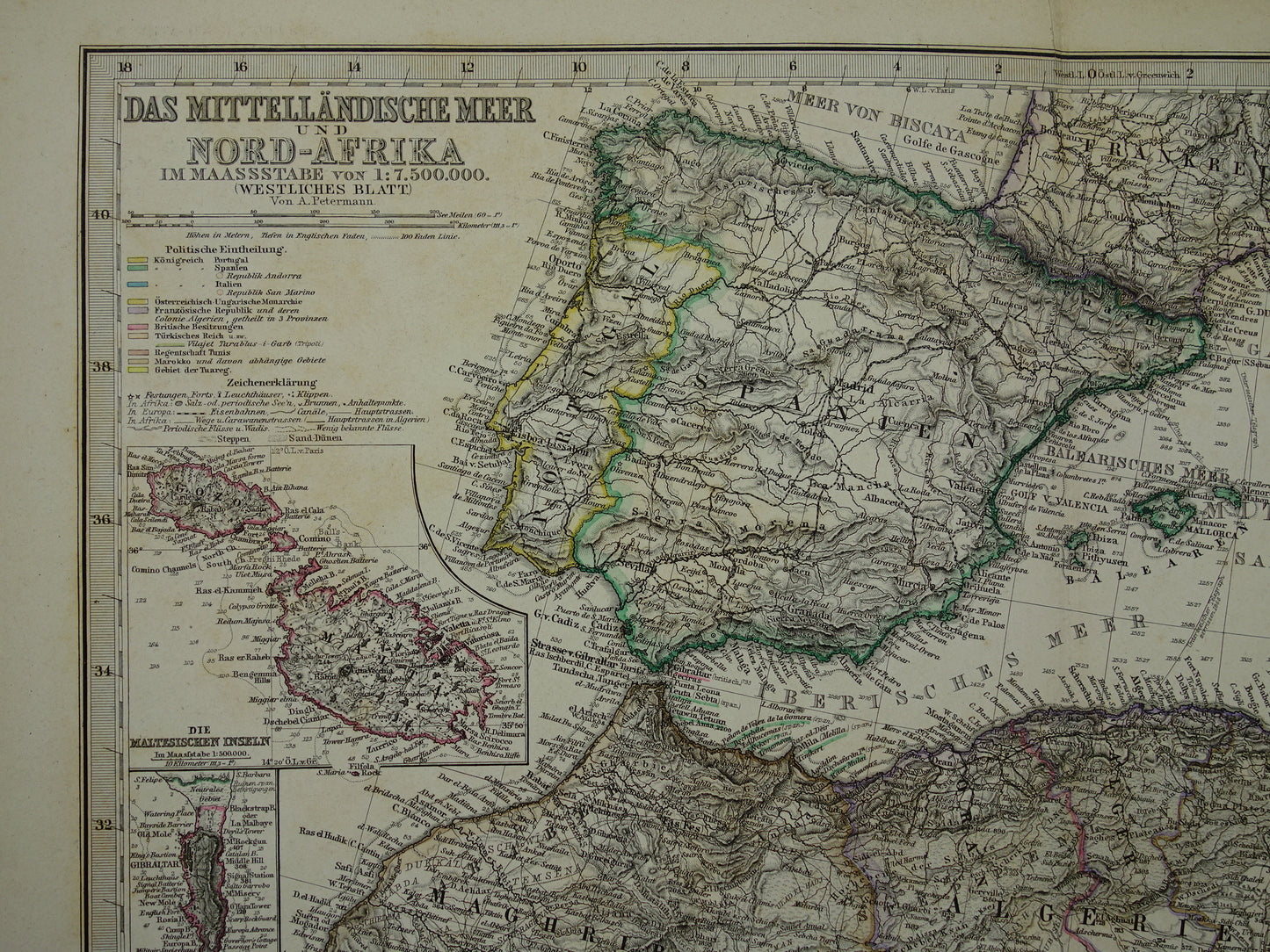
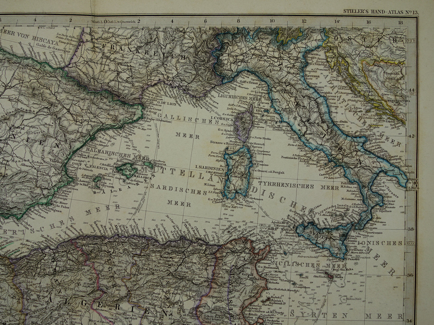
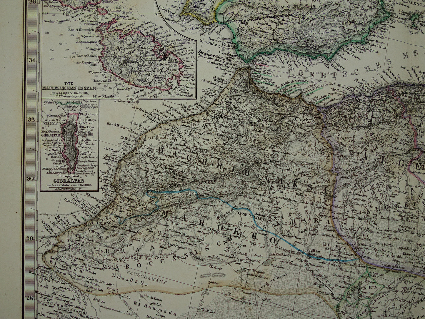
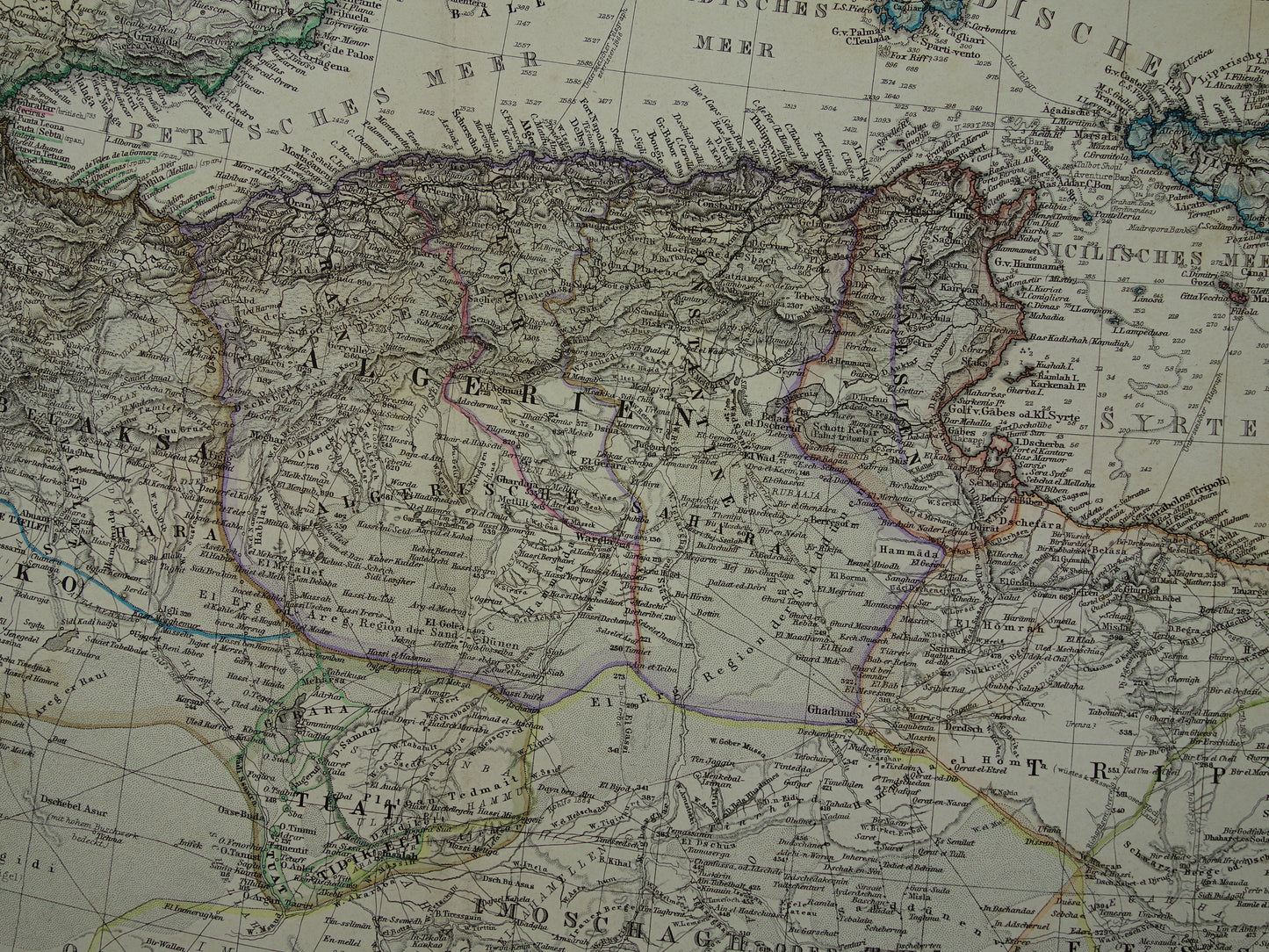
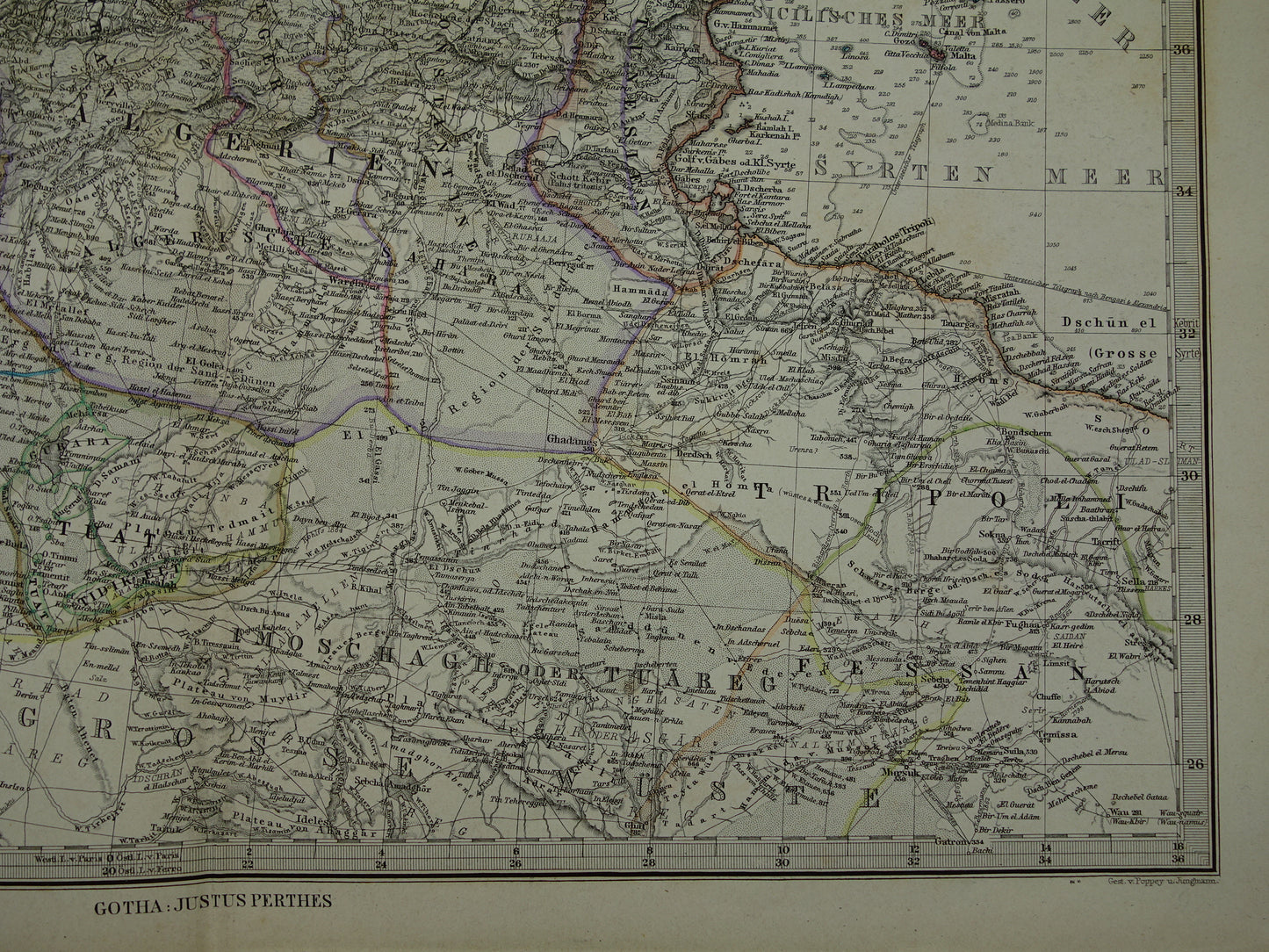
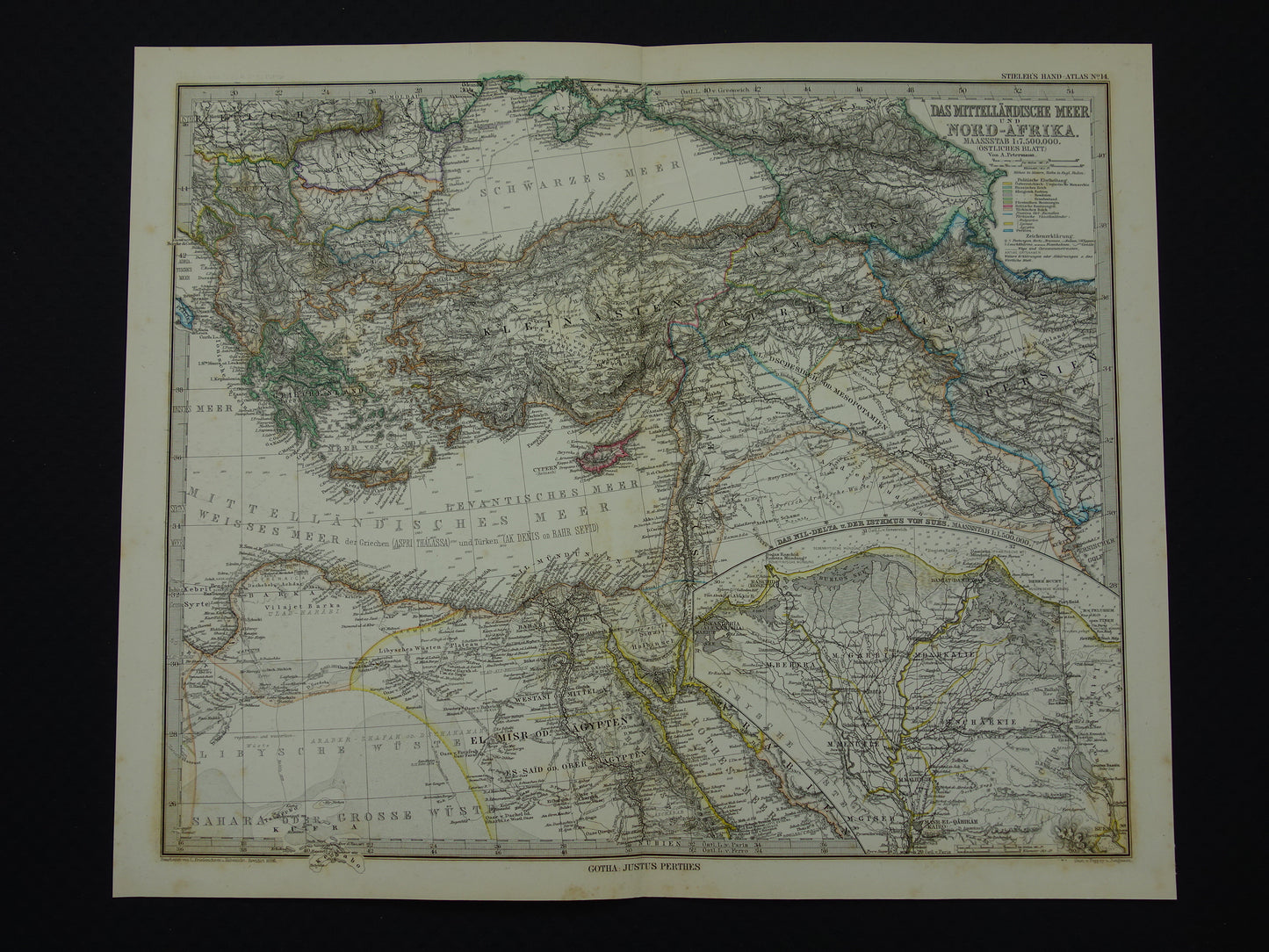
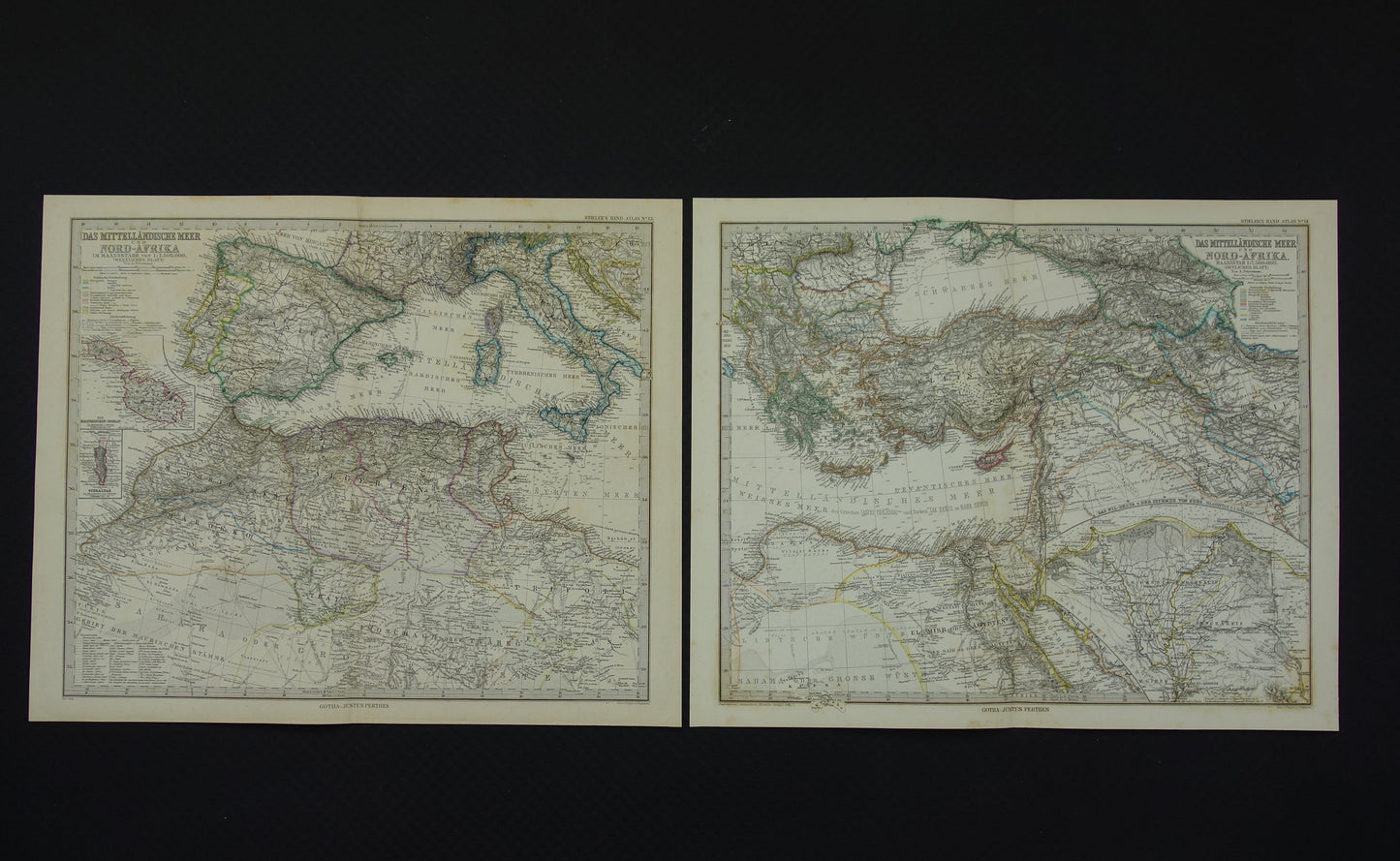
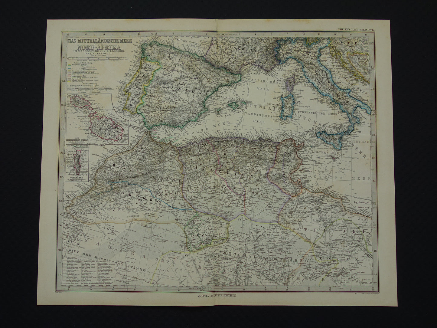
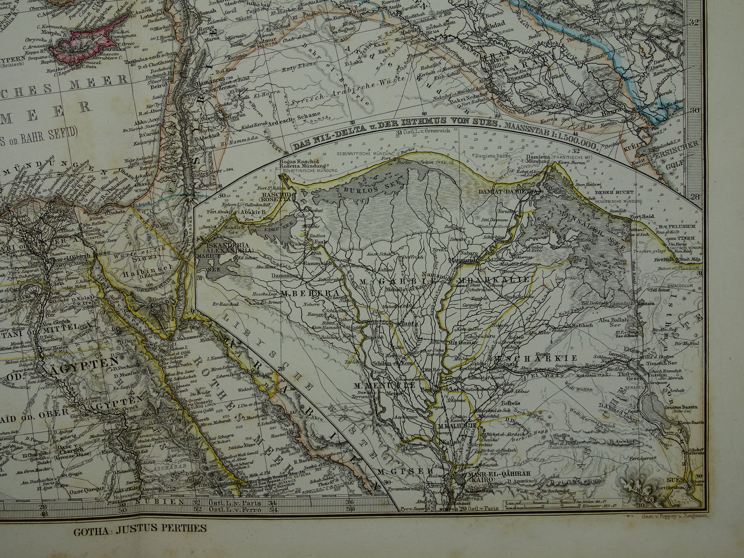
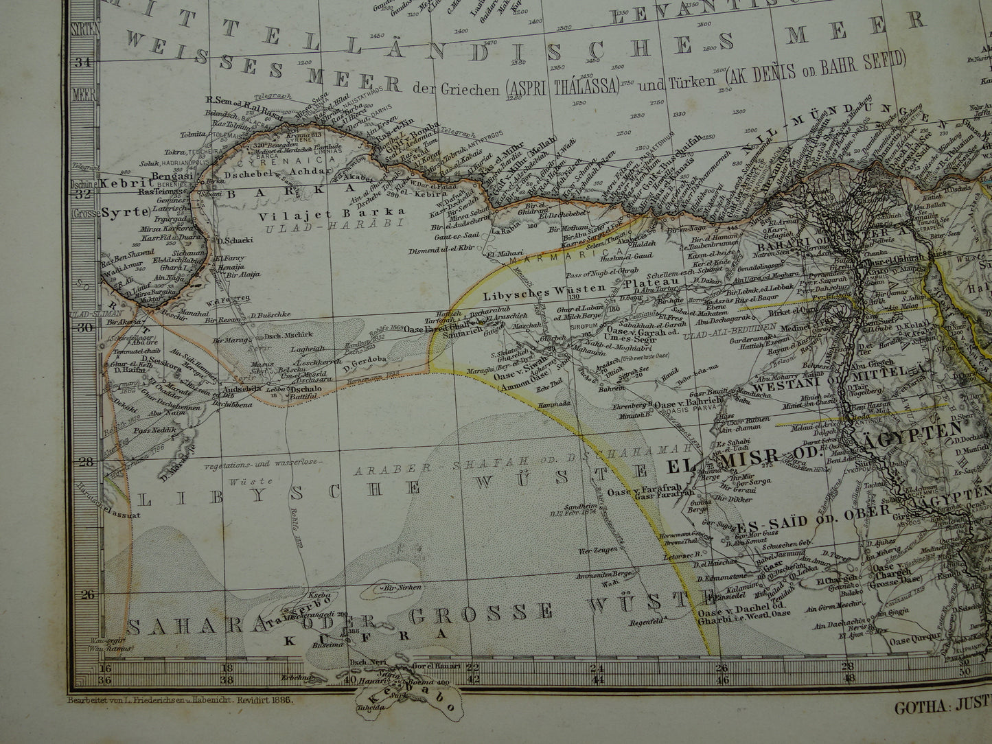
Beautiful and detailed antique German map of the Mediterranean in the year 1886 in two parts. The map is very detailed, zoom the photos to see that well. The map is a hand-colored copper engraving. Inset maps of Malta & Gozo, of Gibraltar and a large inset map of the Nile Delta. The year 1886 can be found at the bottom (printed small, see last photo). Nice wide margins and very suitable for framing.
Dimensions: each sheet is 36.5 x 45 cm, together 36.5 x 90 cm
Condition: Both pages have some brown age spots. Both pages have a centerfold, as issued. At the top, just next to the centerfold, of the left page is a 3 cm cut / tear. This has been repaired on the back with acid-free archival tape. In good overall condition.
Origin:Stieler's Hand Atlas - Edition of 1886
ORDER WITHOUT RISK At Oudekaarten.com you always order without risk. Are you not completely satisfied with your purchase? You can return your purchase free of charge and get your full purchase price back.
We sell only original antique and vintage maps. We guarantee that your purchase was made on or around the date stated in the description.
Fast shipping
We will ship your order the next business day at the latest. Free shipping within the Netherlands when purchasing 2 cards. Click here for more information
"Beautiful card, exactly as described. Fast shipping and the card was packaged perfectly. Great transaction, thank you very much!"
ANNE ESCHER
Choosing a selection results in a full page refresh.