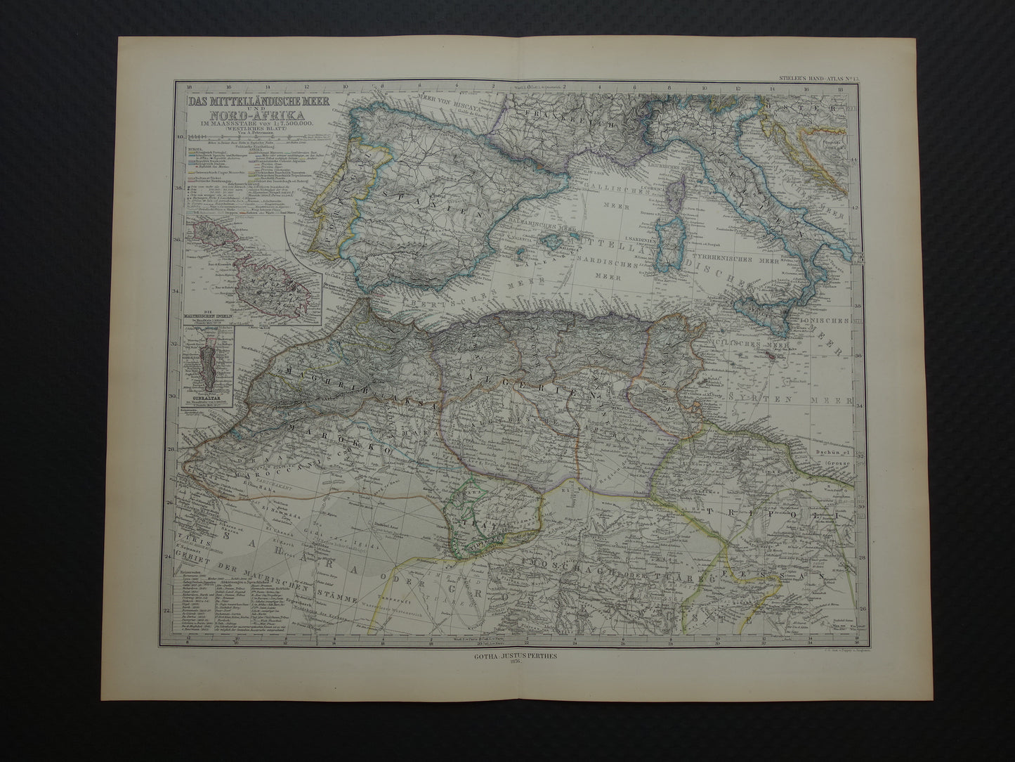
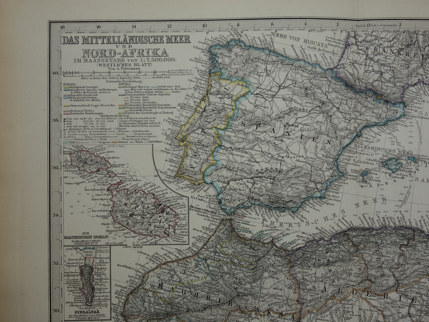
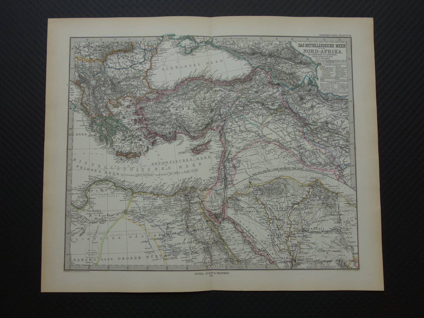
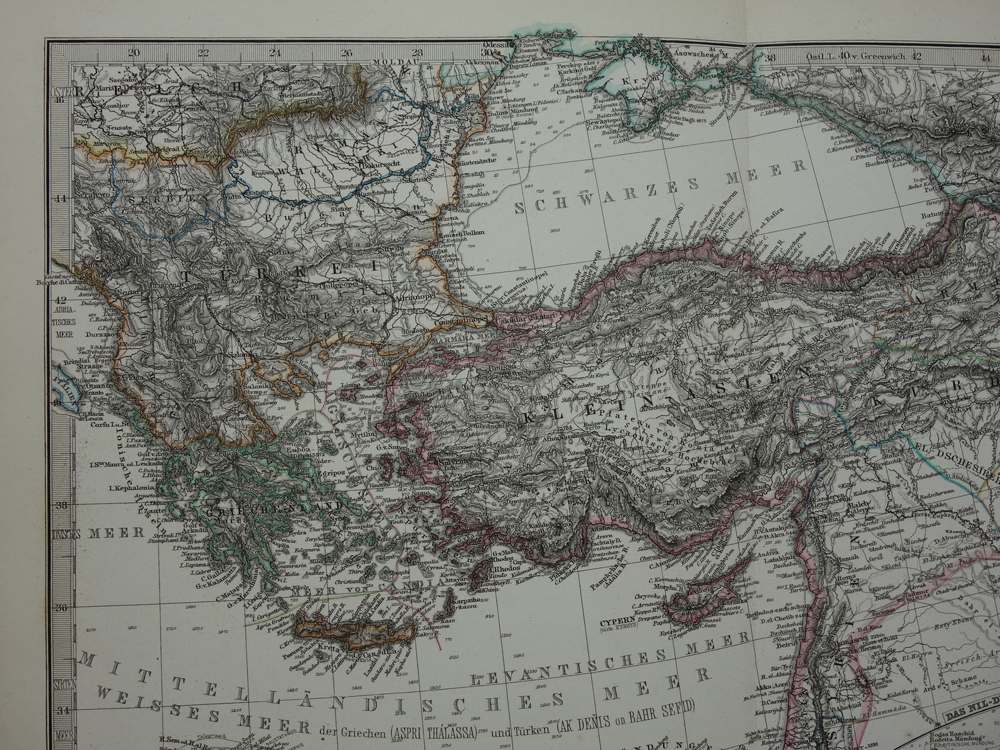
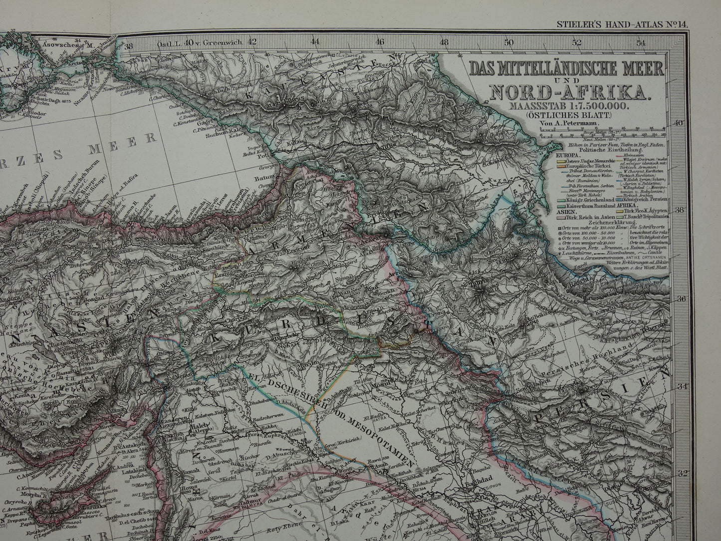
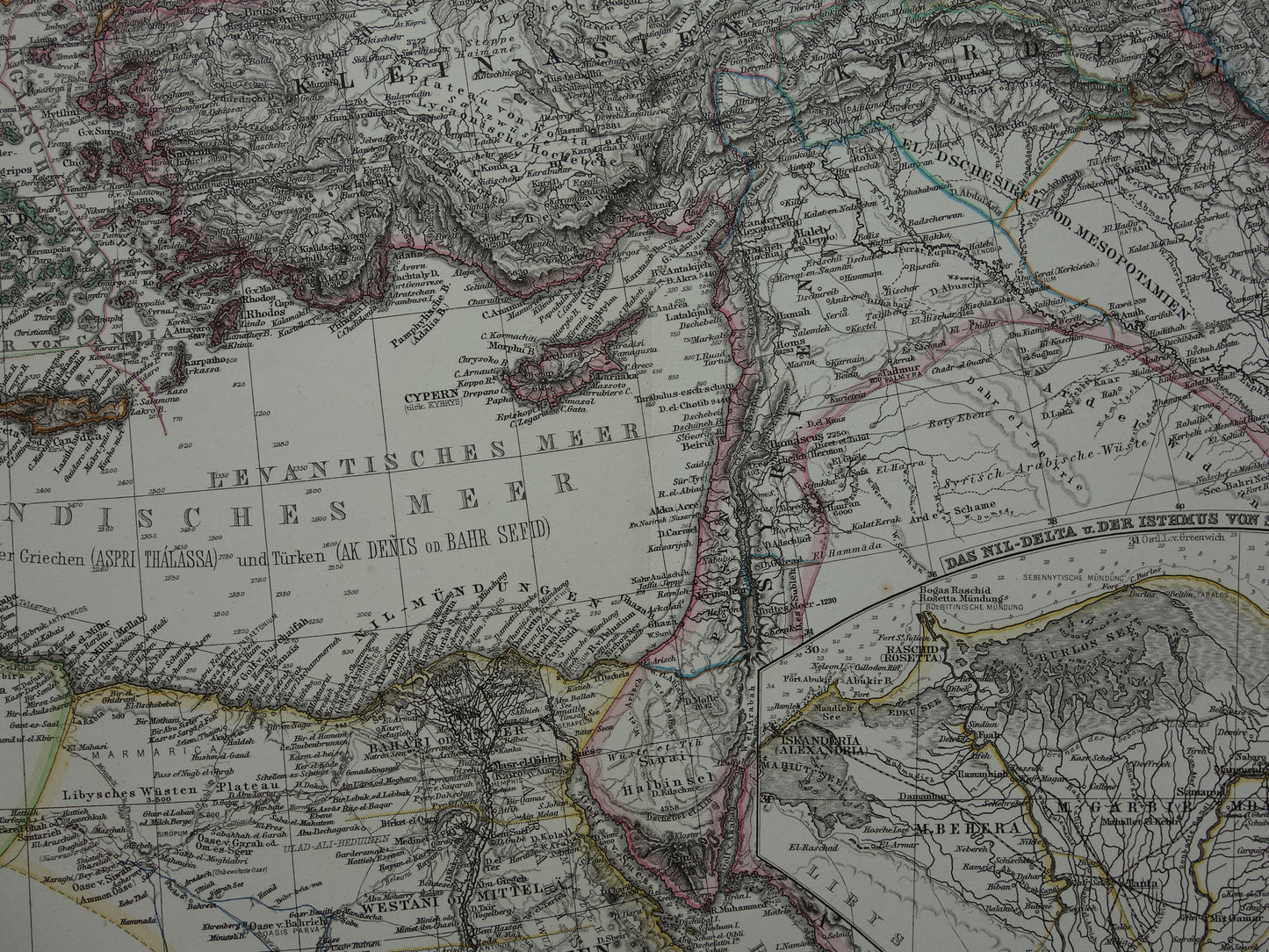
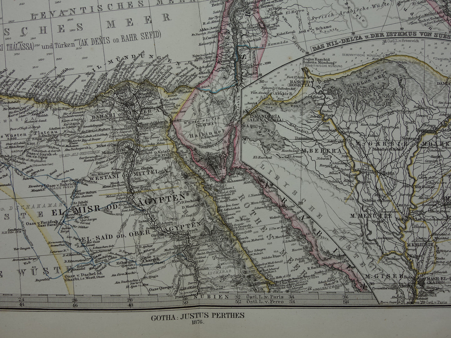
Beautiful, very detailed, antique German map of the Mediterranean in the year 1876 in two parts . The map is a hand-colored copper engraving. Inset maps of Malta & Gozo, of Gibraltar and a large inset map of the Nile Delta. The year 1876 can be found at the bottom. Nice wide margins and very suitable for framing.
Dimensions: each sheet is 39 x 47 cm, together 94 x 39 cm
Condition: In good overall condition (= some minor signs of age - paper intact - in good overall condition). Both sheets have a centrefold, as issued.
Origin:Stieler's Hand Atlas - Edition of 1876
ORDER WITHOUT RISK At Oudekaarten.com you always order without risk. Are you not completely satisfied with your purchase? You can return your purchase free of charge and will then receive your full purchase amount back.
We sell only original antique and vintage maps. We guarantee that your purchase was made on or around the date stated in the description.
Fast shipping
We will ship your order the next business day at the latest. Free shipping within the Netherlands when purchasing 2 cards. Click here for more information
"Beautiful card, exactly as described. Fast shipping and the card was packaged perfectly. Great transaction, thank you very much!"
ANNE ESCHER
Choosing a selection results in a full page refresh.