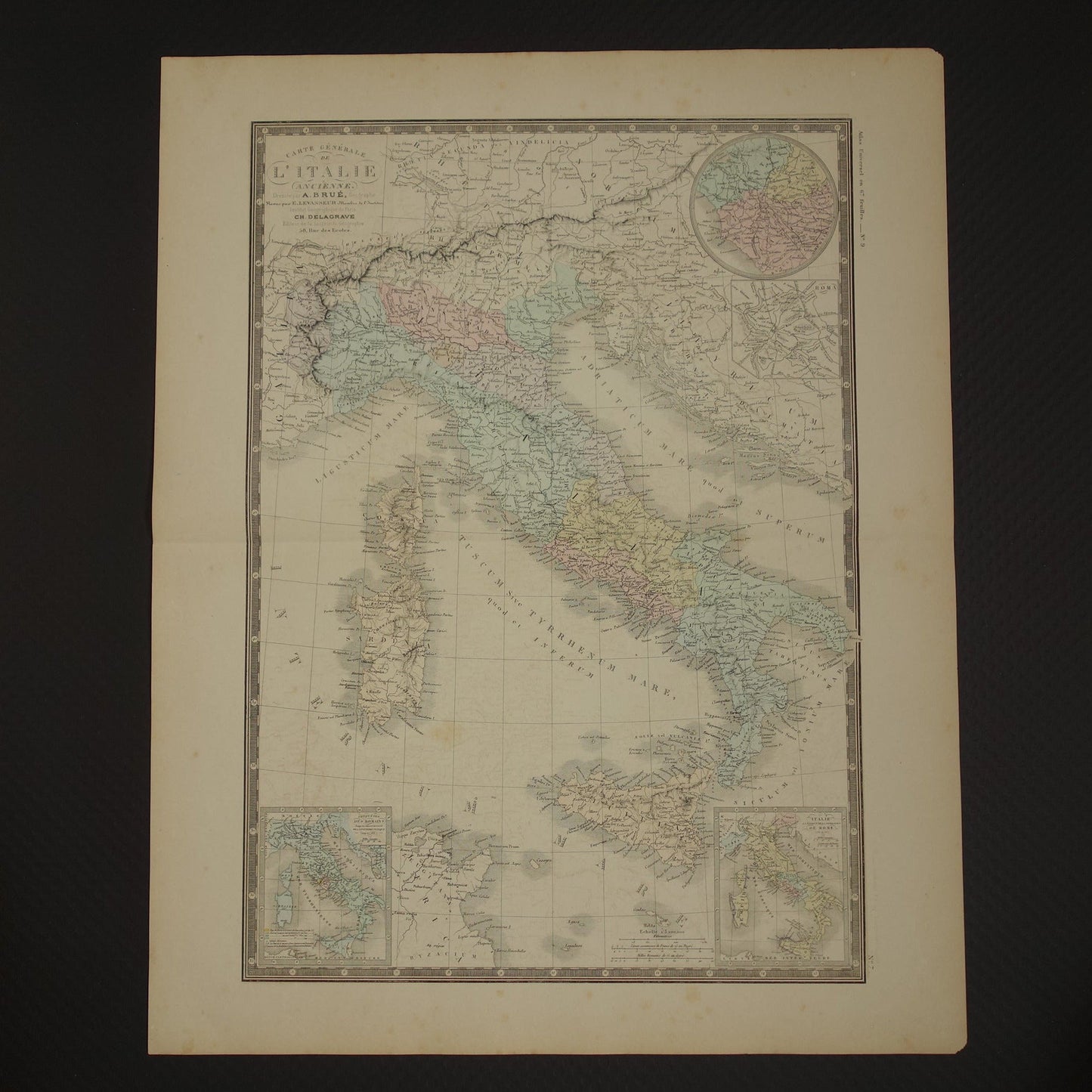
Beautiful, large, hand-colored French map of Italy in classical antiquity. With the following inset maps: Rome (top right) - Rome and environs (top right) - Conquests up to the Second Punic War in 219 BC (bottom left) - Italy at the time of Rome's founding in 755 BC (bottom right). Wide margins and very suitable for framing.
Dimensions: 48 x 60 cm
Condition: paper somewhat discoloured due to age - here and there some brown age spots - tip of the right corners is missing - some offsetting is vaguely visible - issued with centre fold - in good general condition
Origin:'Atlas Universel de geographie physique, politique, ancienne et modern' - A. Brué / E. Levasseur - Edition of 1875
ORIGINAL ANTIQUE MAP Oudekaarten.com sells only original old maps; we do not sell modern reprints.
We sell only original antique and vintage maps. We guarantee that your purchase was made on or around the date stated in the description.
Fast shipping
We will ship your order the next business day at the latest. Free shipping within the Netherlands when purchasing 2 cards. Click here for more information
"Beautiful card, exactly as described. Fast shipping and the card was packaged perfectly. Great transaction, thank you very much!"
ANNE ESCHER
Choosing a selection results in a full page refresh.