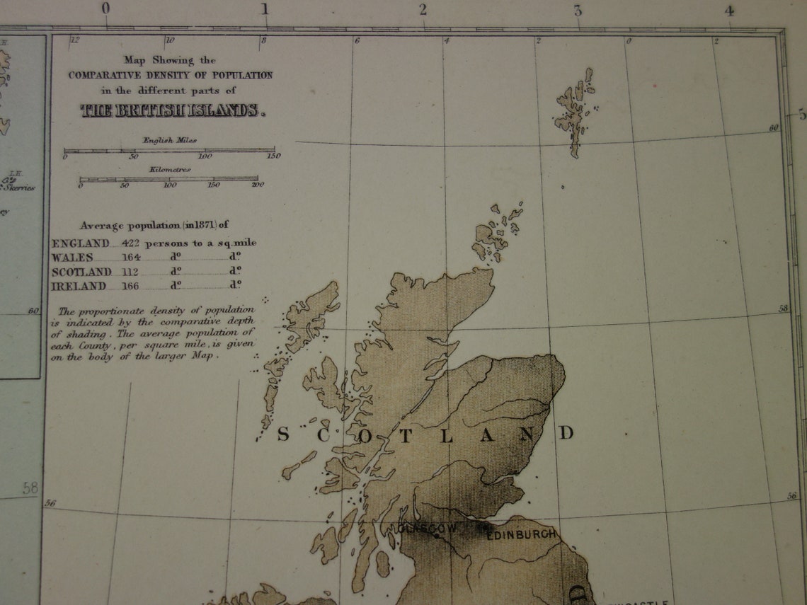
For sale is a large vintage map of Great Britain and Ireland from 1875. This large English map is an industrial map and shows the railways, canals, and navigable rivers, the population of each county (per square mile according to the 1871 census), all towns with more than 2,000 inhabitants, lightships and lighthouses, and the main regional products (for example, boots and shoes in Northampton and gloves in Yeovil). An inset map at the top left shows the main mining production in each area, and the map at the top right shows the comparative population density.
The map has wide margins and is very suitable for framing.
Dimensions: 55 x 71 cm
Condition: good/very good. The map has a center fold, as issued.
Origin: Atlas Universel - William Hughes - Edition of 1874
We sell only original antique and vintage maps. We guarantee that your purchase was made on or around the date stated in the description.
Fast shipping
We will ship your order the next business day at the latest. Free shipping within the Netherlands when purchasing 2 cards. Click here for more information
"Beautiful card, exactly as described. Fast shipping and the card was packaged perfectly. Great transaction, thank you very much!"
ANNE ESCHER
Choosing a selection results in a full page refresh.