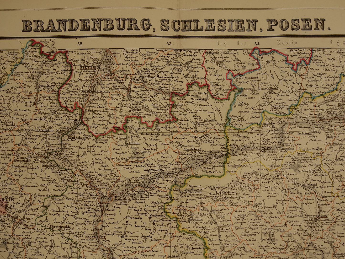
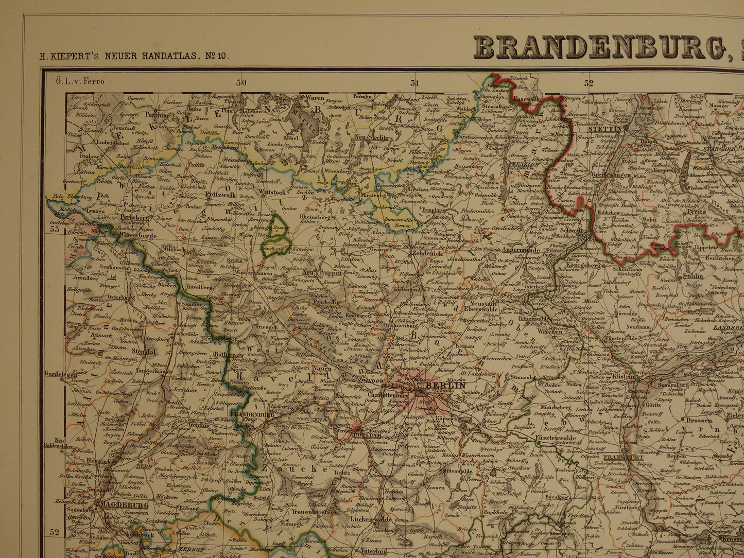
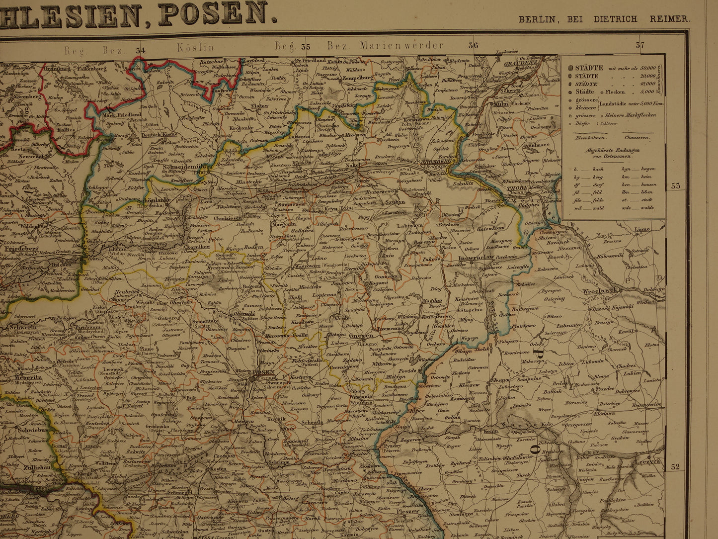
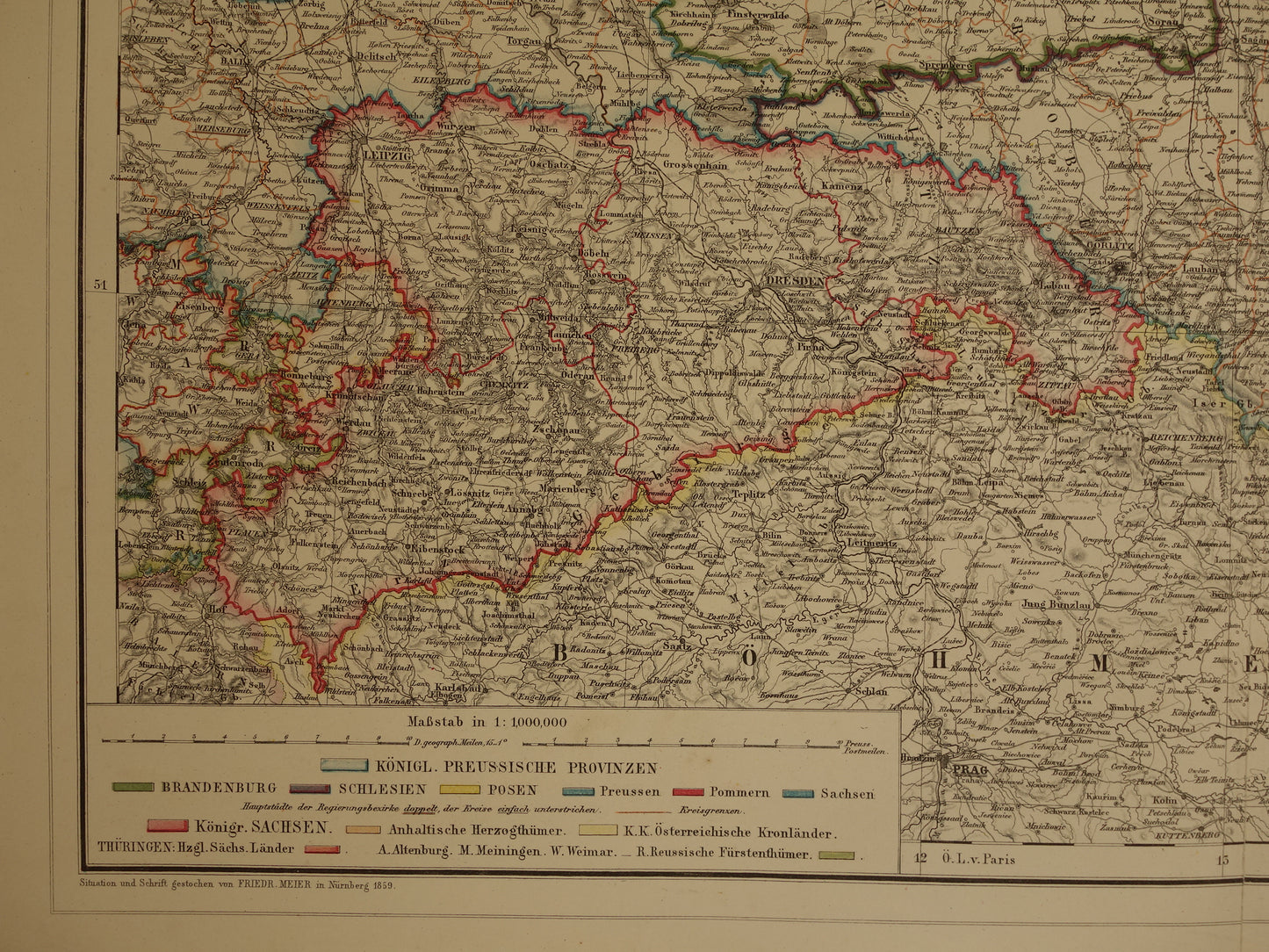
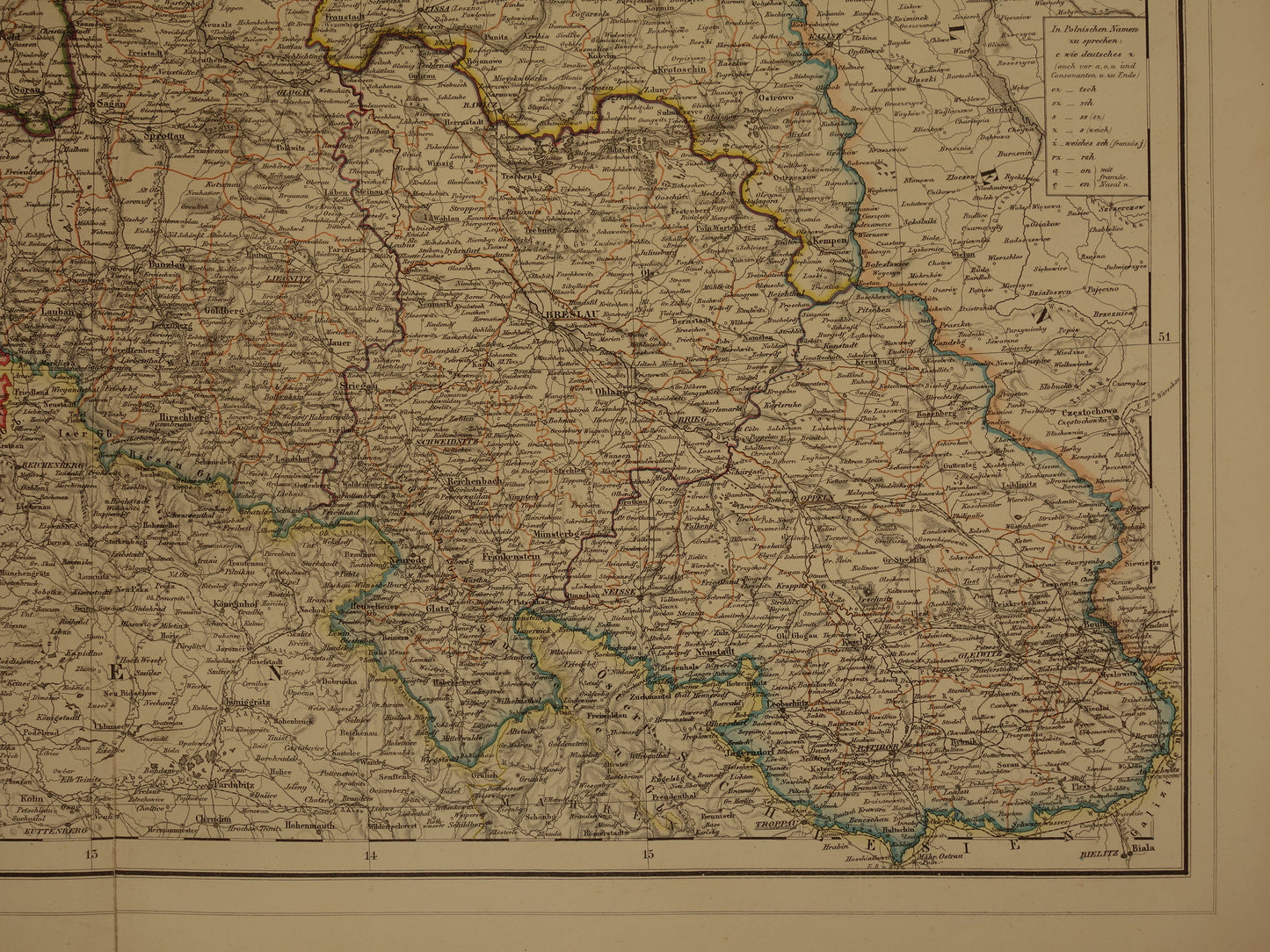
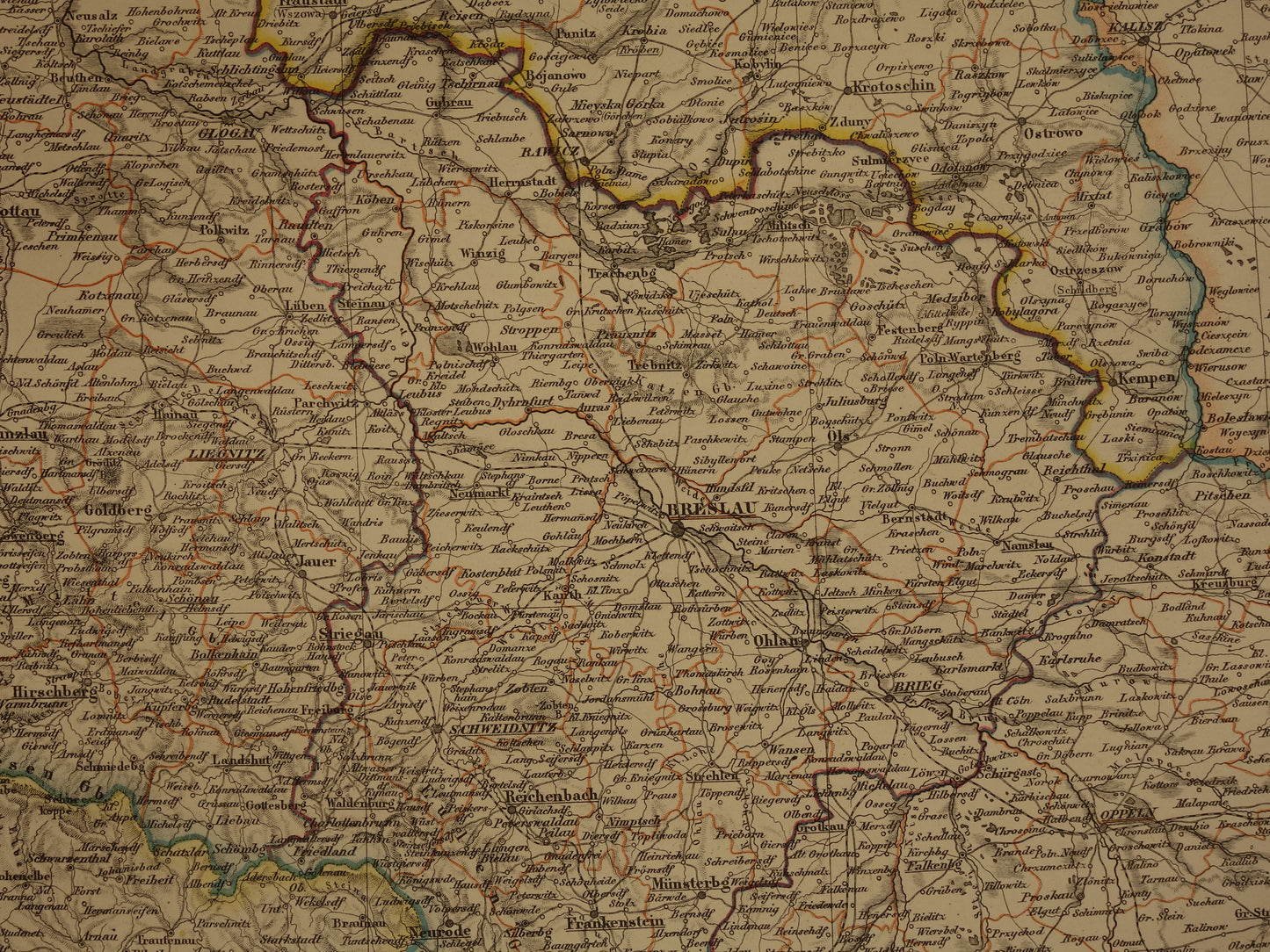
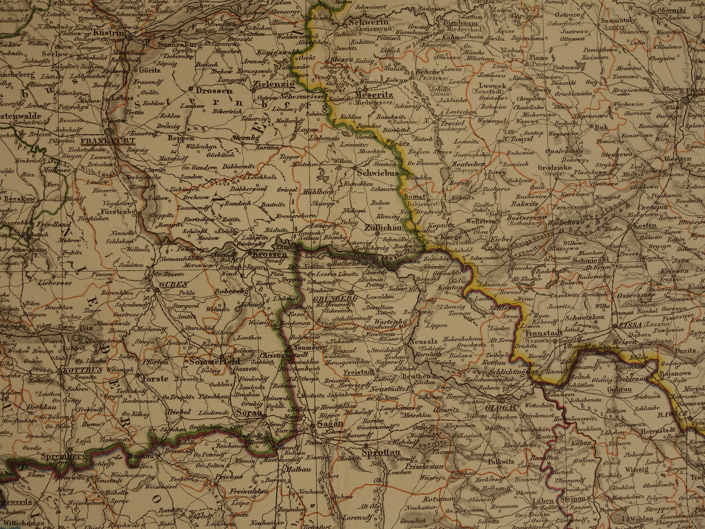
For sale is a large and highly detailed German map of Brandenburg (with Berlin), Silesia (with Wrocław), and Posen (with Poznan) from the year 1859. A large portion of the depicted area is now part of Poland. It is a hand-colored lithograph (the borders are hand-colored). The year 1859 is printed at the bottom, which is the year the map was designed. This copy dates from 1860. Zoom in on the photos to see all the details.
Dimensions: 49.5 x 62 cm
Condition: In good general condition (= some minor signs of age and use - plus a 6 cm tear at the bottom of the centrefold, fortunately barely visible - in good general condition).
Origin: Neuer Hand-Atlas über alle Theile der Erde - Heinrich Kiepert - Edition 1860
ORDER WITHOUT RISK At Oudekaarten.com, ordering is always risk-free. Not completely satisfied with your purchase? You can return it and receive a full refund. Returns are free for Dutch customers.
We sell only original antique and vintage maps. We guarantee that your purchase was made on or around the date stated in the description.
Fast shipping
We will ship your order the next business day at the latest. Free shipping within the Netherlands when purchasing 2 cards. Click here for more information
"Beautiful card, exactly as described. Fast shipping and the card was packaged perfectly. Great transaction, thank you very much!"
ANNE ESCHER
Choosing a selection results in a full page refresh.