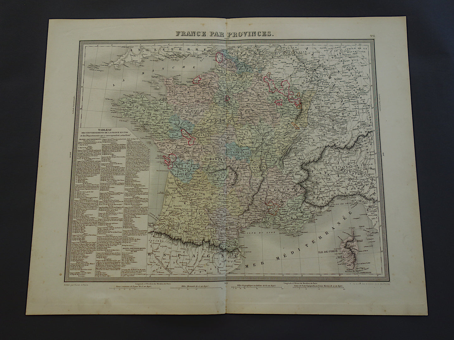
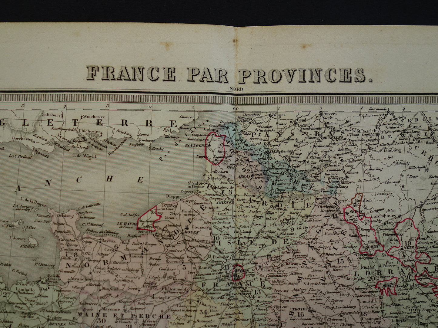
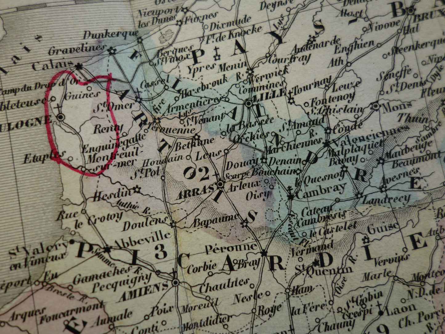
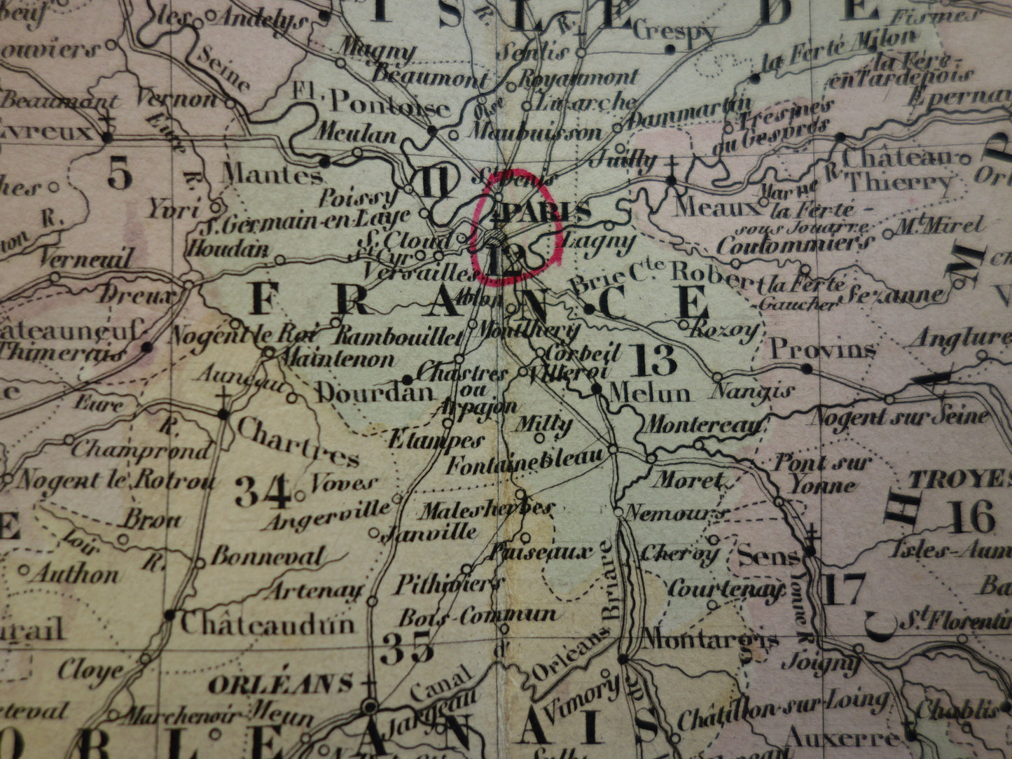
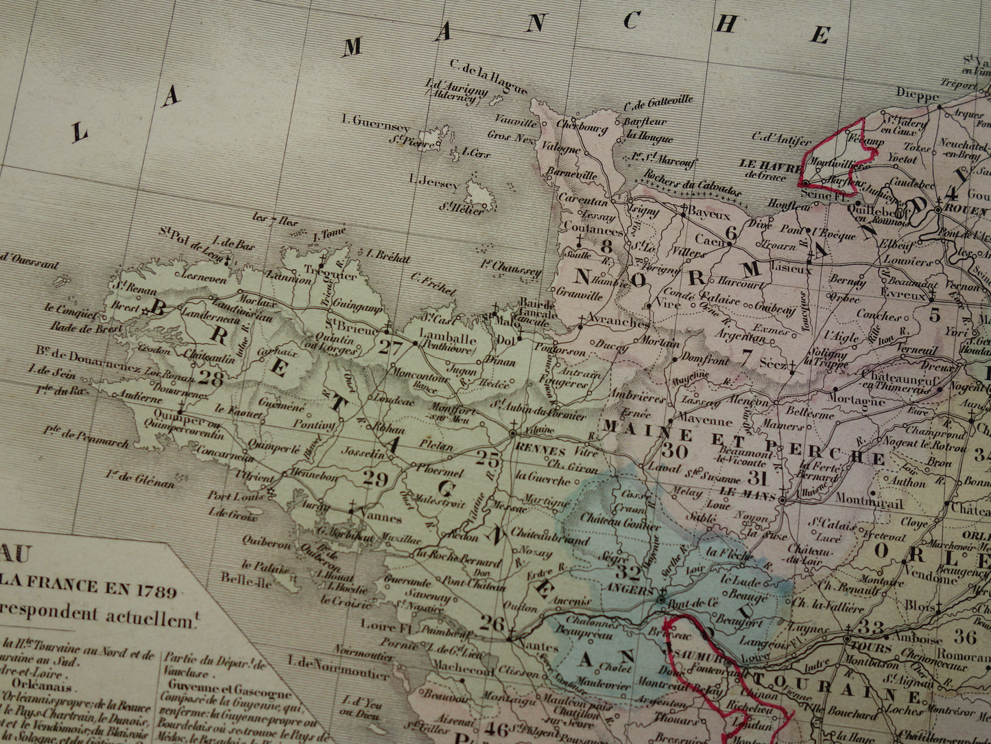
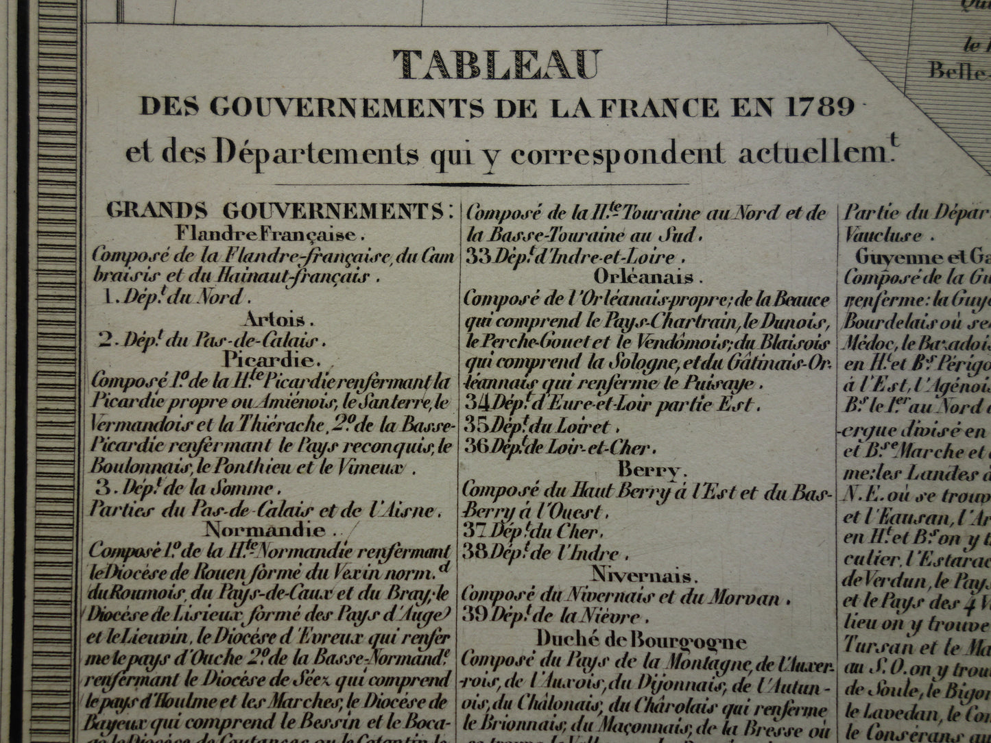
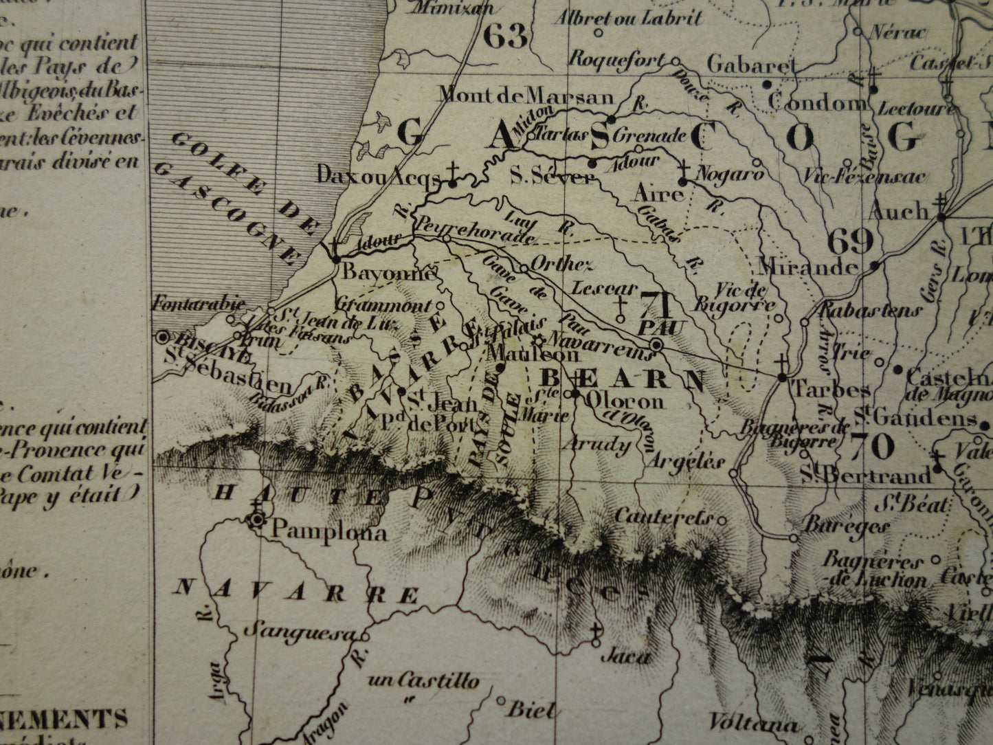
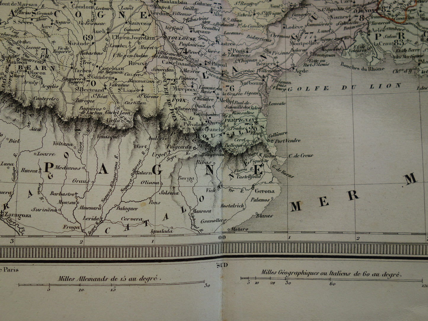
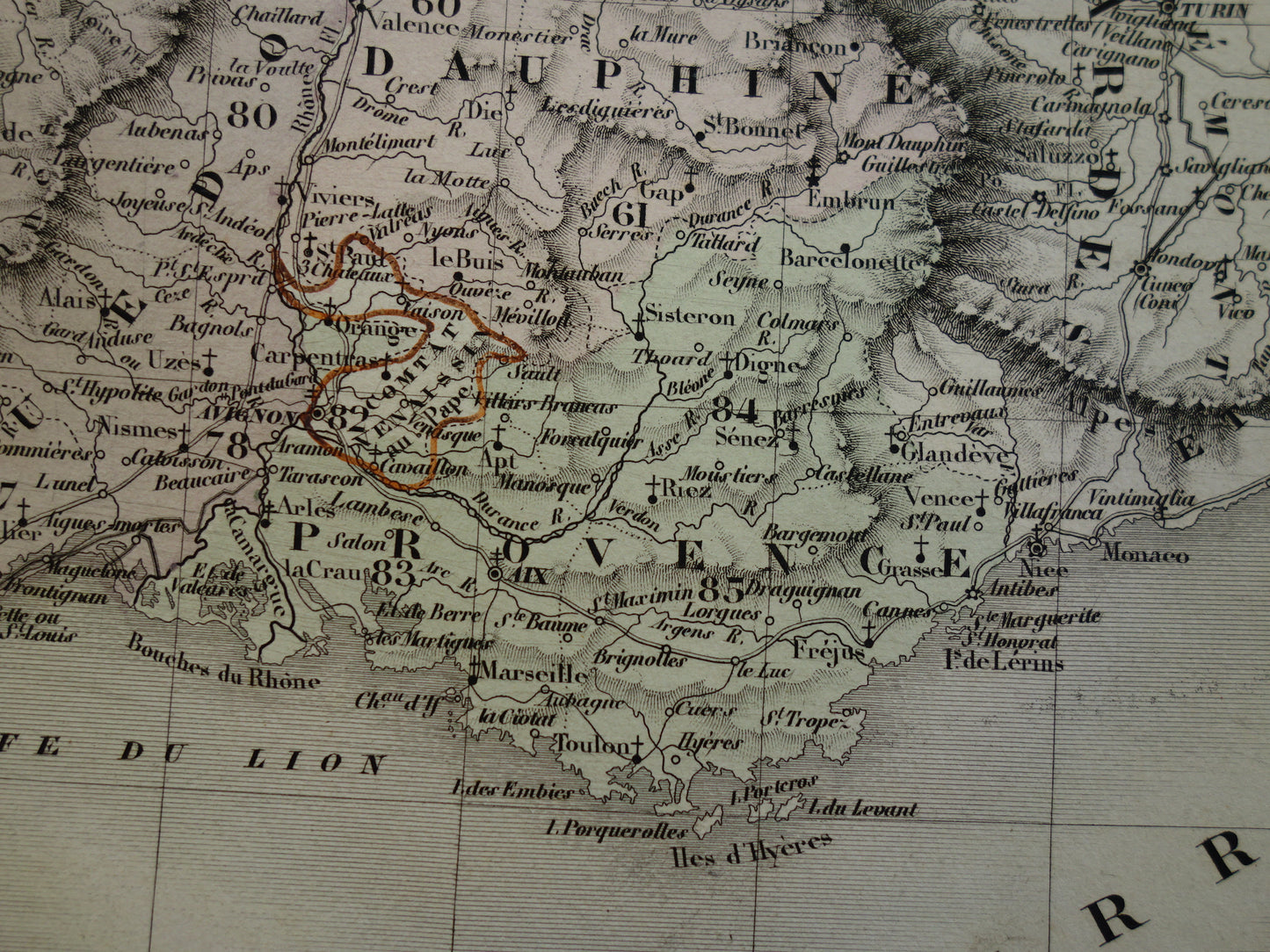
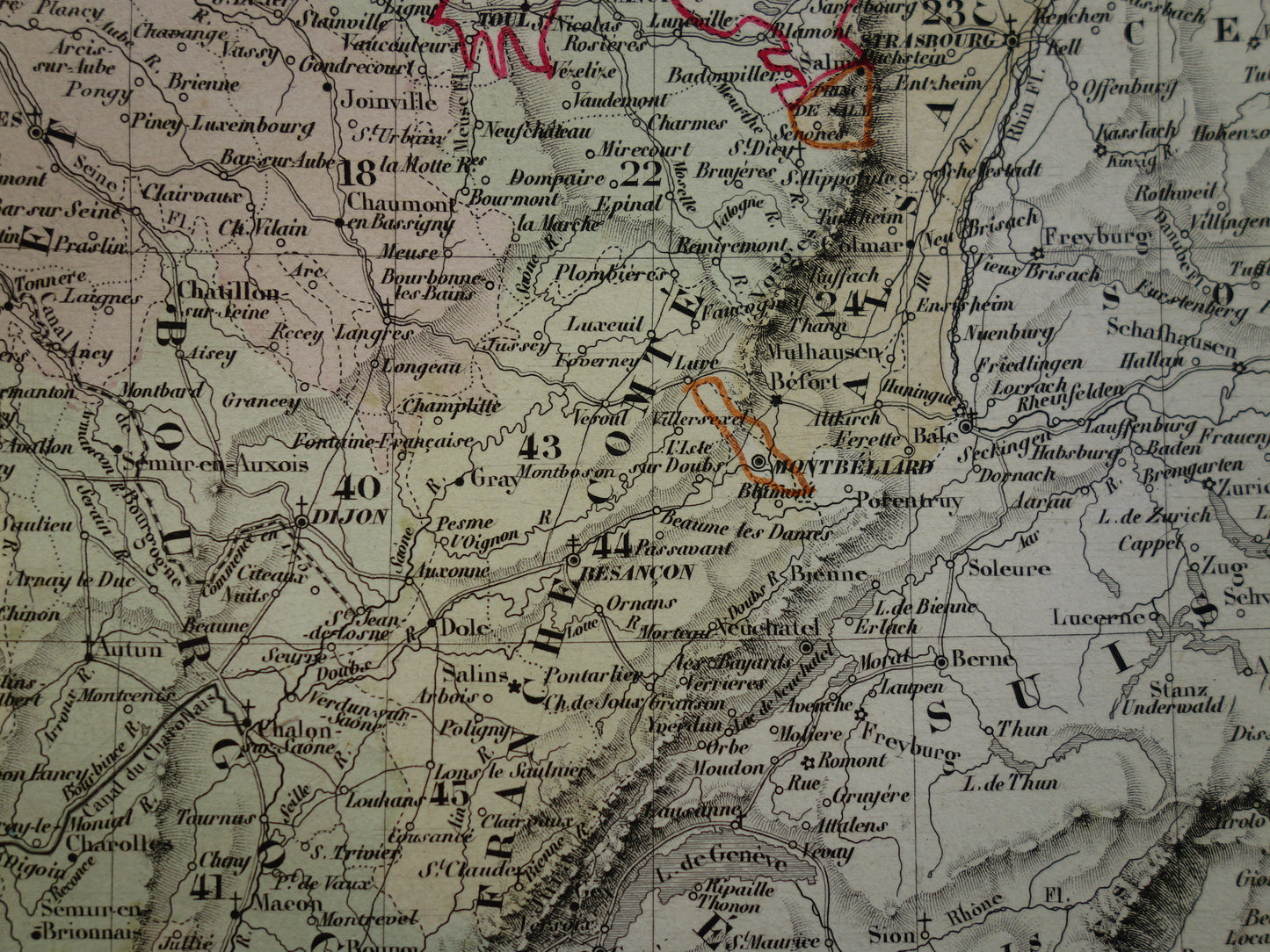
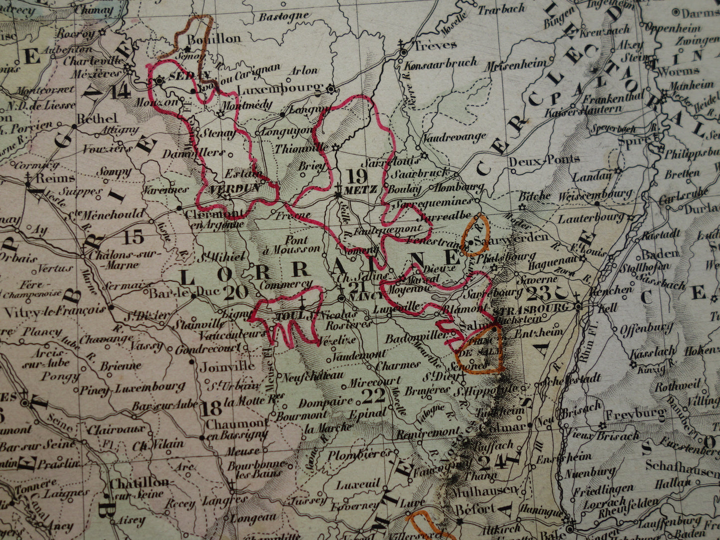
Beautiful, antique French map of France divided into provinces from the year 1858. The map is very detailed, zoom the photos to see this well . Beautiful colors that are colored by hand.
Foreign buyers: this card may have an additional shipping charge depending on the destination. Please inquire before ordering via info@oudekaarten.com
Dimensions: 41.5 x 51.5 cm
Condition: in good condition (= some minor signs of age/use, mainly in the margins). Printed on heavy paper. This map has a vertical centrefold, as issued.
Origin:Atlas Universel De Geographie Ancienne Et Moderne - Ambroise Tardieu / A. Vuillemin - Paris 1858
We sell only original antique and vintage maps. We guarantee that your purchase was made on or around the date stated in the description.
Fast shipping
We will ship your order the next business day at the latest. Free shipping within the Netherlands when purchasing 2 cards. Click here for more information
"Beautiful card, exactly as described. Fast shipping and the card was packaged perfectly. Great transaction, thank you very much!"
ANNE ESCHER
Choosing a selection results in a full page refresh.