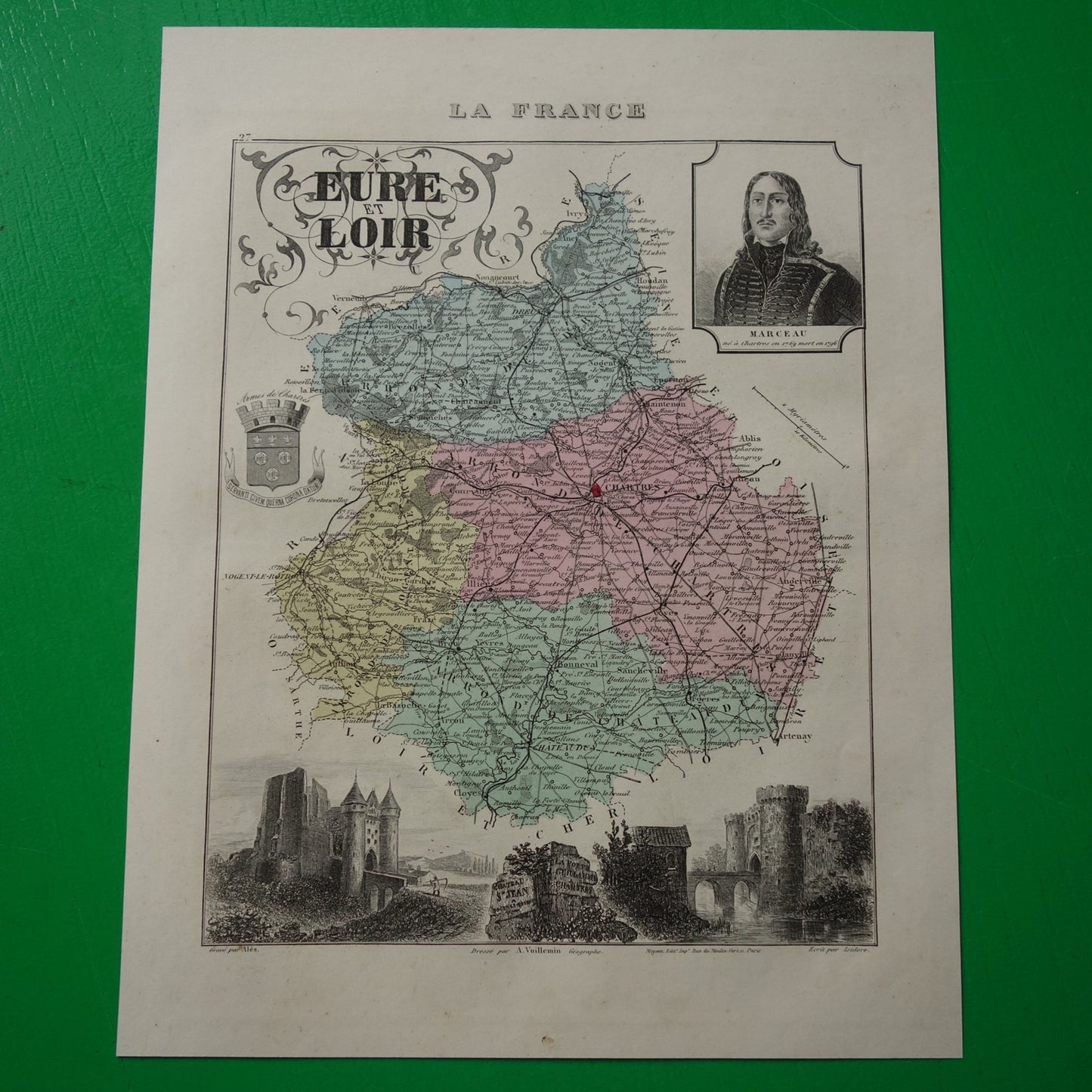
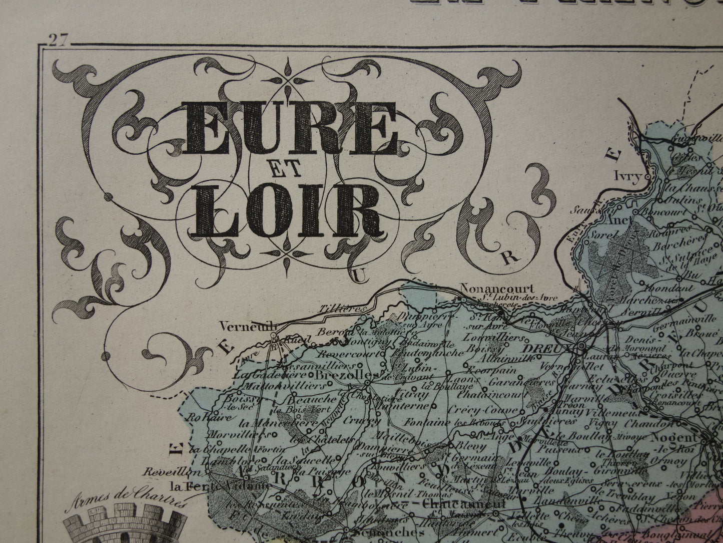
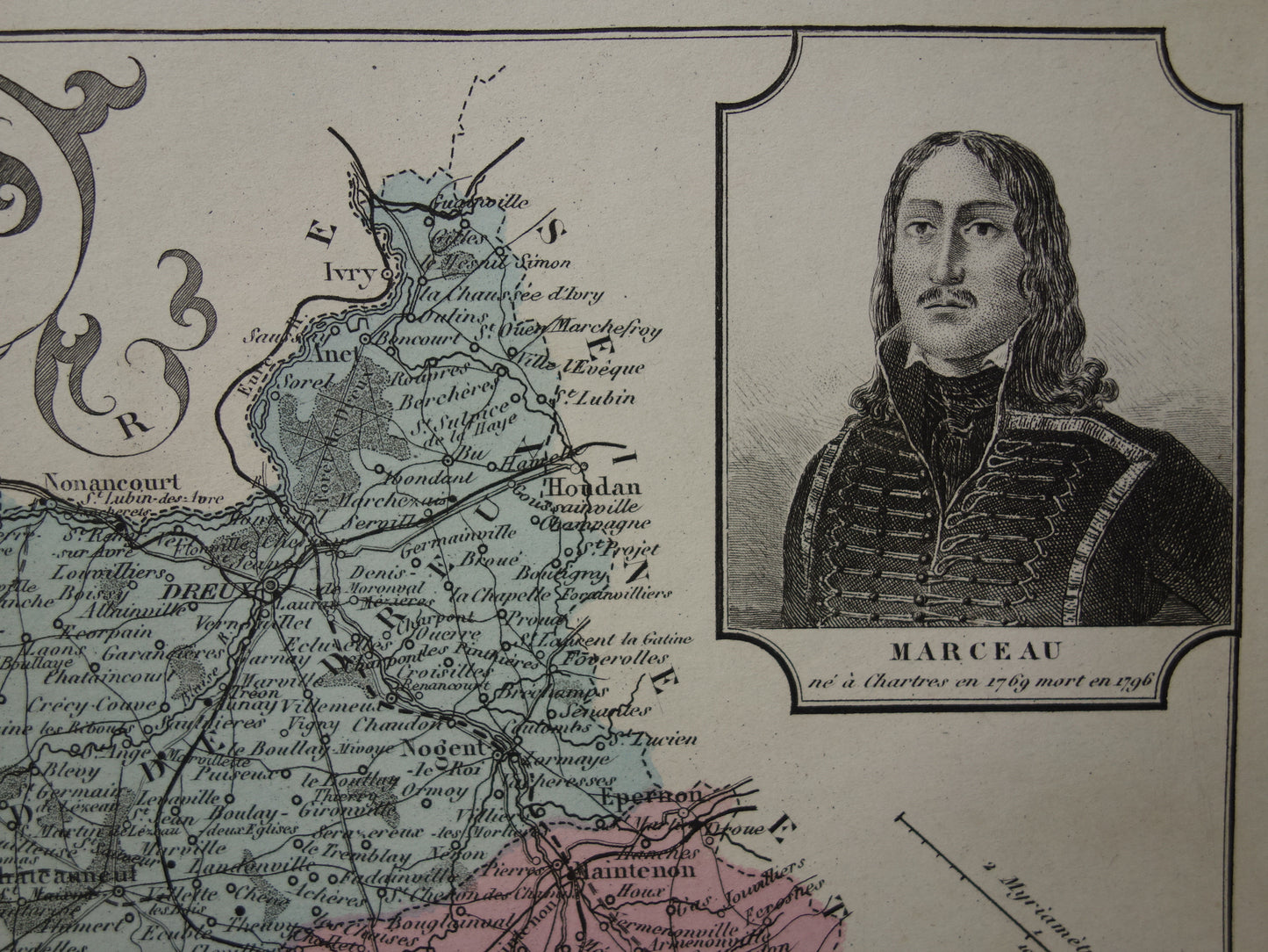
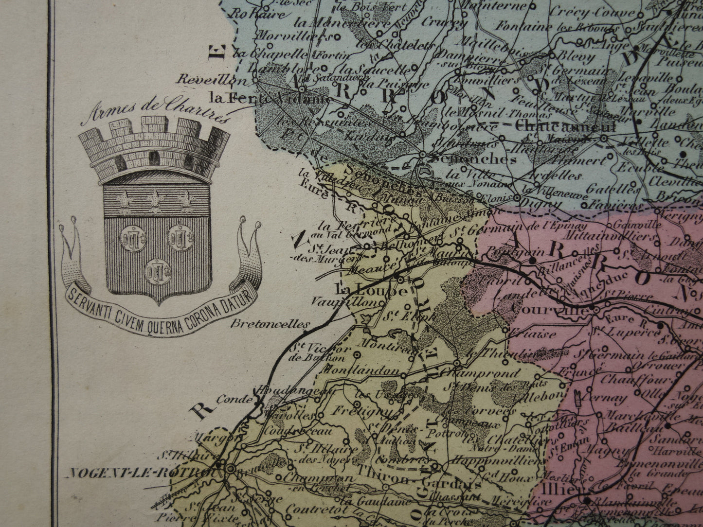
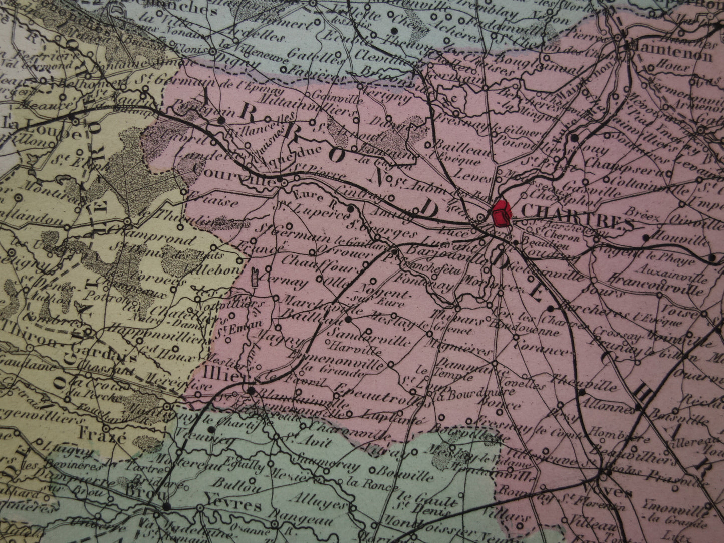
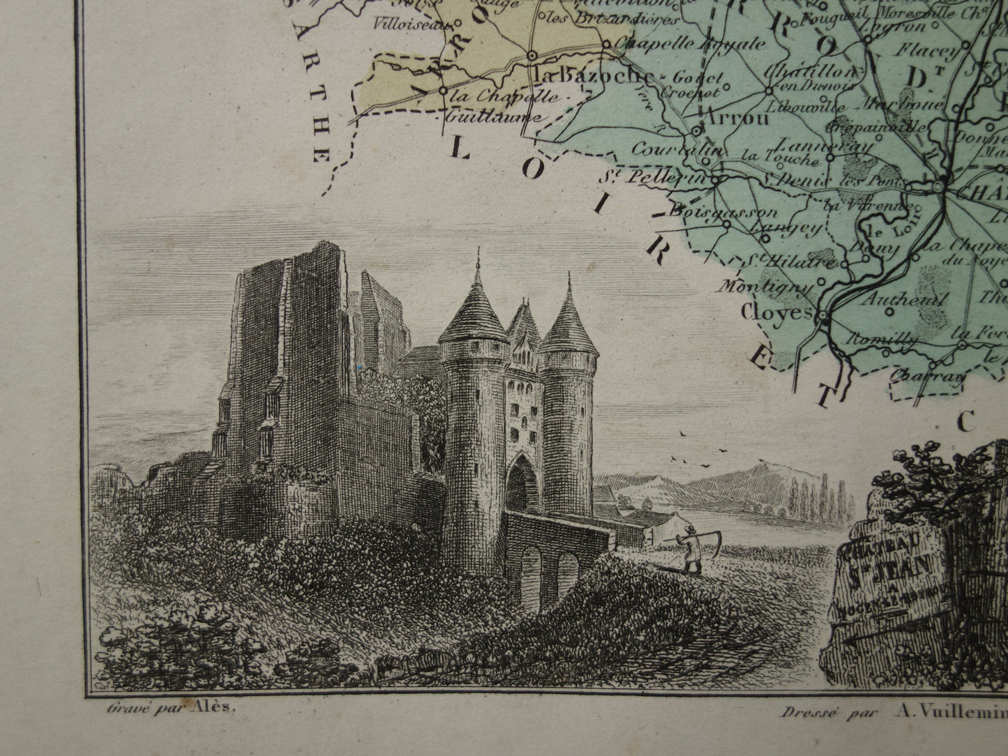
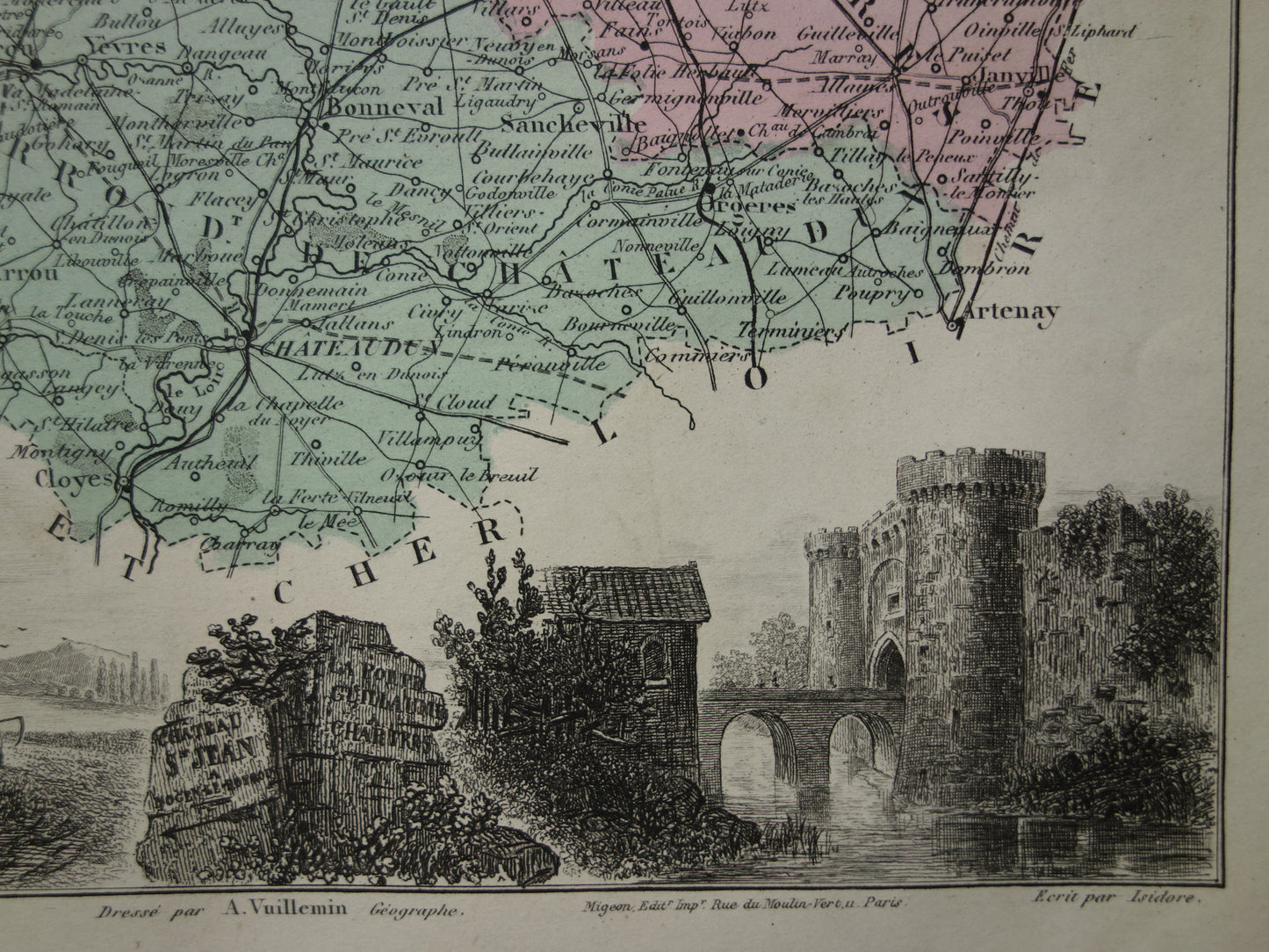
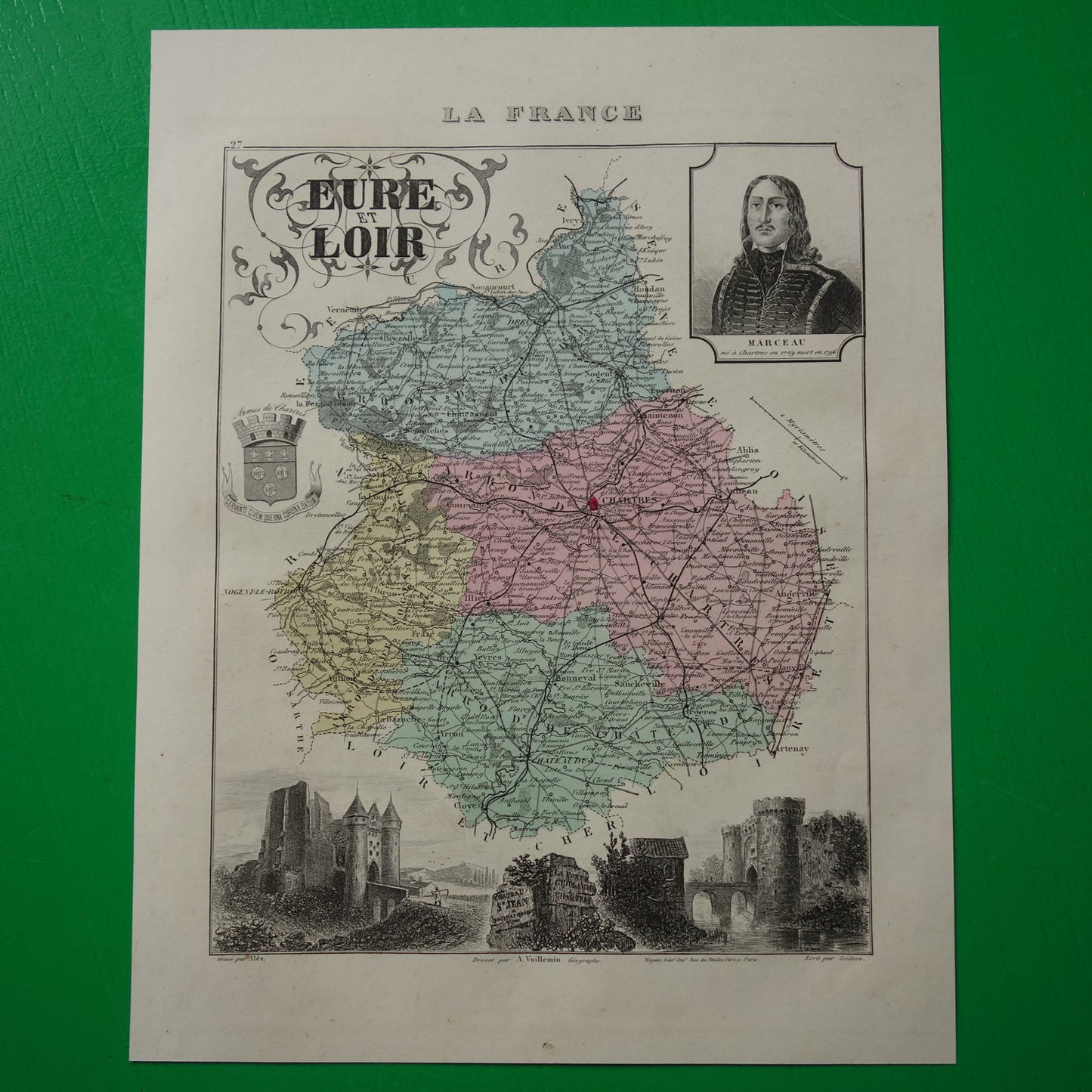
For sale is a beautiful antique French map of the department Eure-et-Loir from the year 1880. The map has images of a city gate in Chartres, the coat of arms of Chartres, castle Le château Saint-Jean in Nogent-le-Rotrou and a portrait of Marceau (born in the department). The map is hand-colored. A very beautiful map with nice wide margins.
Dimensions: 22.5 x 28.5 cm
Condition: the map is in good condition (= only some minor signs of age/use - paper is completely intact)
Origin: La France et ses Colonies, published in Paris by Migeon (1880)
We sell similar maps of all French departments, but not all of them are advertised. Are you interested in such a map of another department? Send an email to info@oudekaarten.com
ORDER WITHOUT RISK At Oudekaarten.com you always order without risk. Are you not completely satisfied with your purchase? You can return your purchase free of charge and get your full purchase price back.
We sell only original antique and vintage maps. We guarantee that your purchase was made on or around the date stated in the description.
Fast shipping
We will ship your order the next business day at the latest. Free shipping within the Netherlands when purchasing 2 cards. Click here for more information
"Beautiful card, exactly as described. Fast shipping and the card was packaged perfectly. Great transaction, thank you very much!"
ANNE ESCHER
Choosing a selection results in a full page refresh.