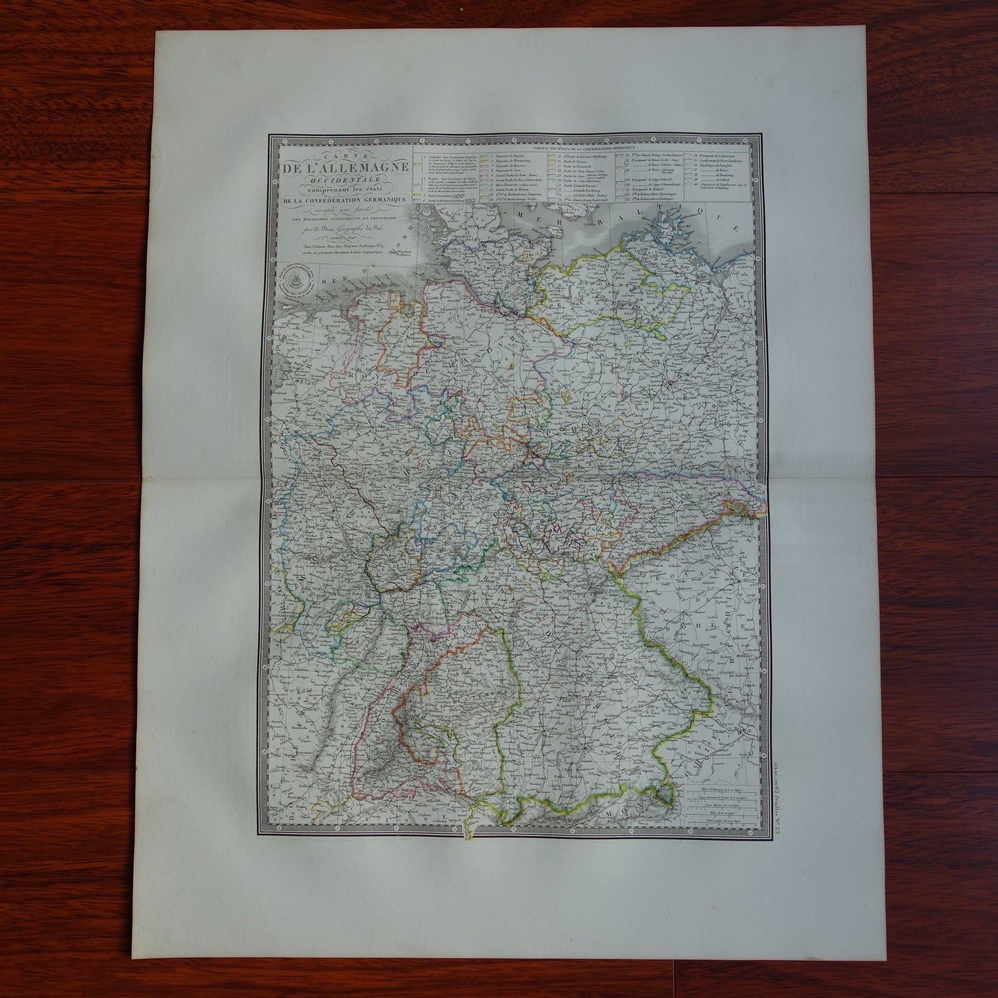
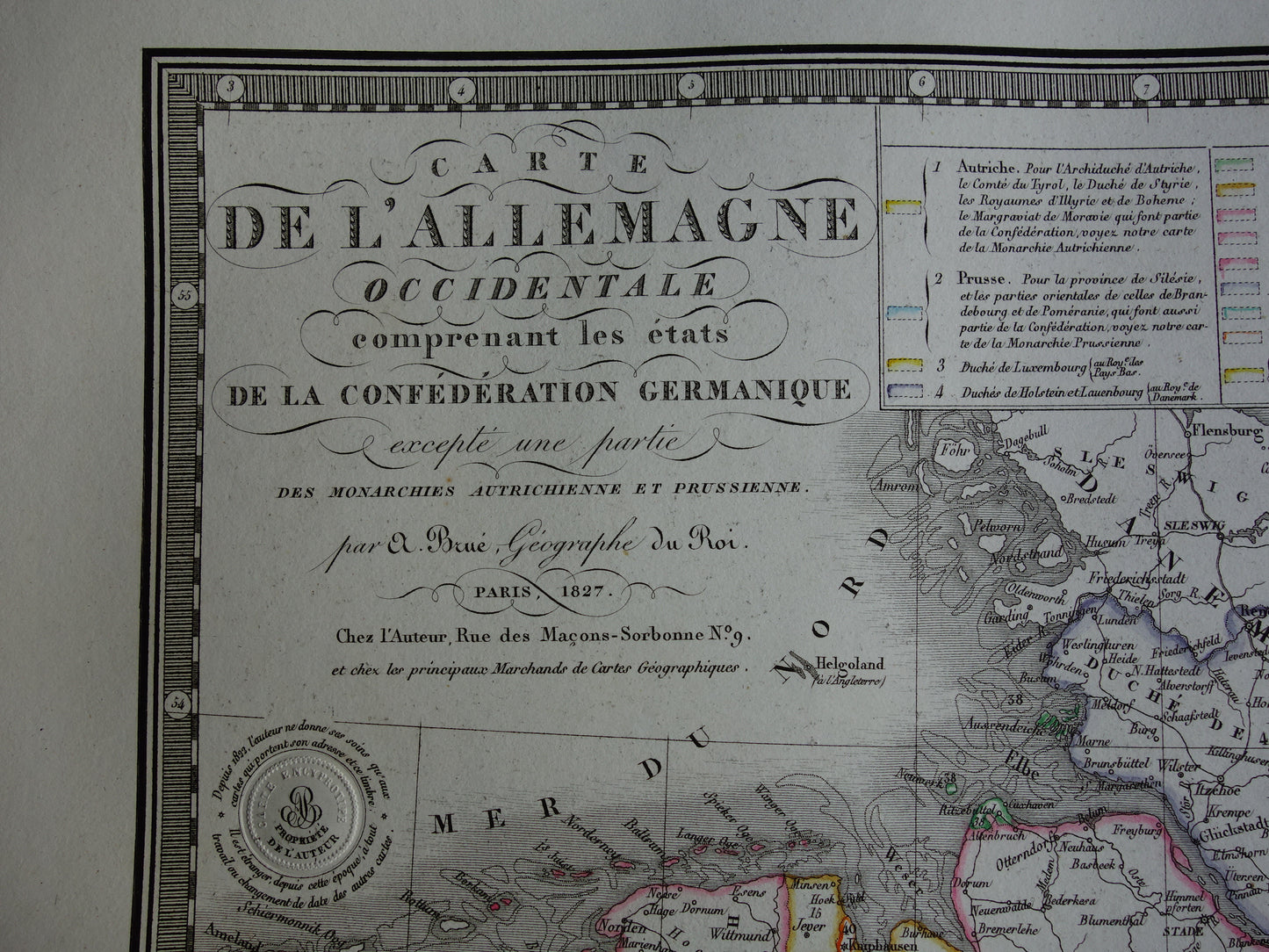
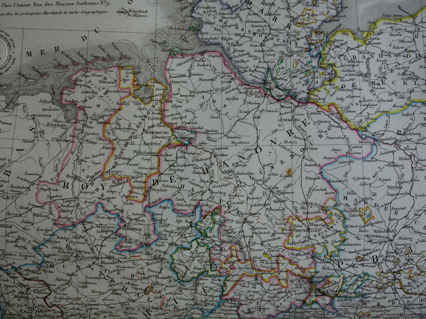
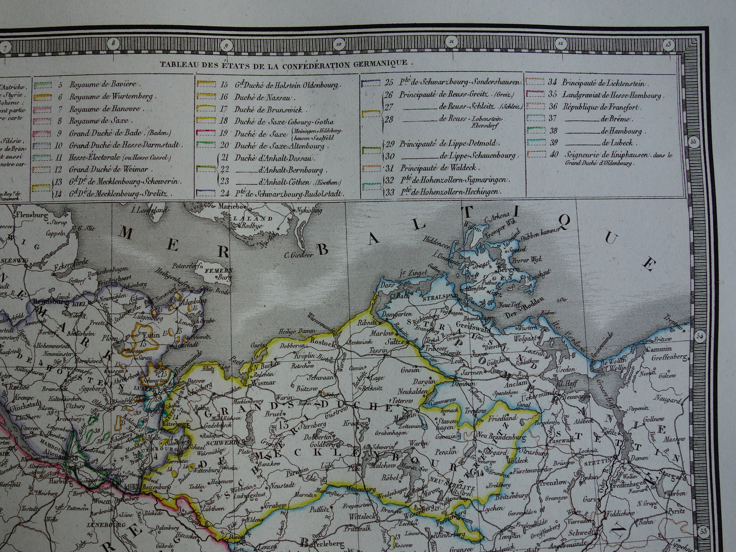
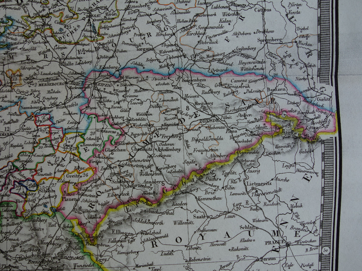
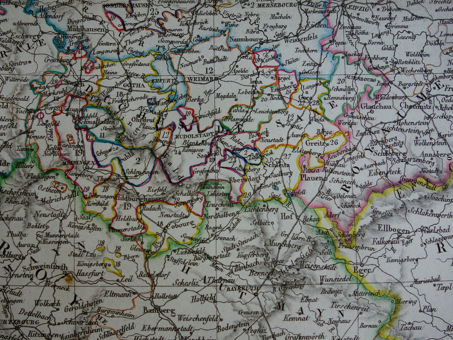
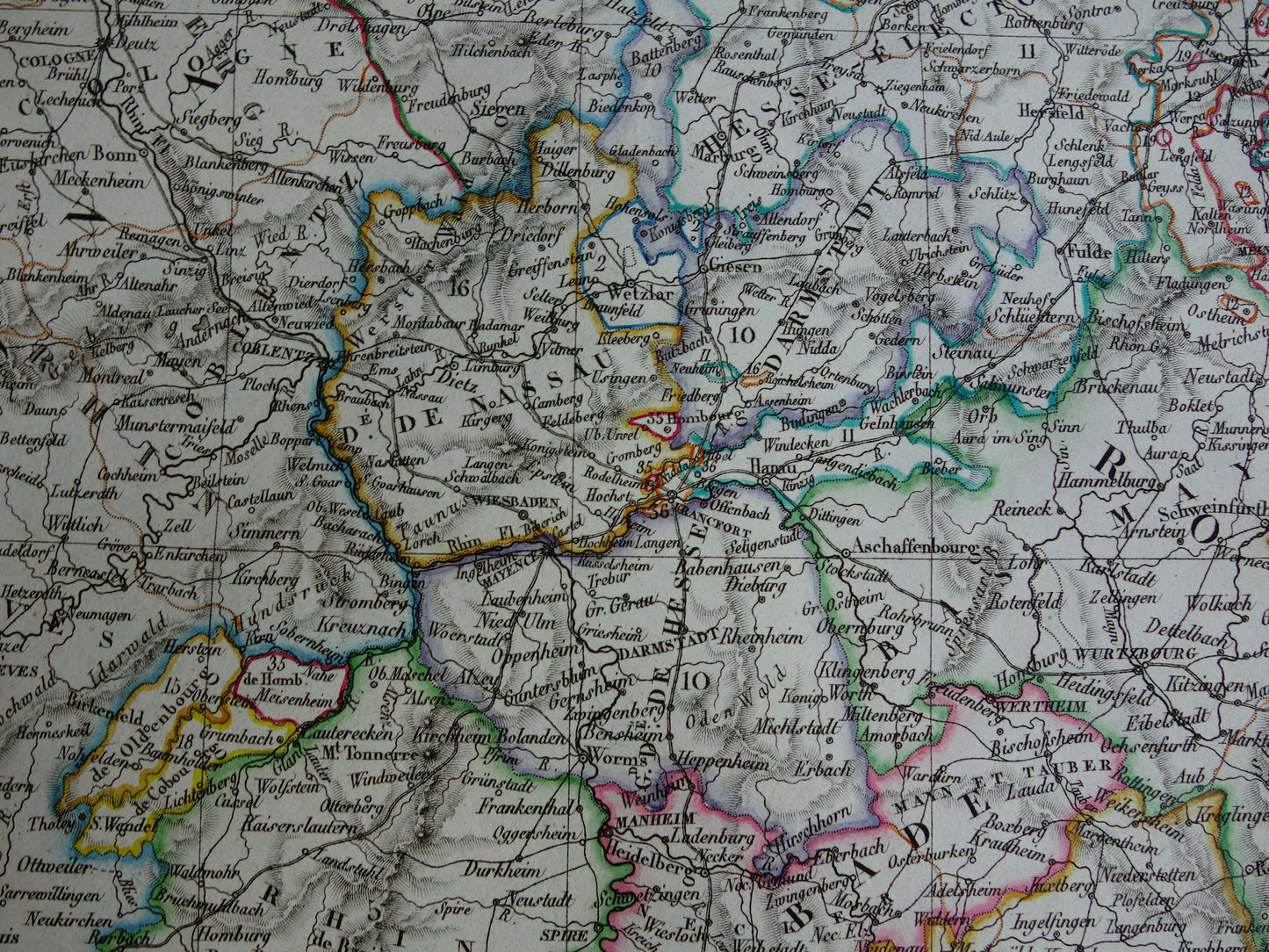
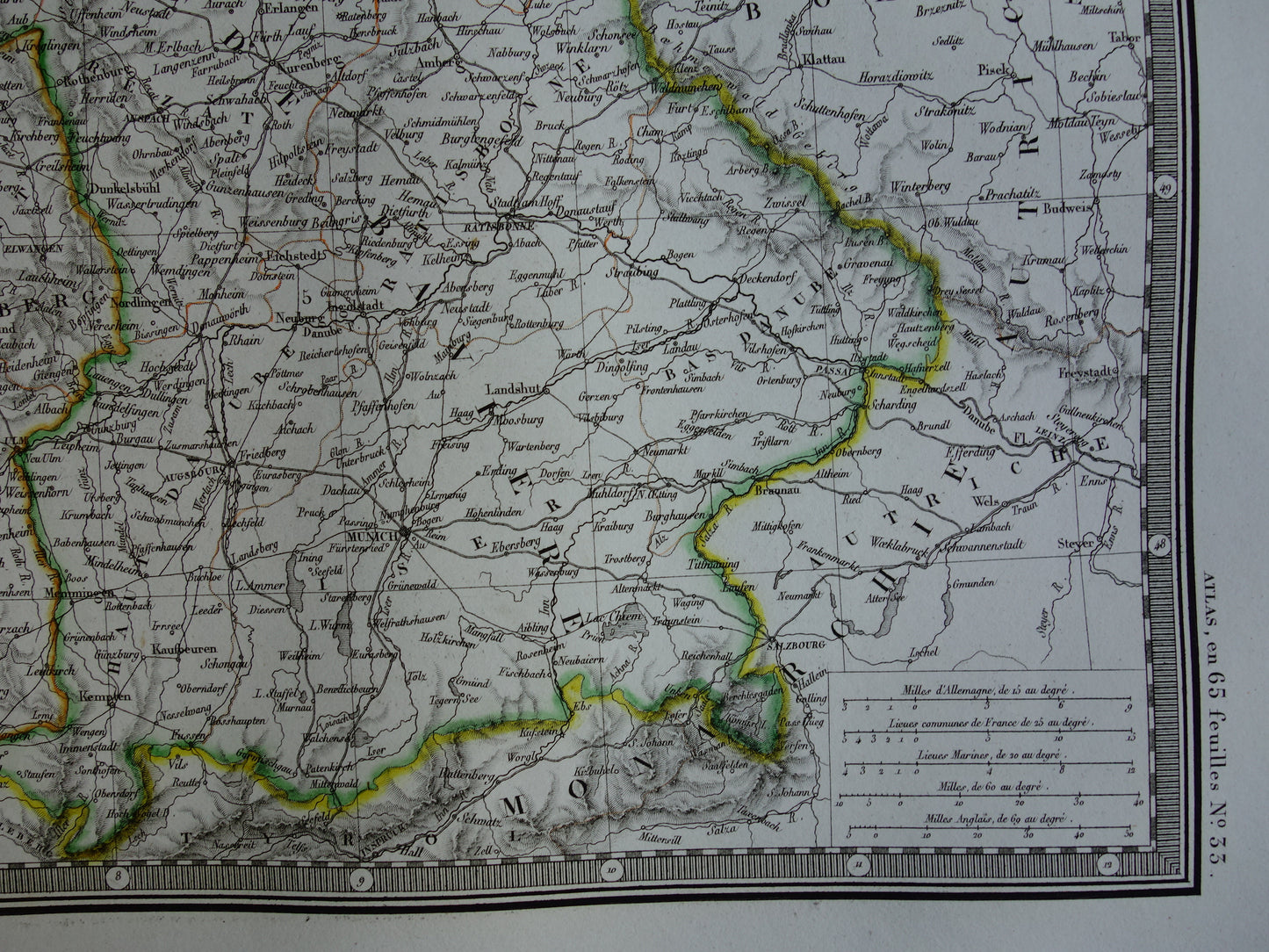
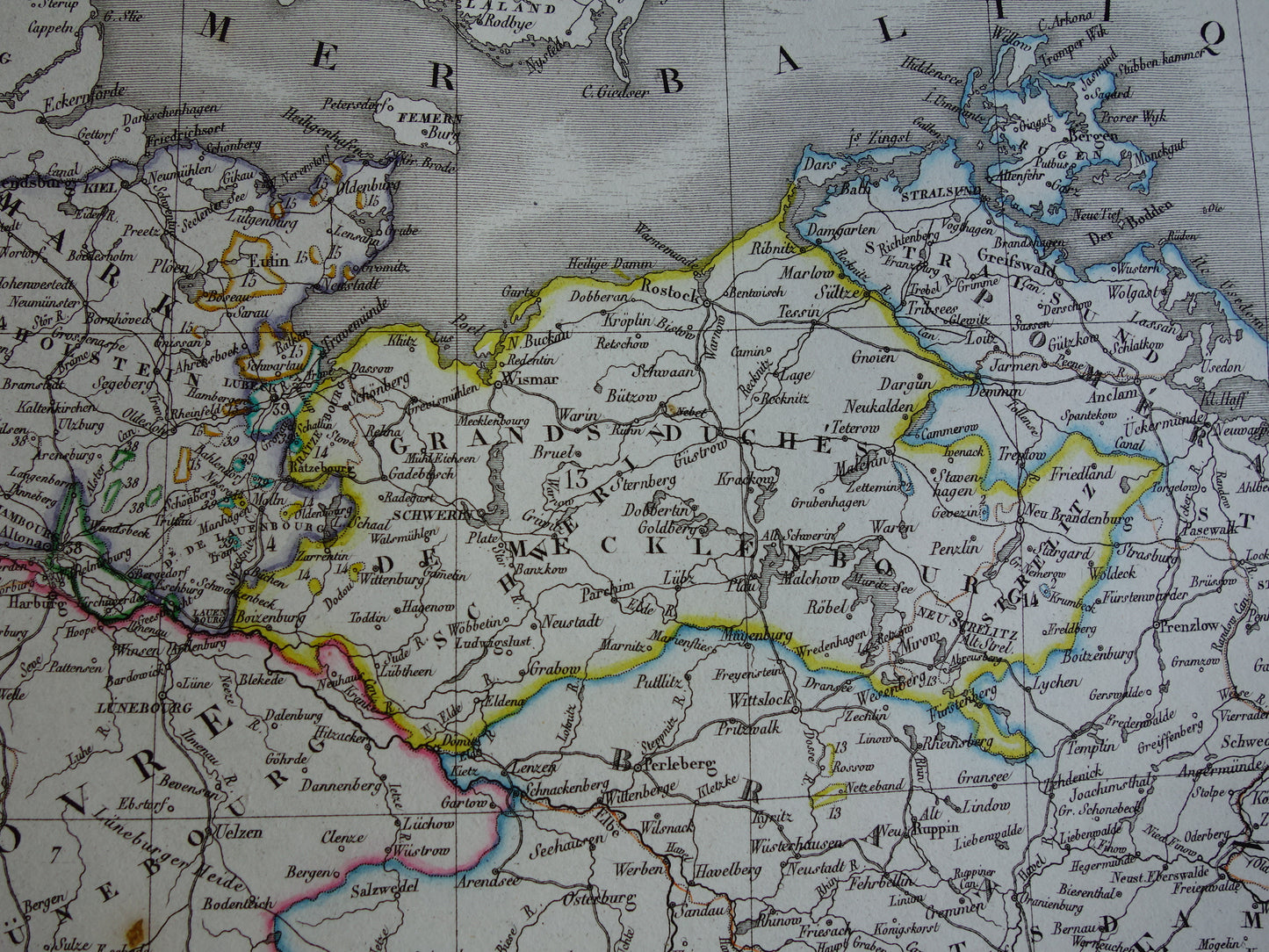
Beautiful large antique French map of the German Confederation (western part, roughly corresponding to present-day Germany) in the year 1827. The year can be found at the bottom of the decorative title. At the top of the map an extensive color index of all states that are part of the German Confederation. The map is a hand-colored copper engraving and has nice wide margins.
Dimensions: 52 x 66 cm
Condition: the map is in good condition. Issued with centerfold. Printed on heavy paper.
Origin:Atlas Classique de Geographie Ancienne et Moderne - AH Brué
ORDER WITHOUT RISK At Oudekaarten.com you always order without risk. Are you not completely satisfied with your purchase? You can return your purchase free of charge and get your full purchase price back.
We sell only original antique and vintage maps. We guarantee that your purchase was made on or around the date stated in the description.
Fast shipping
We will ship your order the next business day at the latest. Free shipping within the Netherlands when purchasing 2 cards. Click here for more information
"Beautiful card, exactly as described. Fast shipping and the card was packaged perfectly. Great transaction, thank you very much!"
ANNE ESCHER
Choosing a selection results in a full page refresh.