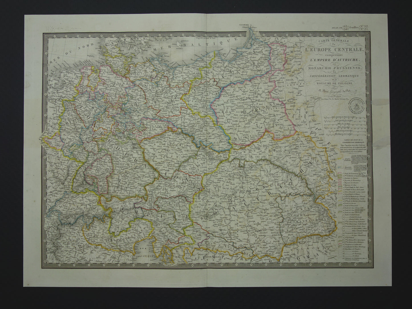
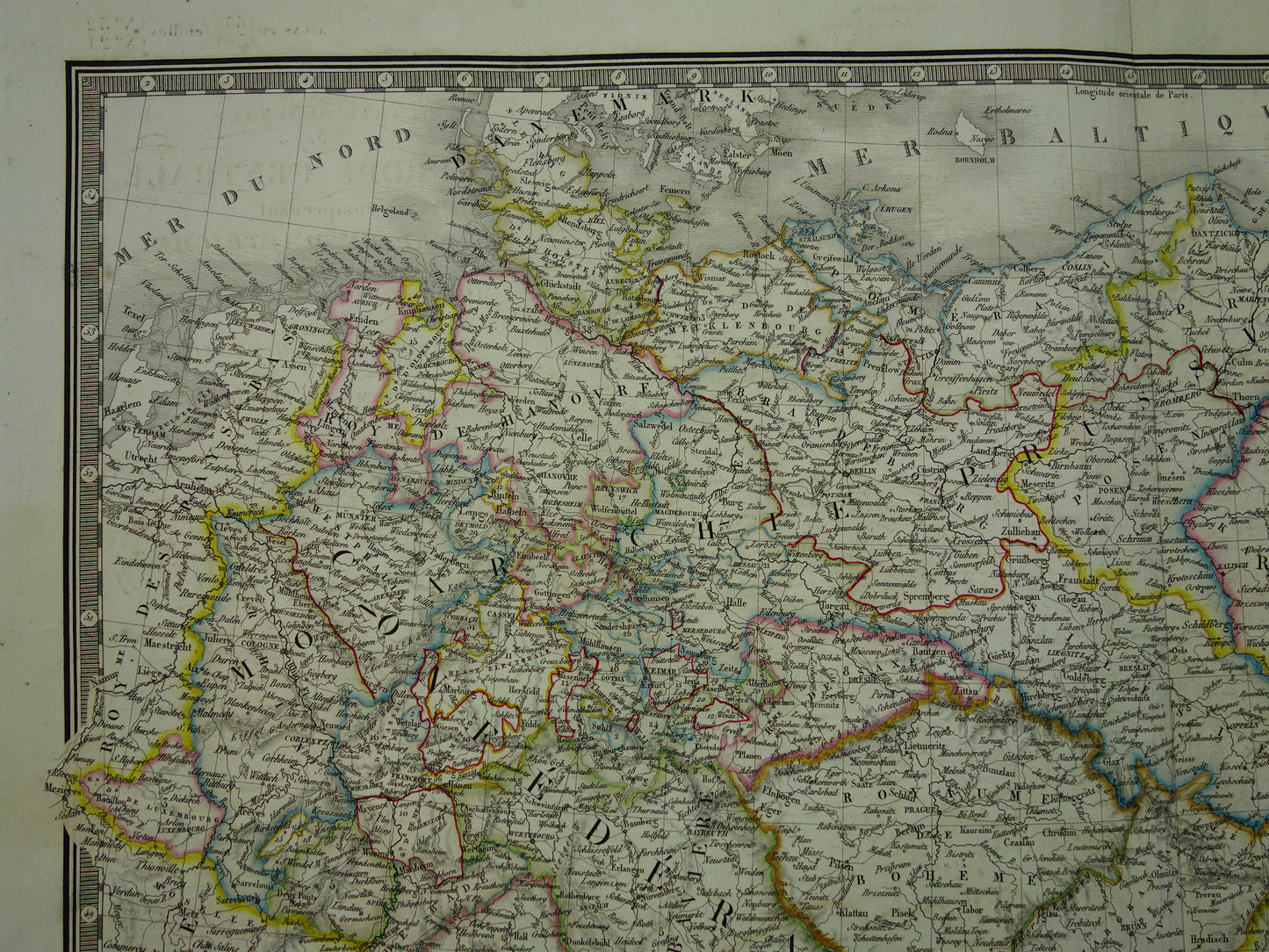
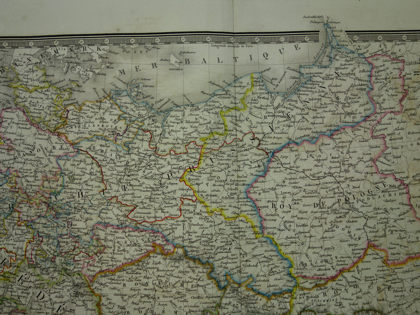
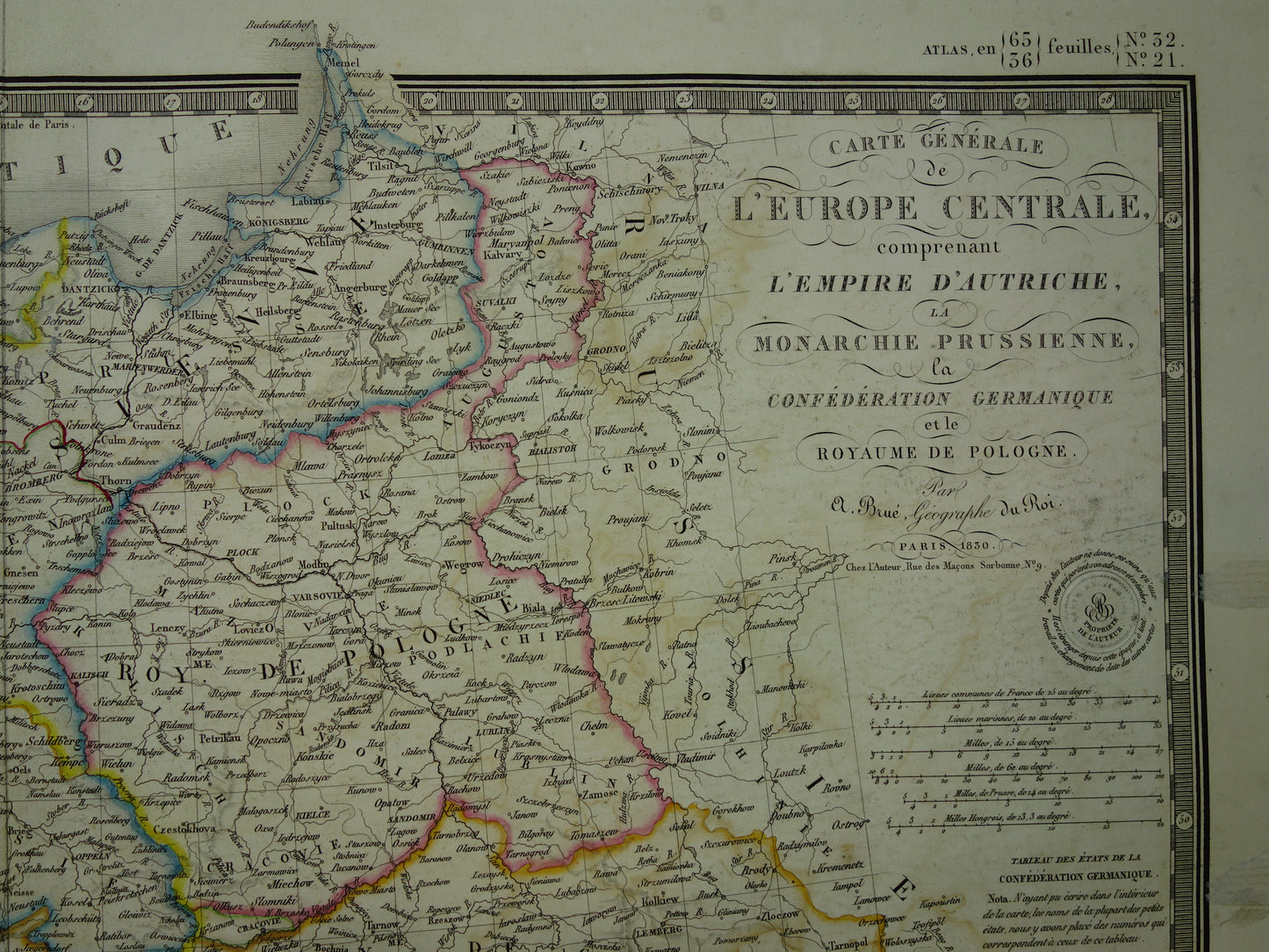
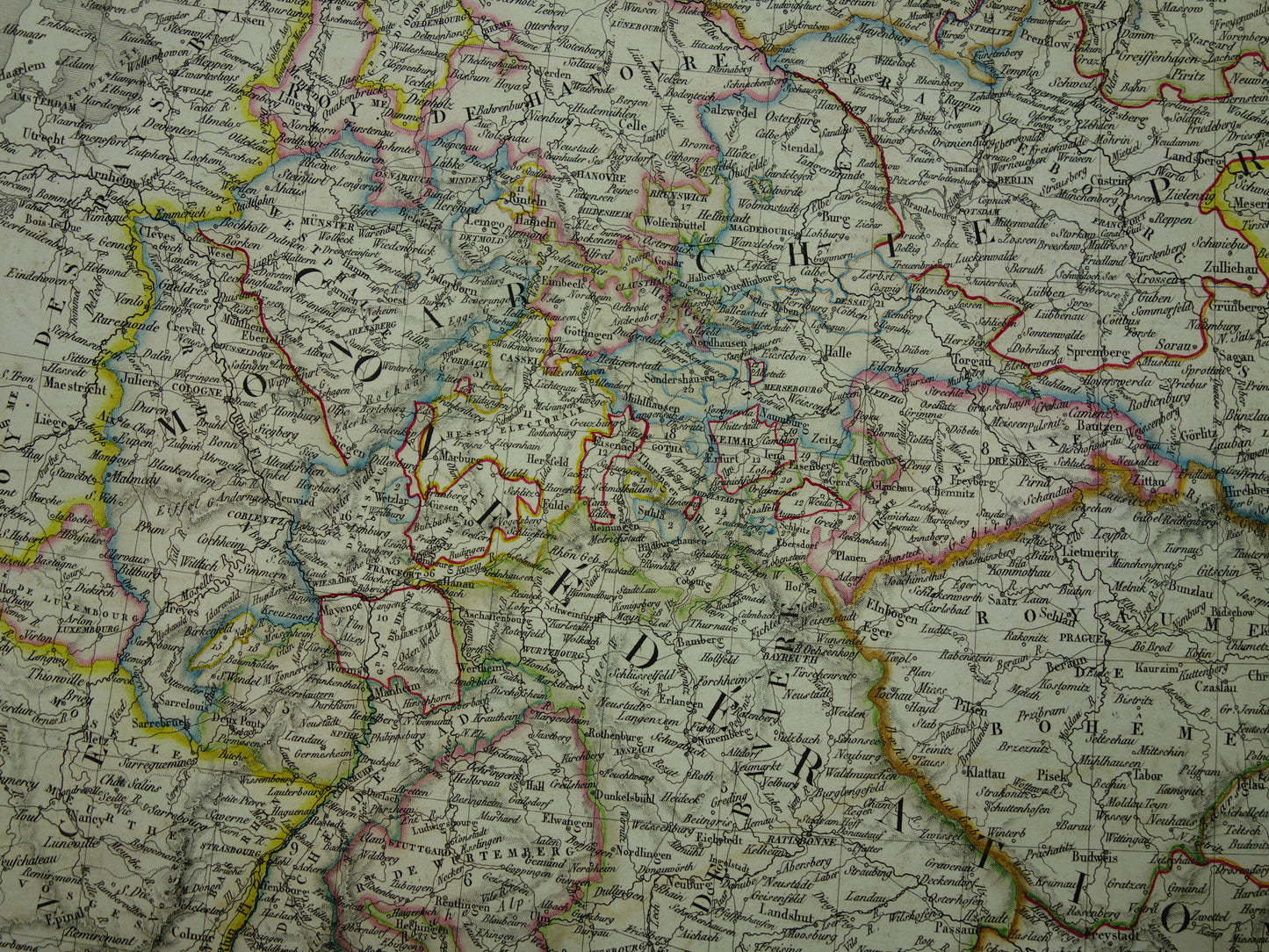
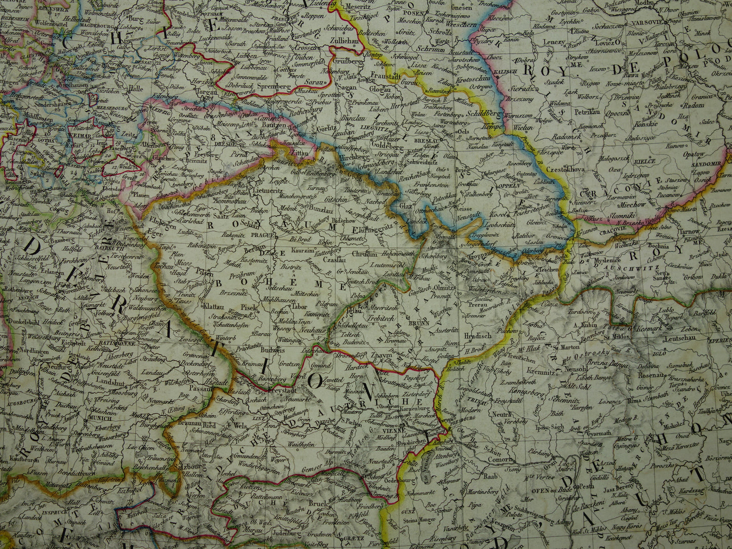
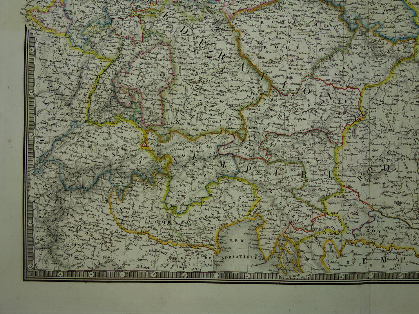
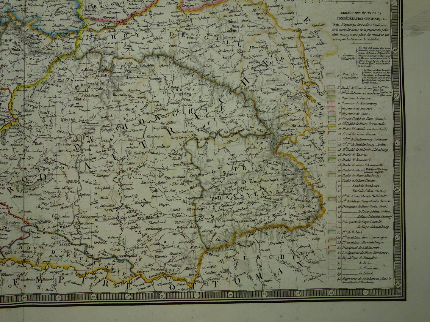
For sale is a large antique French map of central Europe with Germany. Poland and Austria-Hungary in the year 1830. The year can be found in the decorative title. It is a hand-colored copper engraving. Nice wide margins and very suitable for framing.
Dimensions: 42 x 56 cm
Condition: 2 pieces of paper residue visible in right margin. Map has some offsetting (ink from 1 side of map is visible on other side). Visible mainly around title. Map has a centerfold, as issued.
Origin:Atlas classique de geographie ancienne et modern - Adrien Hubert Brué
Foreign buyers: for this card there may be an additional surcharge on shipping costs (between €5 and €15) depending on the destination. Please inquire before ordering via info@oudekaarten.com
ORIGINAL ANTIQUE MAP Oudekaarten.com only sells original old maps, we do not sell modern reprints.
ORDER WITHOUT RISK At Oudekaarten.com you always order without risk. Are you not completely satisfied with your purchase? You can return your purchase free of charge and get your full purchase price back.
We sell only original antique and vintage maps. We guarantee that your purchase was made on or around the date stated in the description.
Fast shipping
We will ship your order the next business day at the latest. Free shipping within the Netherlands when purchasing 2 cards. Click here for more information
"Beautiful card, exactly as described. Fast shipping and the card was packaged perfectly. Great transaction, thank you very much!"
ANNE ESCHER
Choosing a selection results in a full page refresh.