WERELDKAART oude kaart van de Wereld Zeestromingen en Transport 1880 originele antieke landkaart Zeestroom Oceaanstromingen Scheepvaartlijnen met datum
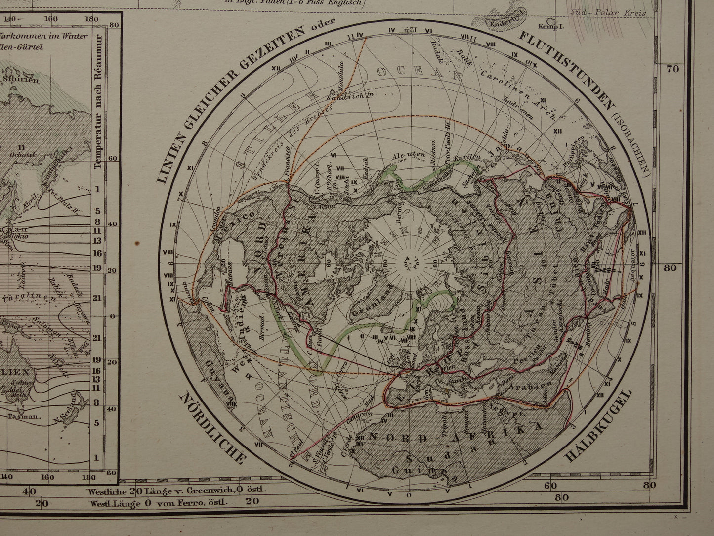
Te koop is een vrij grote antieke Duitse wereldkaart die de zeestromingen laat zien en de belangrijkste transportroutes (o.a. trein, stoomvaart en telegraaflijnen). Linksonder en rechtsonder twee kaarten die gebieden met hetzelfde getij laten zien, daartussen een kaart met isothermen van watertemperatuur (gemeten in de koudste maand). Een zeer gedetailleerde kaart, zoom de foto's om het goed te zien. De kaart is handgekleurd en onderaan staat het jaar 1880 gedrukt.
Afmetingen: 37 x 45,5 cm
Conditie: goed / zeer goed. Uitgegeven met een middenvouw.
Afkomst: Stieler's Hand-Atlas - Uitgave 1880
BESTEL ZONDER RISICO Bij Oudekaarten.com bestelt u altijd zonder risico. Bent u niet helemaal tevreden met uw aankoop? U kunt uw aankoop retourneren en krijgt dan uw volledige aankoopbedrag retour. Voor Nederlandse klanten is retourneren gratis.