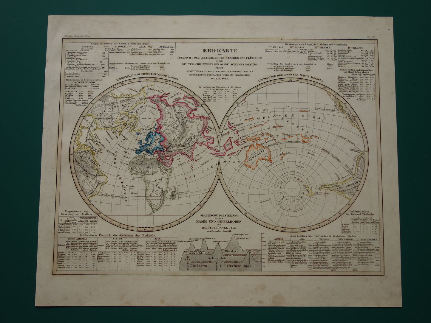
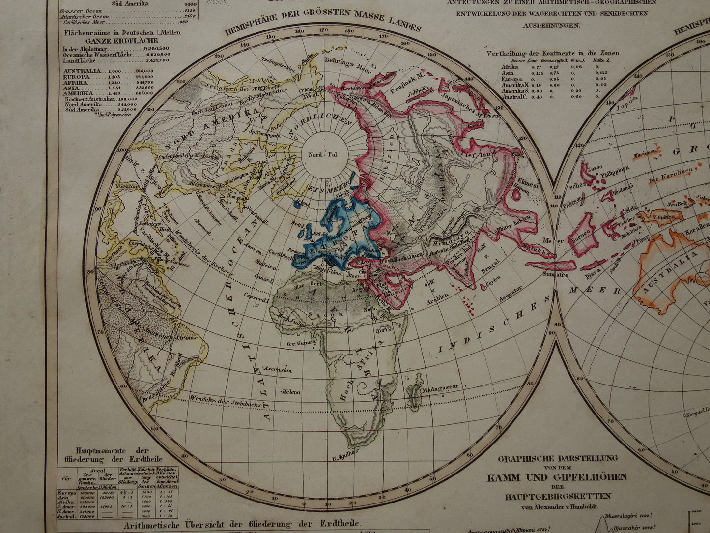
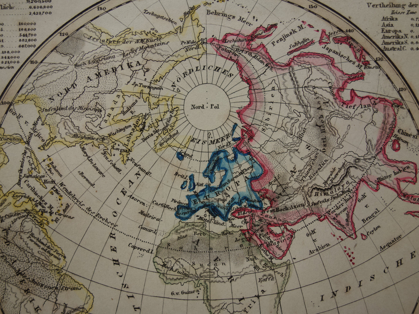
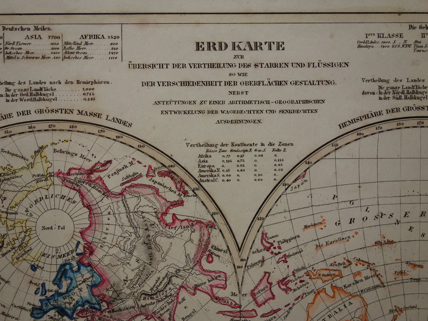
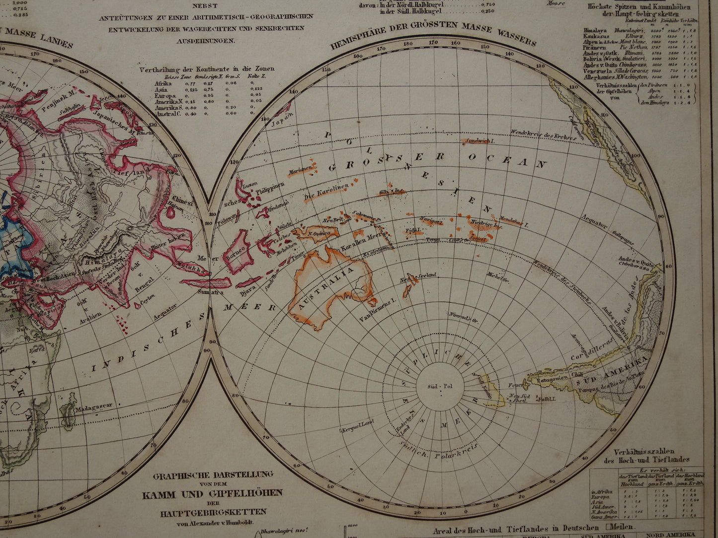
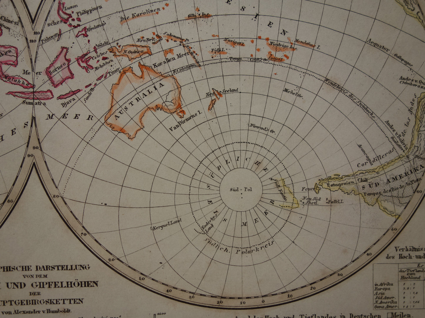
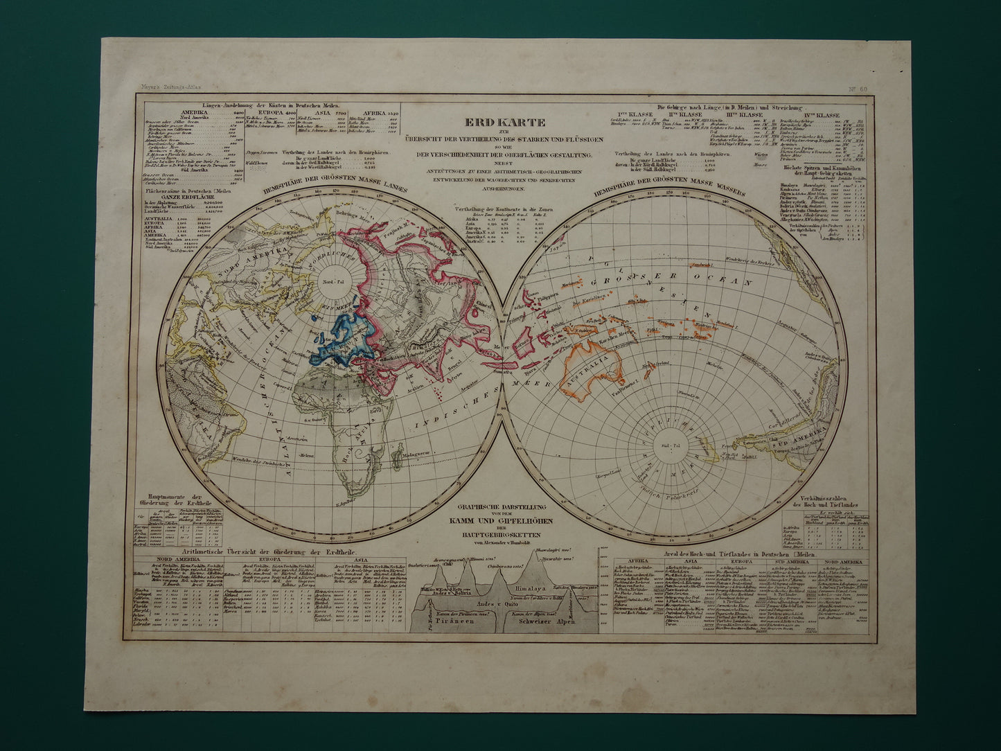
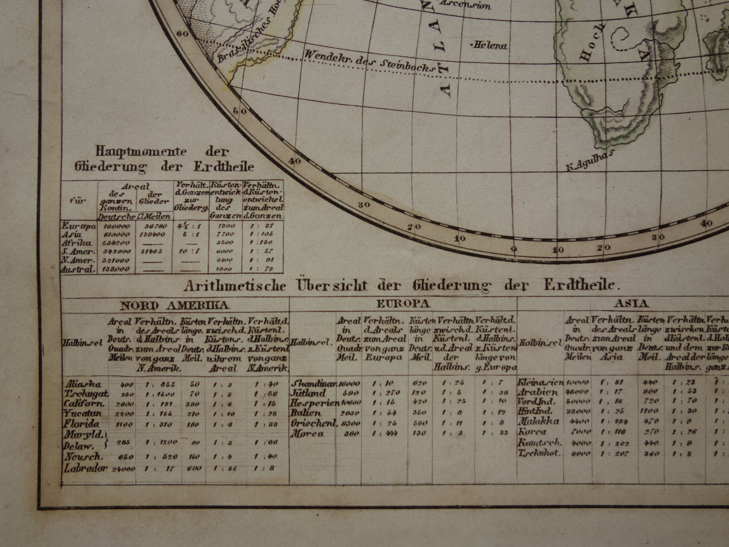
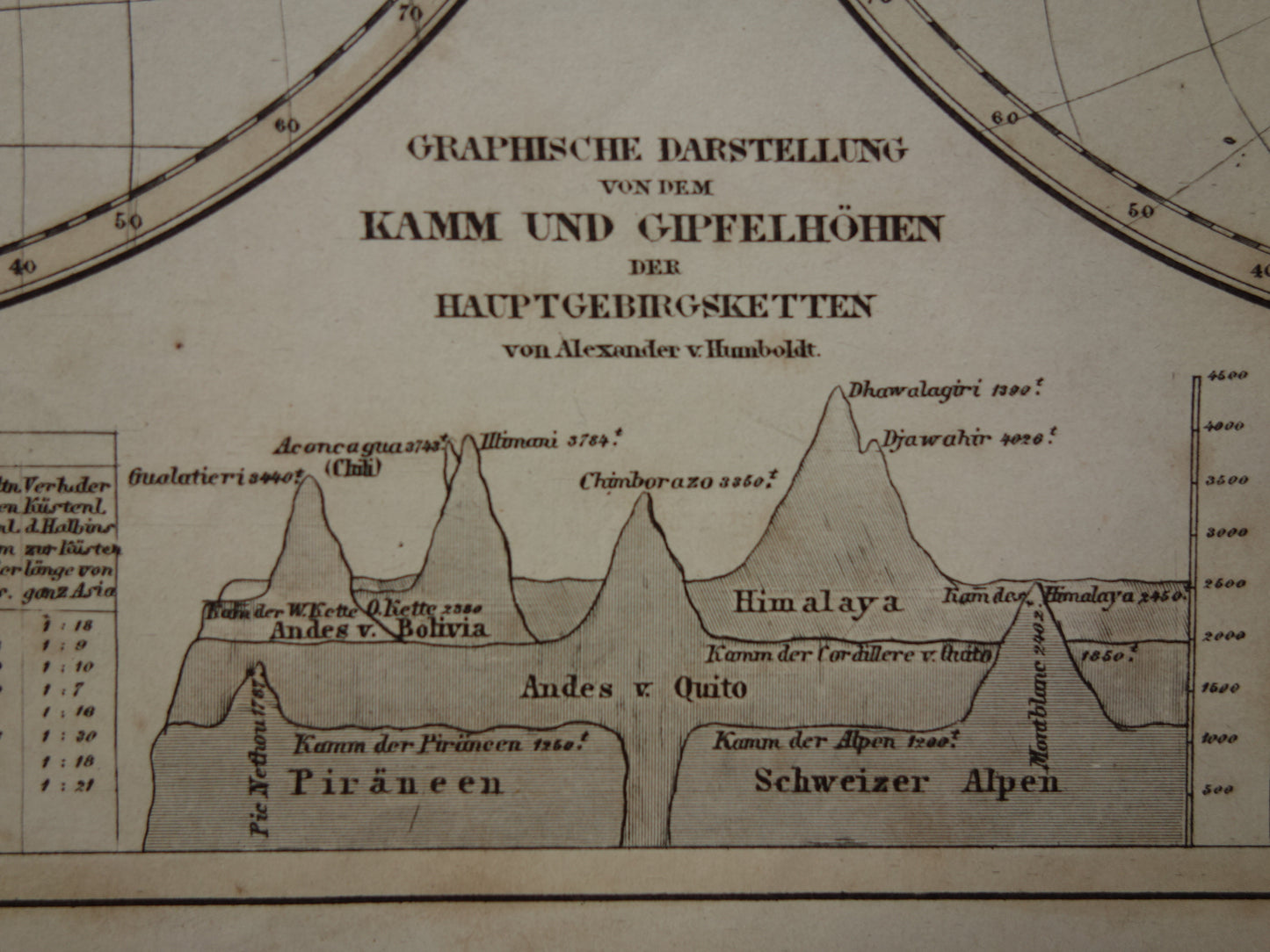
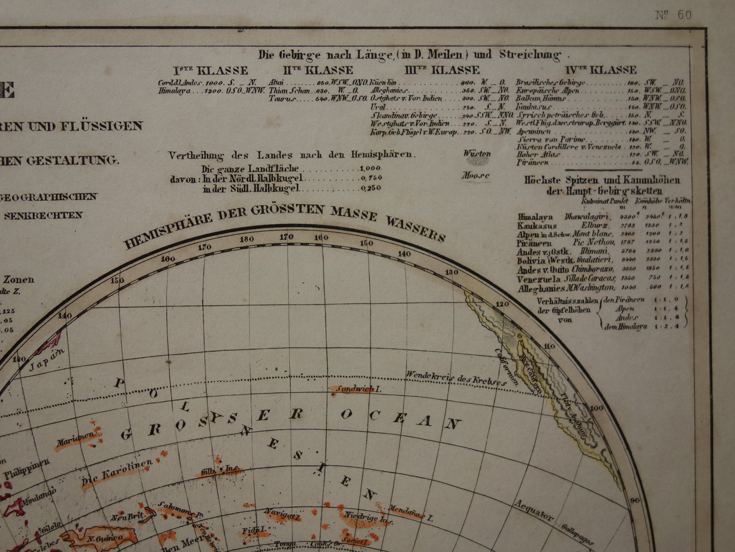
Te koop is een mooie, antieke Duitse kaart van de wereld uit het jaar 1849. Dit is een kaart van de hemisferen met de grootste landmassa (links) en de kleinste landmassa (rechts).Er is veel geografische informatie rond de kaart gedrukt.Bijvoorbeeld de oppervlakte in vierkante (Duitse) mijlen van elk continent, de bergketens met de hoogste toppen, de lengte van de bergketens, de lengte van de kustlijnen op de verschillende continenten, en nog veel meer.Het lettertype is klein en jeen vergrootglas is waarschijnlijk nodig om alles te kunnen lezen.Het is een staalgravure met originele handkleuring.
Afmetingen: 24,5 x 30 cm
Conditie: goed. Kleine tekenen van ouderdom en gebruik. Papier volledig intact.
Afkomst: Neuester Zeitungs-Atlas - Uitgave 1849
BESTEL ZONDER RISICO Bij Oudekaarten.com bestelt u altijd zonder risico. Bent u niet helemaal tevreden met uw aankoop? U kunt uw aankoop gratis retourneren en krijgt dan uw volledige aankoopbedrag retour.