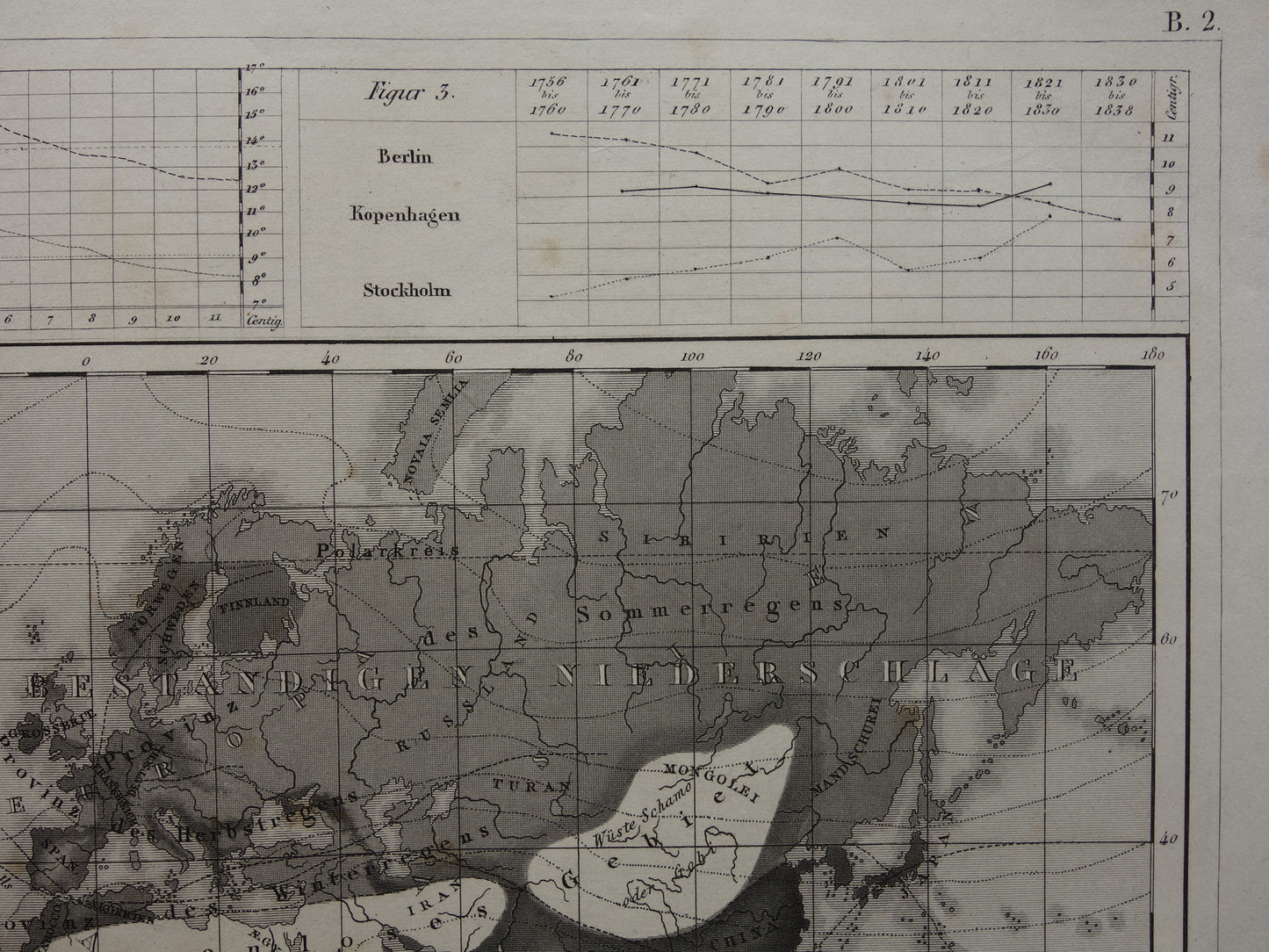
Te koop is een antieke meteorologische Duitse wereldkaart. De hoofdkaart laat neerslag zien in verschillende grijstinten. De grafieken boven en onder laten de temperaturen Padua and Leith voor elke maand van het jaar zien (linksboven), de gemiddelde temperatuur voor elk decennium van 1756 tot 1838 voor Berlijn, Kopenhagen en Stockholm. De onderste grafiek laat de gemiddelde temperatuur in Berlin, Kopenhagen en Stockholm voor elk jaar zien van 1758 tot 1834.
Afmetingen: 22 x 28 cm
Conditie: goed (= kleine sporen van ouderdom en gebruik). Het papier heeft wat bruine ouderdomsvlekken, maar de prent is in goede algemene conditie.
ORIGINELE ANTIEKE KAART Oudekaarten.com verkoopt alleen originele oude kaarten, wij verkopen geen moderne herdrukken.
BESTEL ZONDER RISICO Bij Oudekaarten.com bestelt u altijd zonder risico. Bent u niet helemaal tevreden met uw aankoop? U kunt uw aankoop gratis retourneren en krijgt dan uw volledige aankoopbedrag retour.
SNELLE VERZENDING Deze kaart wordt binnen 1 werkdag verzonden.
KORTING EN GRATIS VERZENDING Bij aankoop van twee artikelen wordt uw bestelling gratis verzonden. Bij aankoop van vier of meer artikelen ontvangt u een korting van 25% op het totale orderbedrag en wordt uw bestelling gratis verzonden.