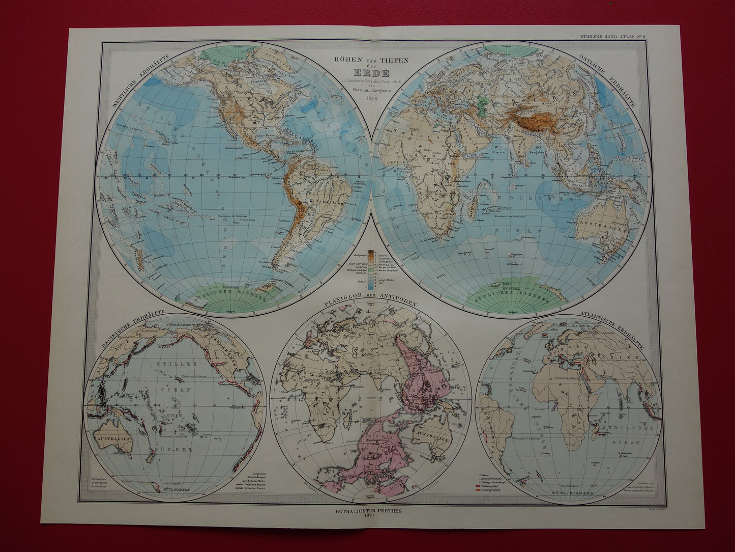
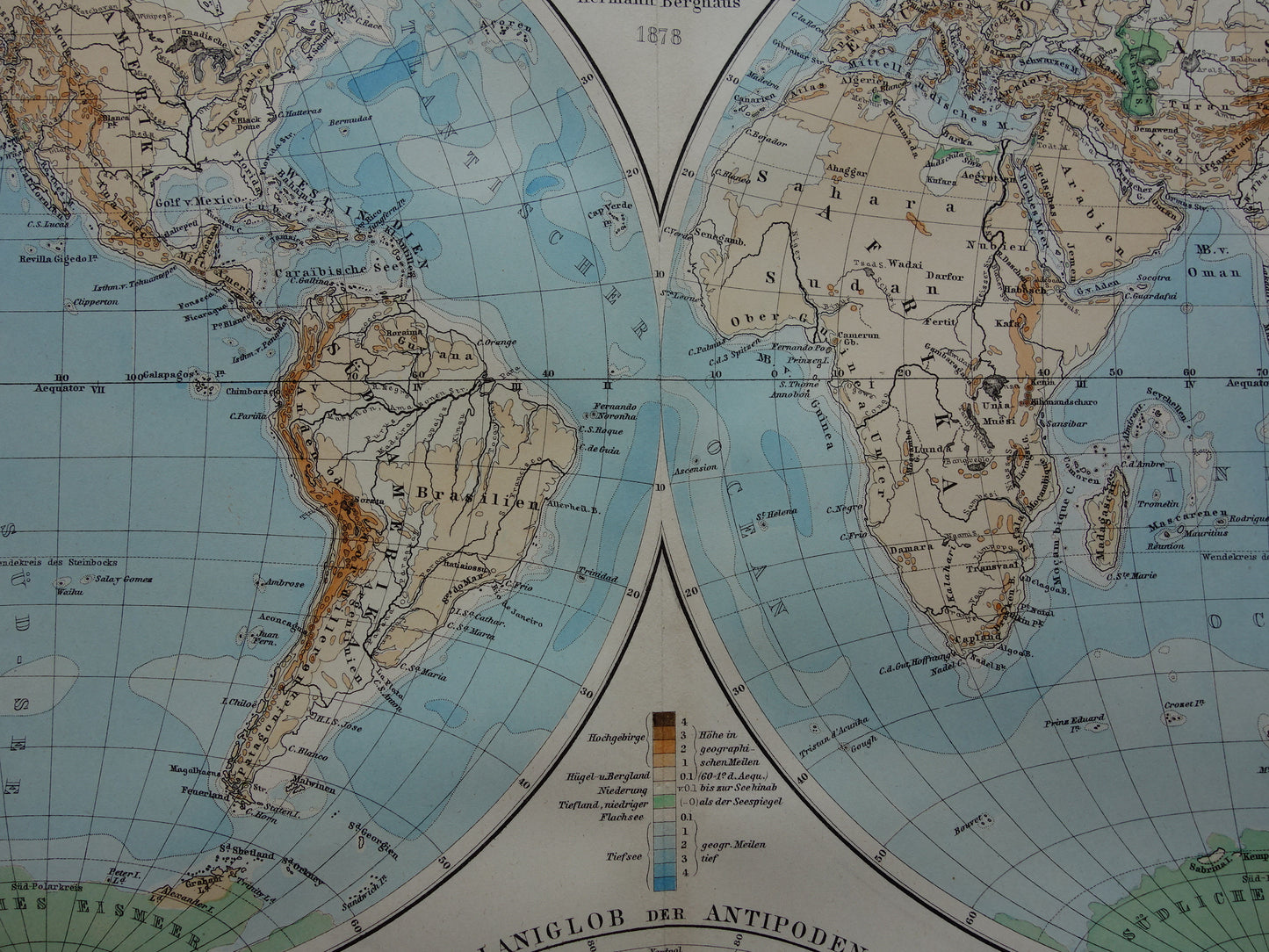
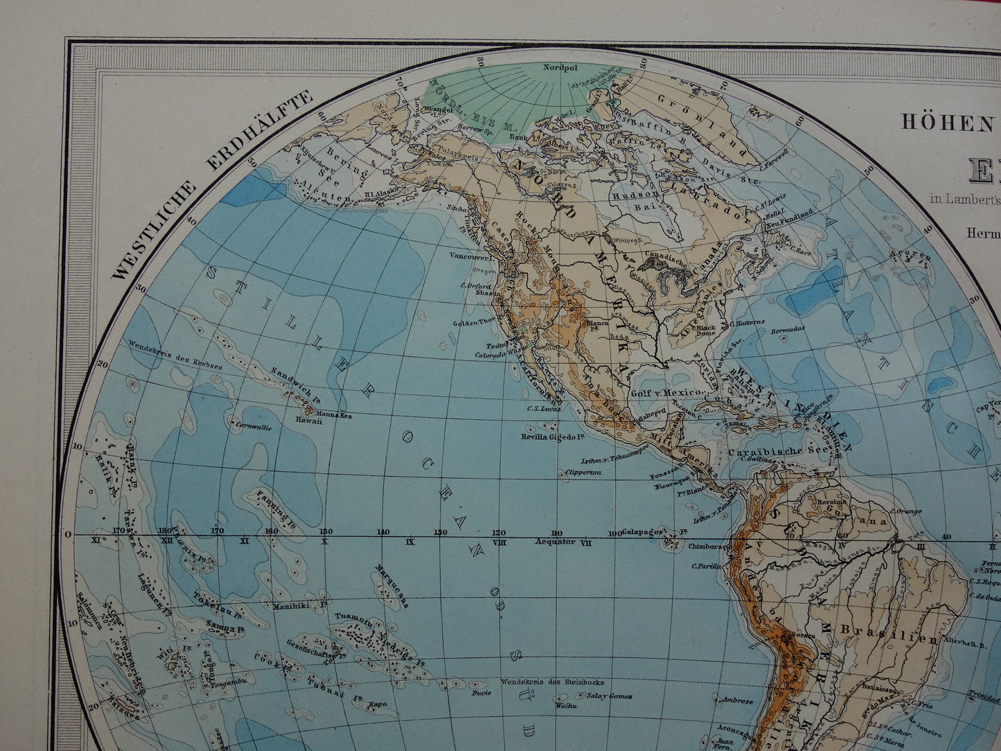
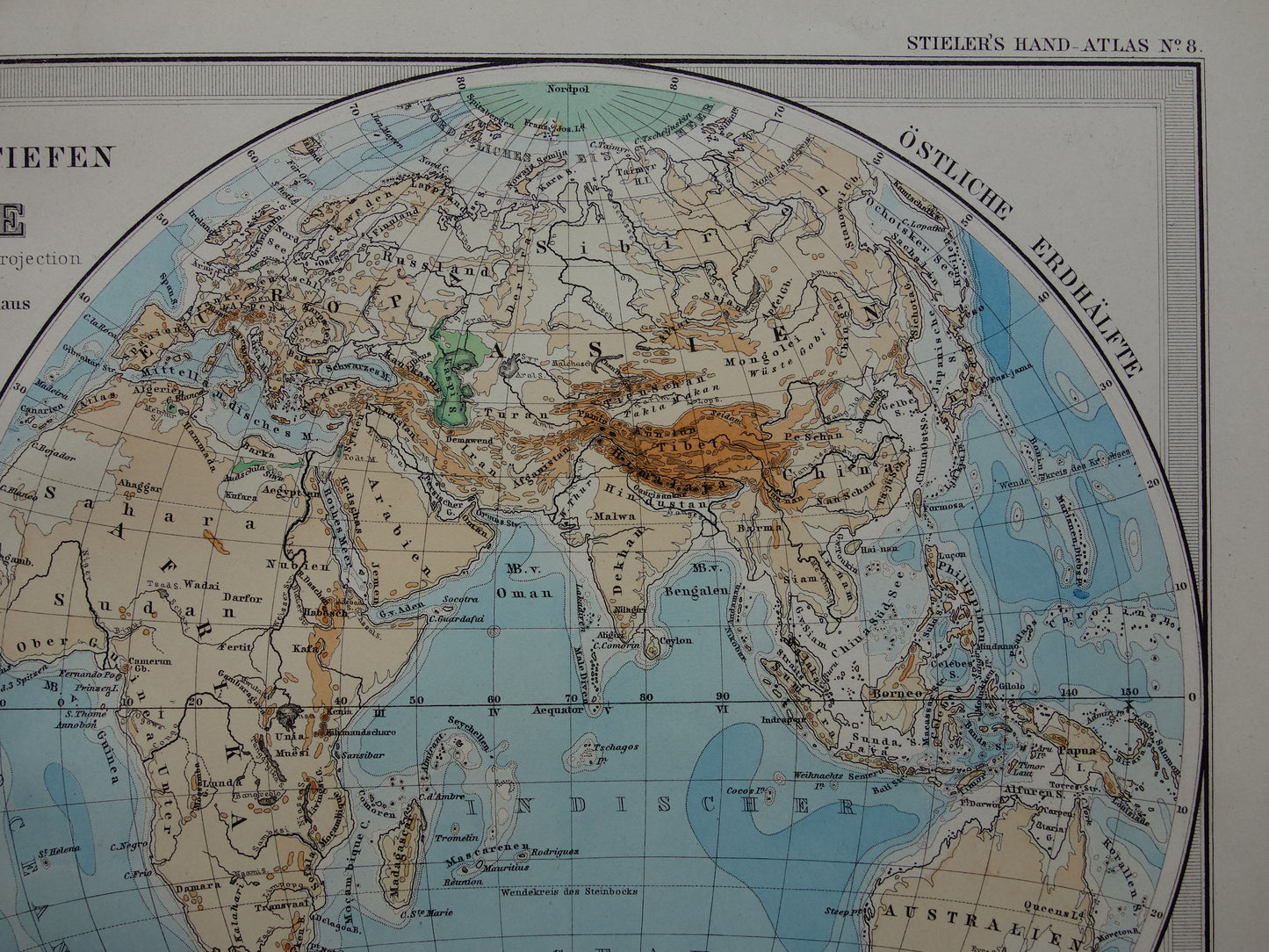
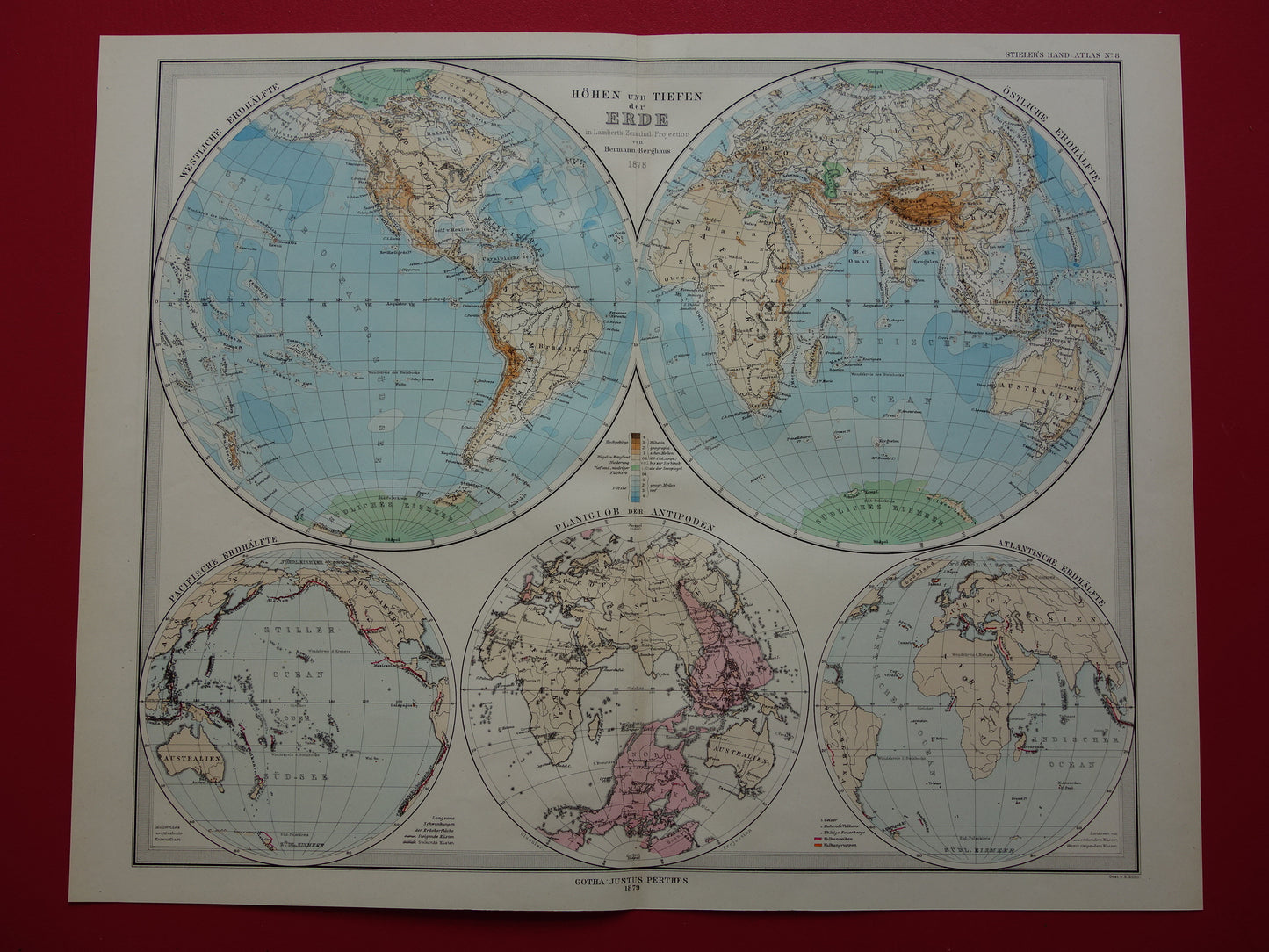
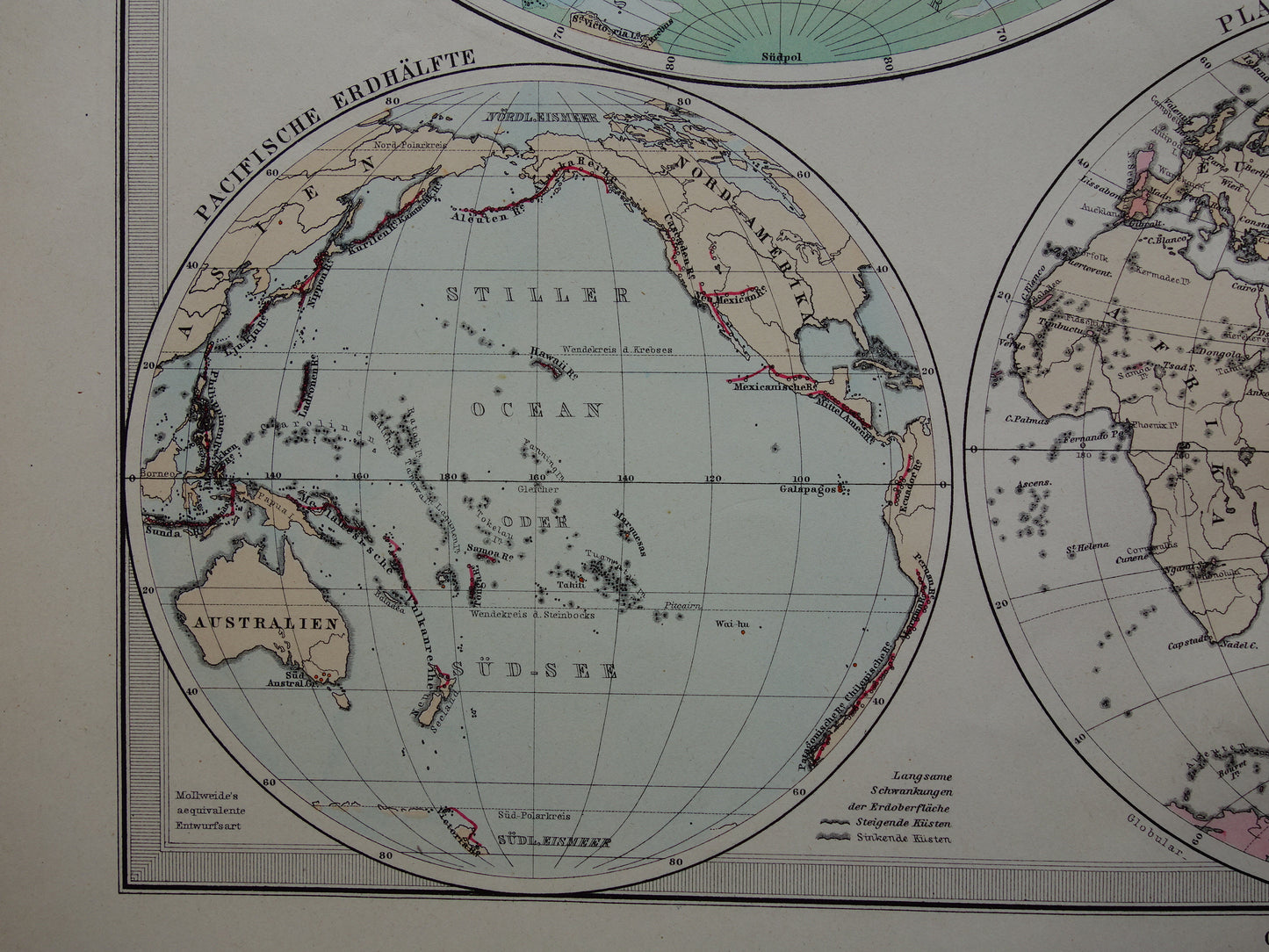
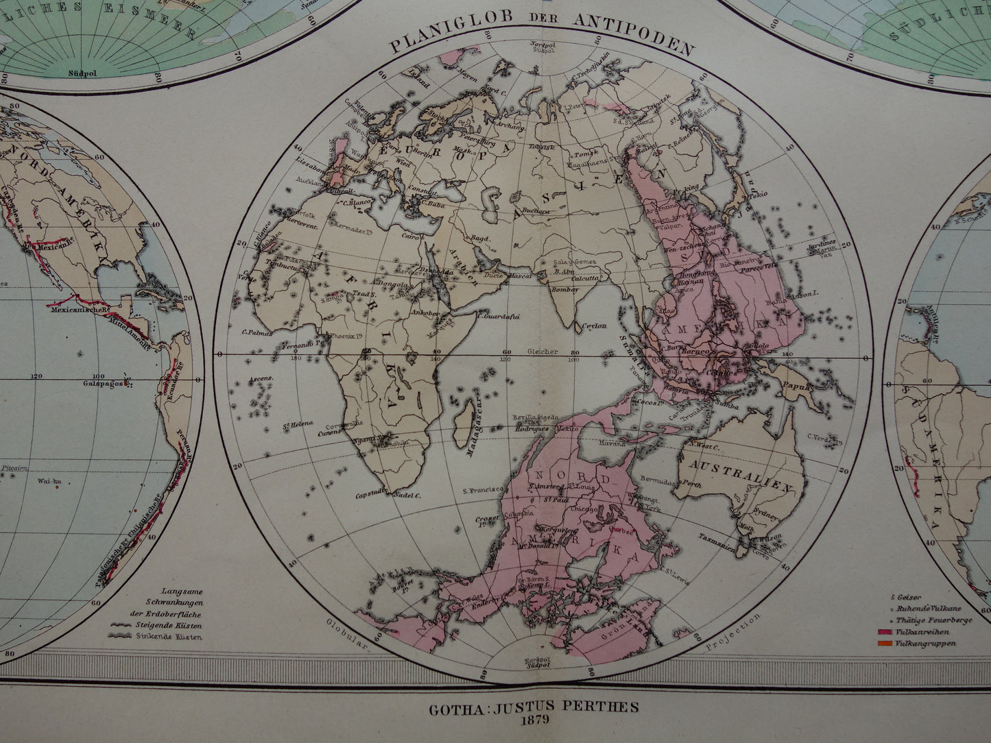
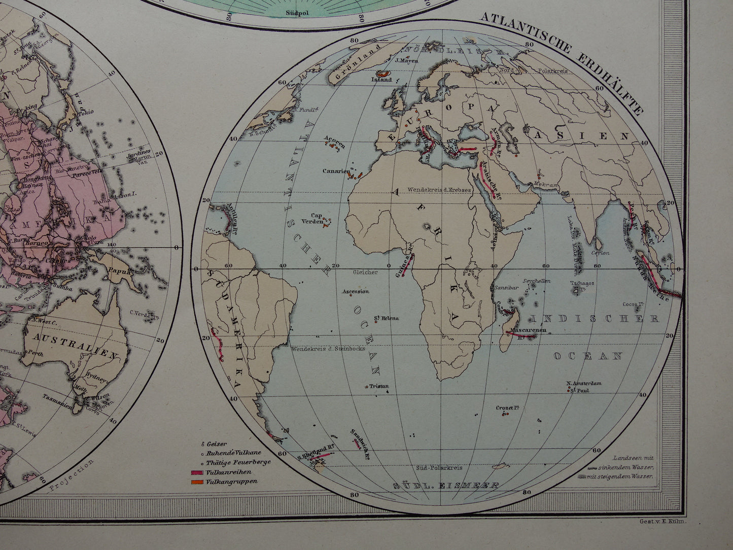
Skip to product information
1 of 9

Oudekaarten.com

World map old German elevation map from 1879 Original antique map with date

World map old German elevation map from 1879 Original antique map with date

Regular price €35,95
Regular price Sale price €35,95
Sale Sold out
Shipping calculated at checkout.

For sale is a beautiful antique German world map. The main map is a height map with a double hemisphere projection. Below that maps of the Atlantic and Pacific Ocean. In between a world map of antipodes, on which you can see which parts are exactly opposite each other. Both in the title (1878) and at the bottom of the map (1879) a year can be found. The map was designed in 1878 and printed in 1879.

Dimensions: 36.5 x 46 cm

Condition: good / very good. Printed on heavy paper. Published with centerfold.

Origin: Stieler's Hand Atlas - Edition 1879


ORDER WITHOUT RISK
At Oudekaarten.com you always order without risk. Are you not completely satisfied with your purchase? You can return your purchase free of charge and get your full purchase price back.


View full details
  • Guaranteed original

    We sell only original antique and vintage maps. We guarantee that your purchase was made on or around the date stated in the description.

  • Fast shipping

    We will ship your order the next business day at the latest. Free shipping within the Netherlands when purchasing 2 cards. Click here for more information

"Beautiful card, exactly as described. Fast shipping and the card was packaged perfectly. Great transaction, thank you very much!"

ANNE ESCHER