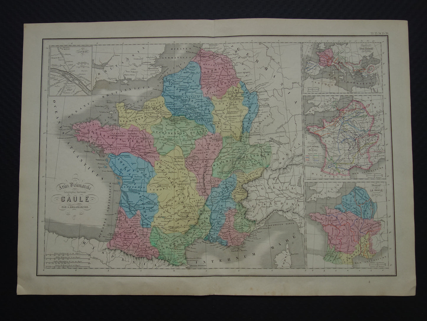
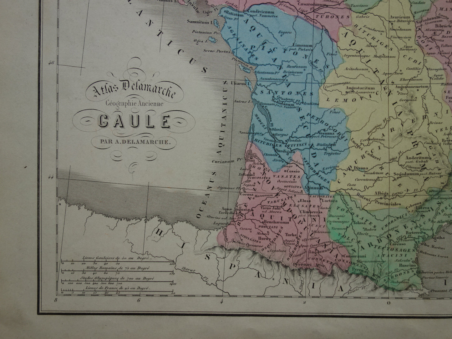
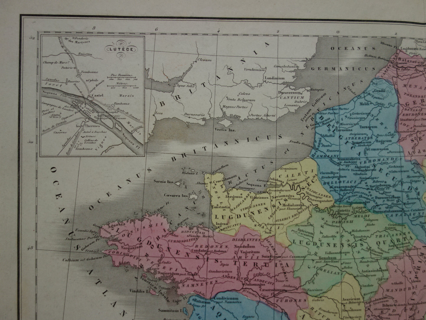
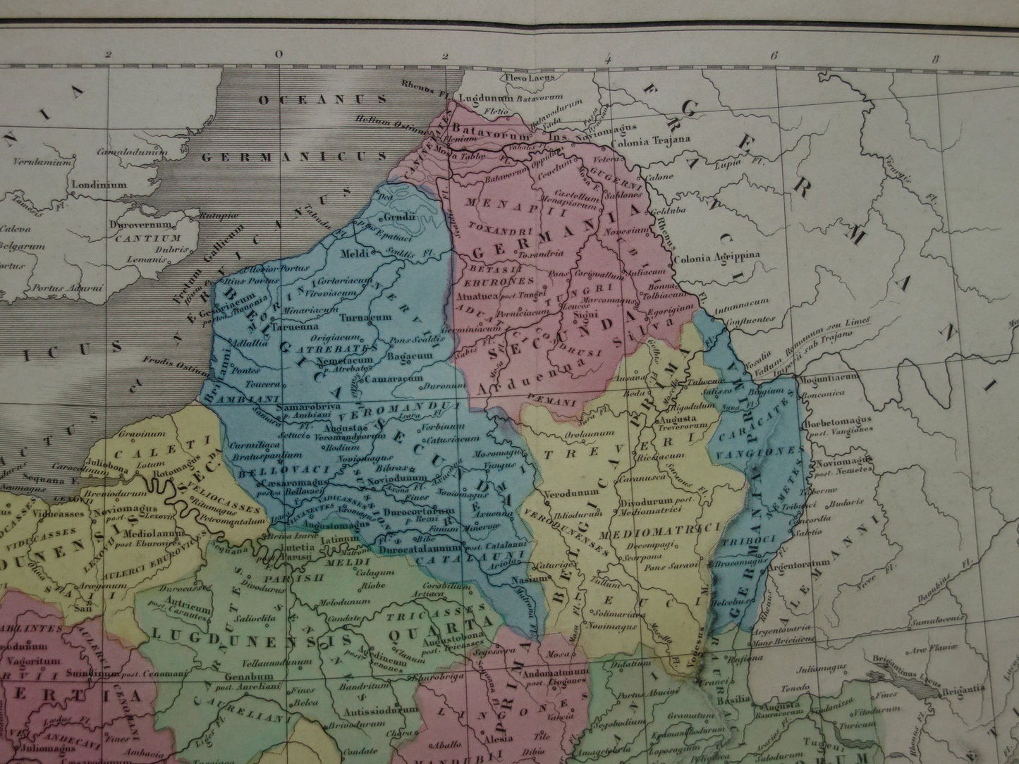
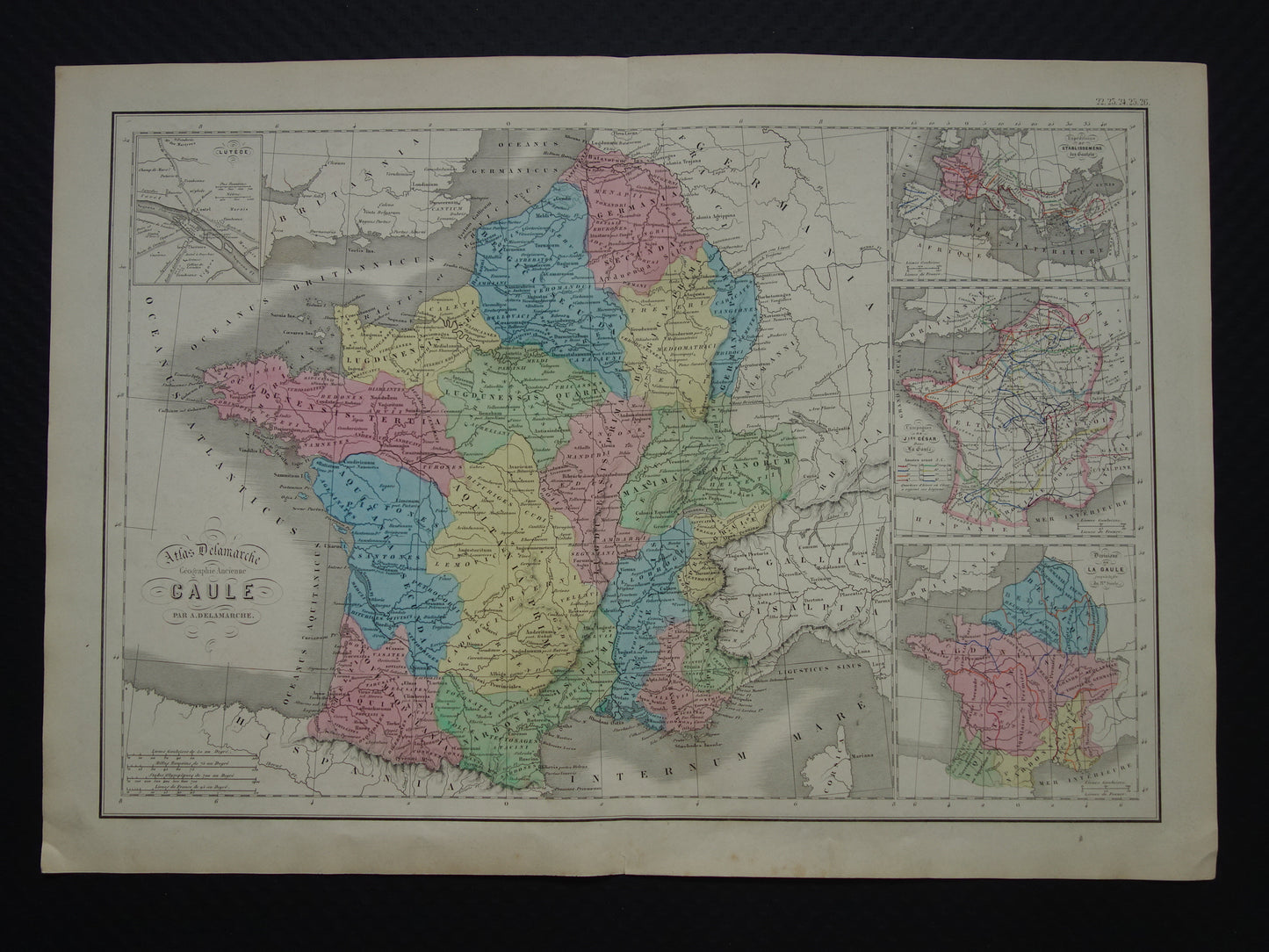
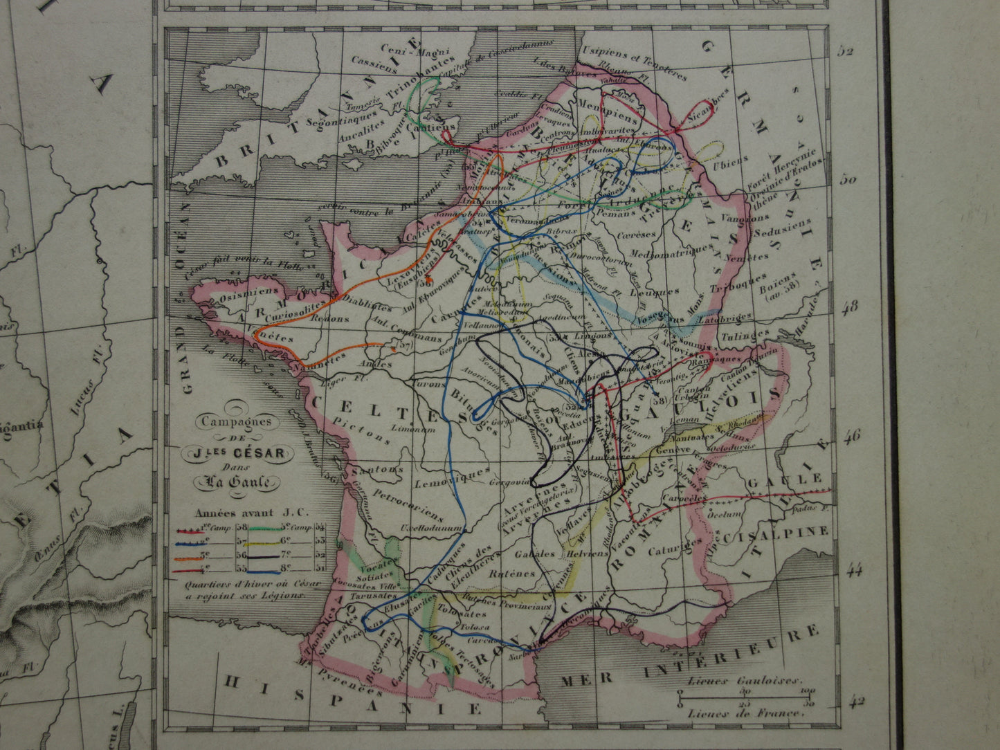
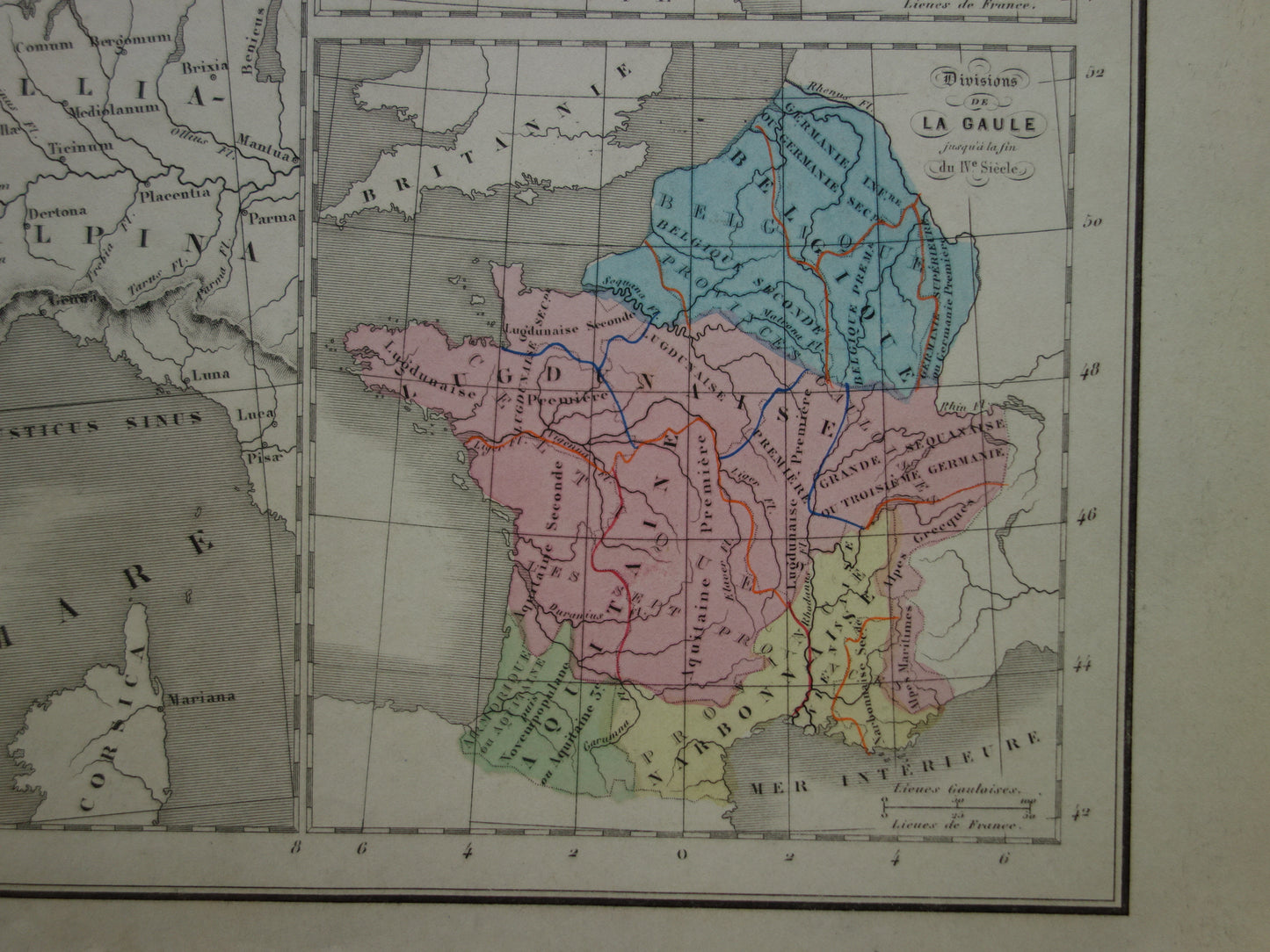
Te koop is een interessante antieke handgekleurde landkaart van Gallië in de klassieke oudheid uit het jaar 1859. De kaart laat naast Frankrijk ook België en het zuiden van Nederland zien, alsmede de Limes die door Nederland en langs de Rijn liep. Alle plaatsen hebben hun Latijnse naam. Rechts drie inzetkaartjes, waaronder een kaart met alle veroveringstochten van Julius Caesar in Gallië. Deze kaart is kleurrijk en gedetailleerd. Zoom de foto's om alle details goed te kunnen zien. De kaart is met de hand ingekleurd.
Afmetingen: 34 x 48 cm
Conditie: in goede conditie (= enkele kleine tekenen van ouderdom / gebruik, maar in goede algehele conditie). Met een middenvouw, zoals uitgegeven.
Afkomst: Atlas de geographie physique, politique, historique adopte par l'universite - Delamarche - Uitgave van 1859
BESTEL ZONDER RISICO Bij Oudekaarten.com bestelt u altijd zonder risico. Bent u niet helemaal tevreden met uw aankoop? U kunt uw aankoop gratis retourneren en krijgt dan uw volledige aankoopbedrag retour.