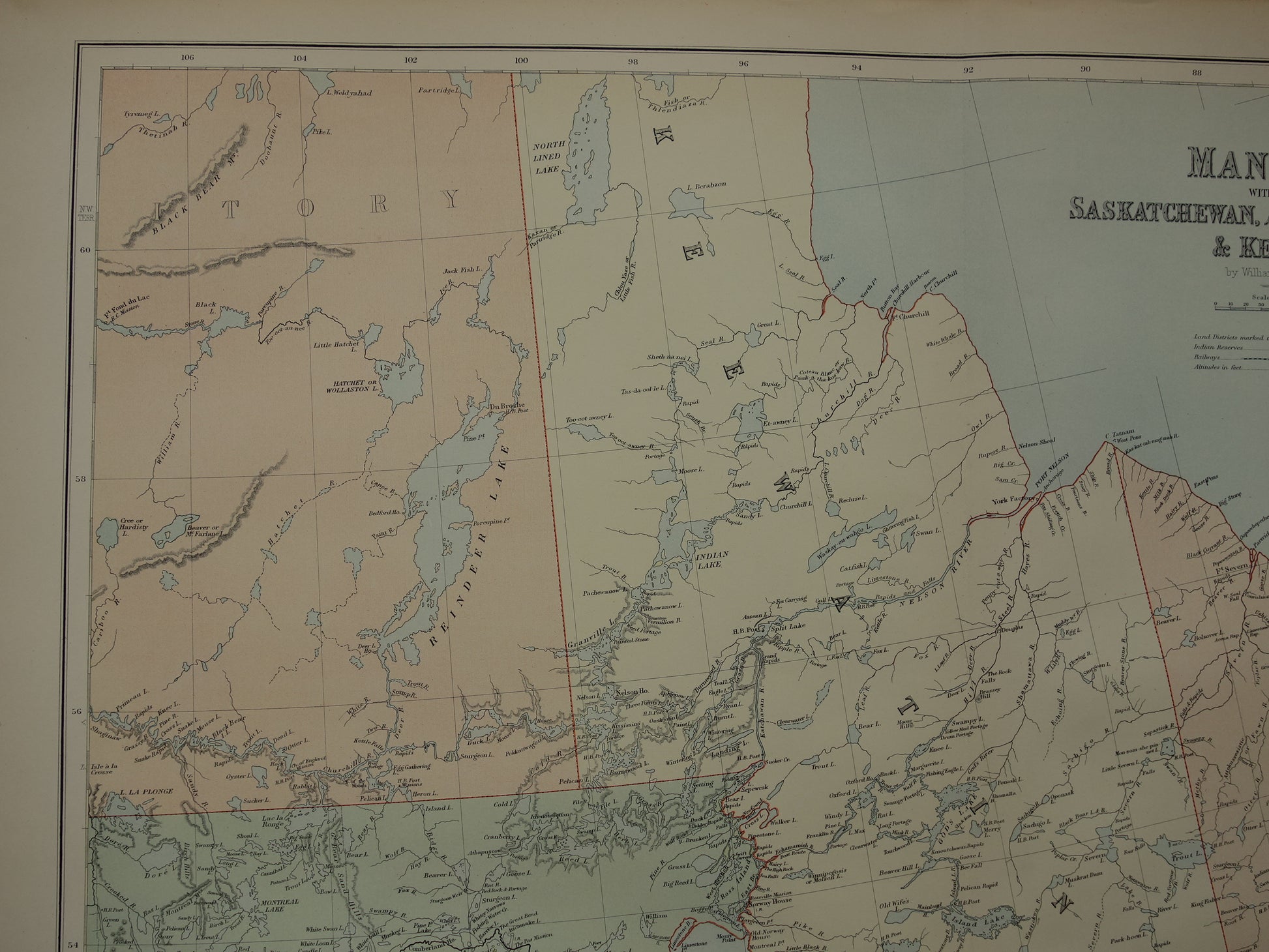
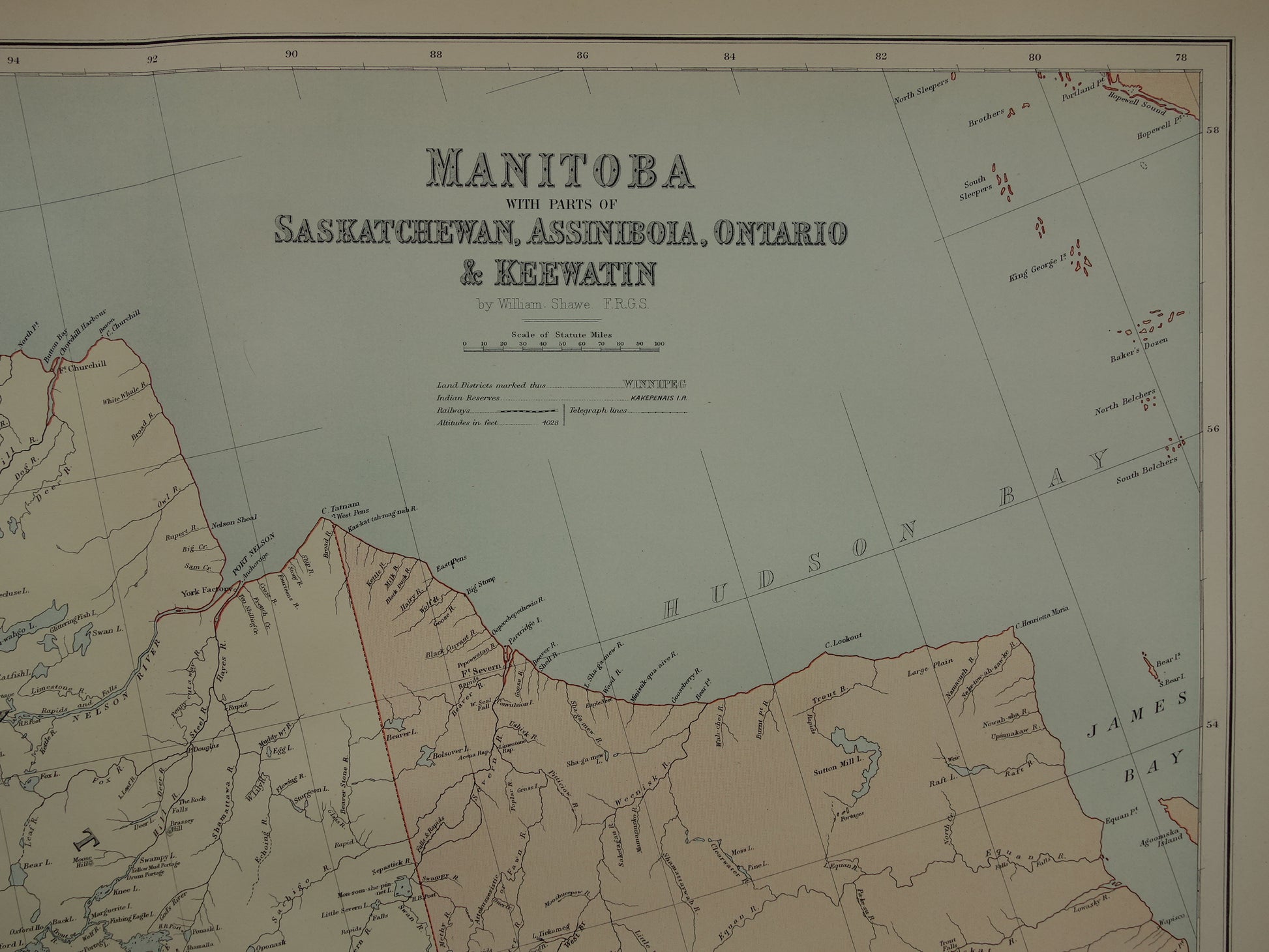
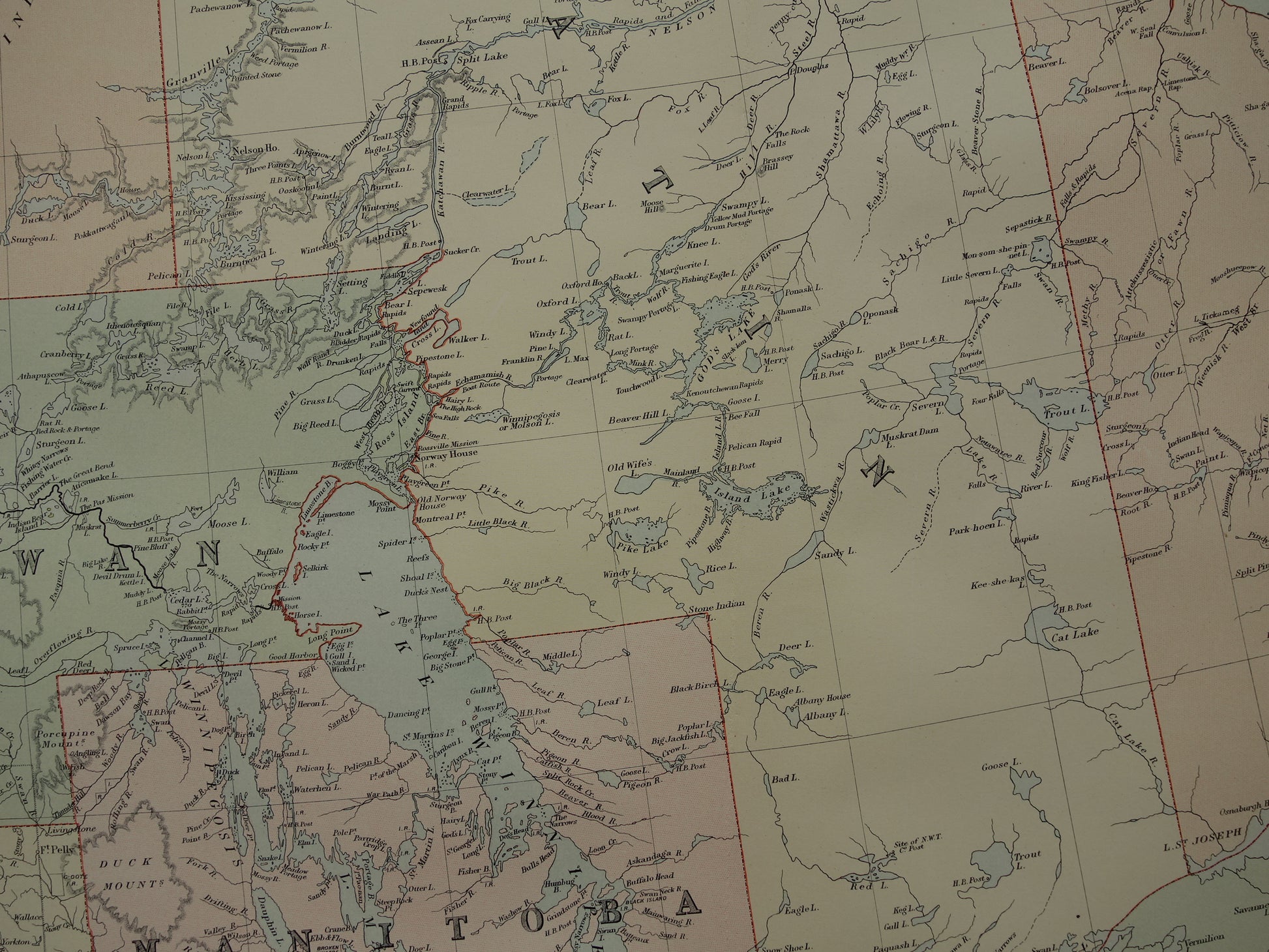
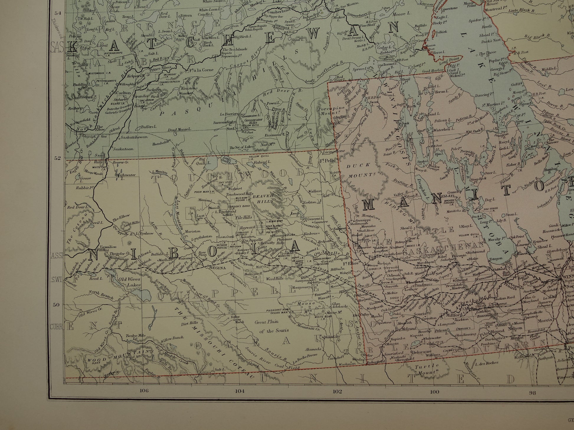
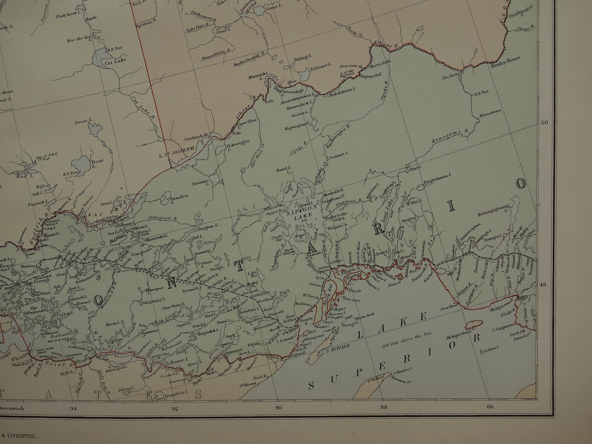
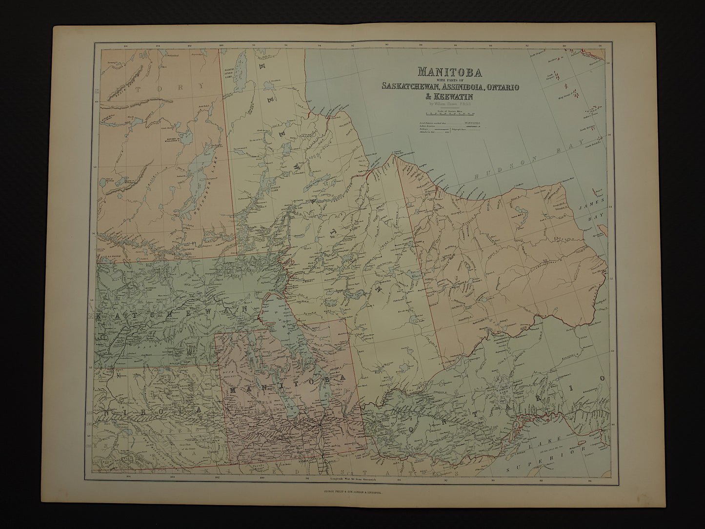
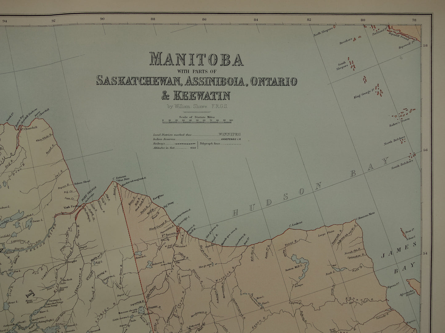
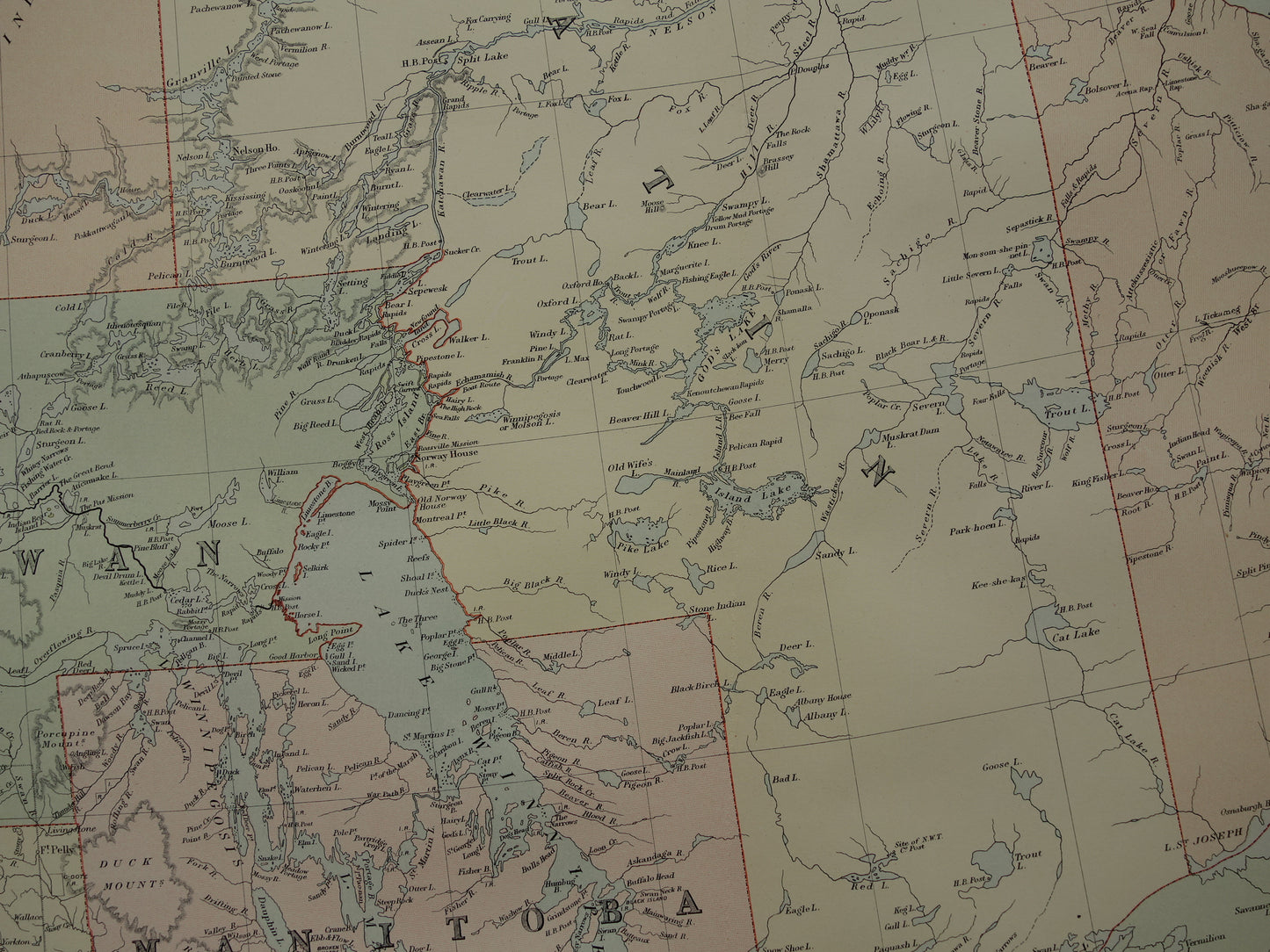
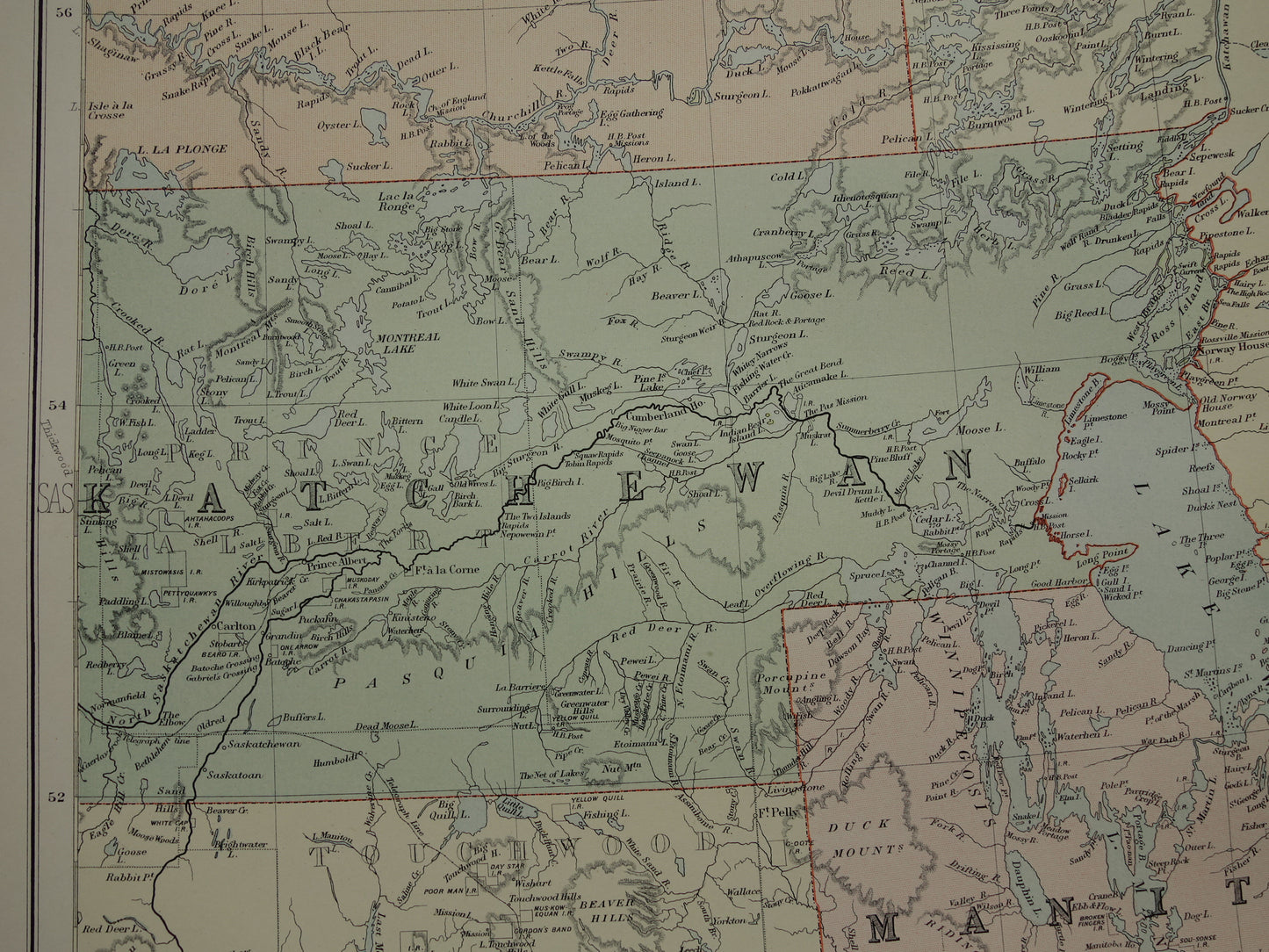
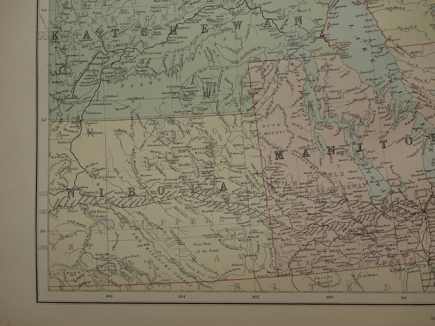
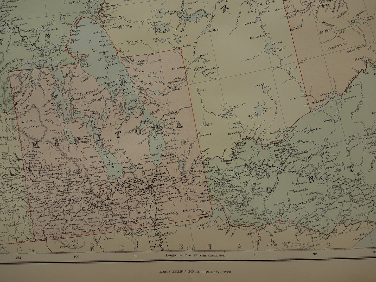
Skip to product information
1 of 8

Oudekaarten.com

CANADA Large Antique Map of Manitoba Saskatchewan Ontario 1890 Old English Map Poster

CANADA Large Antique Map of Manitoba Saskatchewan Ontario 1890 Old English Map Poster

Regular price €69,95
Regular price Sale price €69,95
Sale Sold out
Shipping calculated at checkout.

Beautiful, very large antique map of Manitoba and (parts of) Saskatchewan and Ontario.

Dimensions: 54.5 x 69.5 cm

Condition: good / very good. Tear of 1.5 cm at the bottom of the centerfold, otherwise only a single trace of age/use. Published with centerfold. Printed on heavy paper.

Origin: 'Imperial Atlas' - George Philip & Sons - Edition of 1890

ORIGINAL ANTIQUE MAP
Oudekaarten.com only sells original old maps, we do not sell modern reprints.

ORDER WITHOUT RISK
At Oudekaarten.com you always order without risk. Are you not completely satisfied with your purchase? You can return your purchase free of charge and get your full purchase price back.

FAST SHIPPING
This card will be shipped within 1 business day.

View full details
  • Guaranteed original

    We sell only original antique and vintage maps. We guarantee that your purchase was made on or around the date stated in the description.

  • Fast shipping

    We will ship your order the next business day at the latest. Free shipping within the Netherlands when purchasing 2 cards. Click here for more information

"Beautiful card, exactly as described. Fast shipping and the card was packaged perfectly. Great transaction, thank you very much!"

ANNE ESCHER