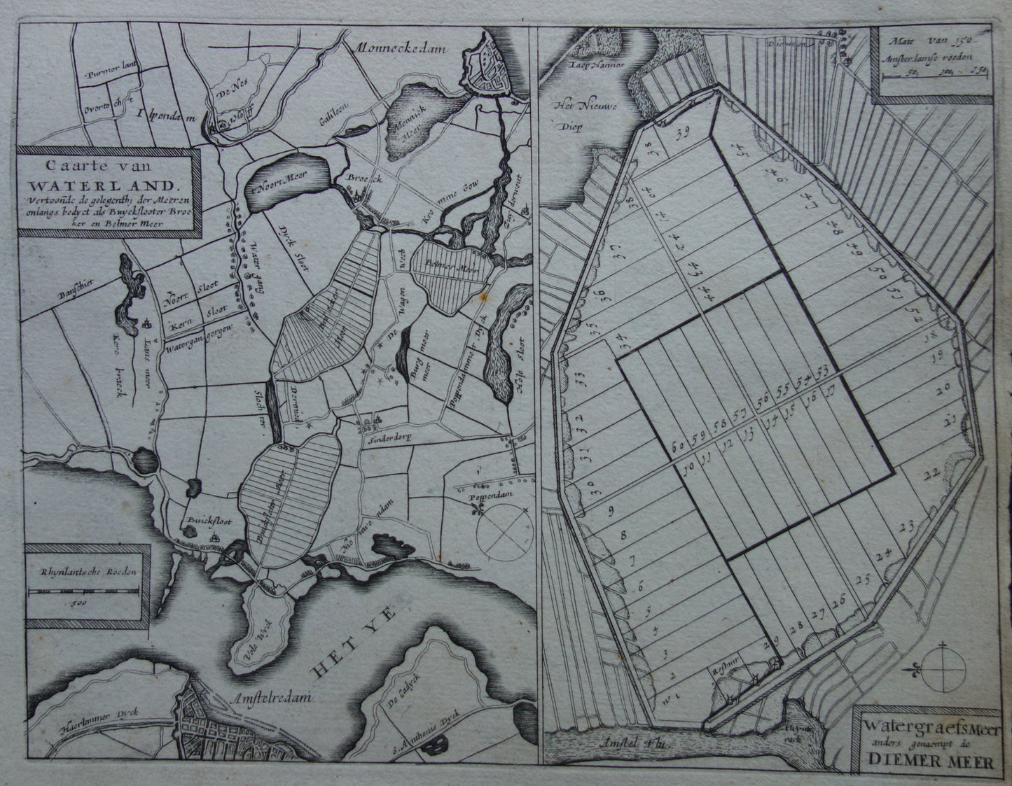
Skip to product information
1 of 6

Oudekaarten.com

AMSTERDAM old map of Amsterdam-North and Amsterdam-East from 1702 original antique map Waterland Watergraafsmeer Diemermeer

AMSTERDAM old map of Amsterdam-North and Amsterdam-East from 1702 original antique map Waterland Watergraafsmeer Diemermeer

Regular price €55,00
Regular price Sale price €55,00
Sale Sold out
Shipping calculated at checkout.

For sale is an antique map of Waterland (showing present-day Amsterdam-Noord up to Monnikendam, which is shown at the top of the map) and of Watergraafsmeer (present-day Amsterdam-East). The second map doesn't show any location markings on the land, but Middenweg is clearly recognizable (the only road running left to right) .

Dimensions: 20 x 25.5 cm

Condition: narrow right margin - some minor signs of age and use - brown spot in the map image.

Origin: Daniel de la Feuille & JA Colom - 1702


ORDER WITHOUT RISK
At Oudekaarten.com, ordering is always risk-free. Not completely satisfied with your purchase? You can return it and receive a full refund. Returns are free for Dutch customers.


View full details
  • Guaranteed original

    We sell only original antique and vintage maps. We guarantee that your purchase was made on or around the date stated in the description.

  • Fast shipping

    We will ship your order the next business day at the latest. Free shipping within the Netherlands when purchasing 2 cards. Click here for more information

"Beautiful card, exactly as described. Fast shipping and the card was packaged perfectly. Great transaction, thank you very much!"

ANNE ESCHER